





15 dage


hurtige fakta

Landtransport i Nepal

Hoteller og tehusindkvartering

Alle måltider undtagen i Kathmandu

Guidet tur og vandretur under hele turen

Efterår, forår

Moderat

nepal

5,416 md

Kathamndu - Dharapani - manang - tilicho - throng pass muktinath - pokhara - Kathamndu


Hvorfor en spændende vandretur på Tilicho-søen?
- Follow the trekking trails along the Marshyndi River and its natural wonders.
- Visit the oldest monastery in Braga, plus the villages of Pisang and Manang.
- Experience the culture of the Tibetan and Gurung (Buddhist and Bon) people.
- Visit the world’s highest Tilicho Lake (4919 m).
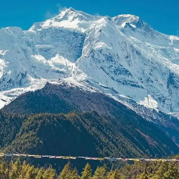
- Stunning view of Mt. Manaslu (8163m), Annapurna 1 (8091), and Dhaulagiri (8167m), crossing the Thorong La Pass (5416m).
- Hindu sacred temple Muktinath with a Buddhist Monastery.
- The hospitality and culture of the Thakali people.
Oversigt over spændende trekking på Tilicho-søen
Tilicho Lake Trekking er en af de mest populære vandreruter i Annapurna-regionen, offering views of the scintillating Tilicho on rugged terrain. At an altitude of 4910 m, Tilicho Lake is the highest lake in the world. Glacier melt on the northern slopes of Annapurna feeds the water that flows from Thorang Peak into Tilicho Lake. The Tilicho søen Trek takes you through some of the most beautiful places in the Annapurna region, offering spectacular views of snow-capped mountains. If you enjoy being close to nature and love warm, smiling faces, you can opt for the Tilicho Lake Trek.
Rejseplan for vandreture ved Tilicho-søen
The 15-day Tilicho Lake trekking route begins with a drive from Kathmandu to Syange, passing through settlements, rivers, waterfalls, and varied landscapes. During this trek, you’ll pass through Dharapani, Chame, Pisang, Manang, and Besisahar. You will also visit ancient Buddhistiske klostre og udforsk Gurung-samfundene med deres forskellige kulturer og dialekter. Det barske, men smukke terræn, den frodige flora, den mangfoldige fauna, de smilende, venlige ansigter, den majestætiske udsigt over bjerge, gletsjere og søer, den rige kultur og de smukke klostre vil føre dig til den fascinerende Tilicho-sø.
The enchanting trek to Tilicho Lake, with deep blue water shining against the snow-covered rocks, will take your breath away. Along the way, you’ll enjoy breathtaking views of the Himalaya, including the Annapurna massif (8091m), dhaulagiri (8167) Gangapurna (7455 m), og Lambung Himal (6983m), among others. The trek will end as you walk back to the beautiful village of Manang to join the Marsyangdi River trail. The best seasons to do the Tilicho Lake Trek are March to May and September to mid-December.
My Everest Trip provides experienced, knowledgeable guides who have led numerous trekking groups across the country. We don’t compromise on service quality, so you get an unforgettable trekking experience.
Oversigt over den spændende vandrerute til Tilicho-søen
The Tilicho Lake Trek begins with a drive from Kathmandu to Dharapani, the start of the walking section. From Dharapani, the trail follows the Marsyangdi Valley through Chame and Pisang before reaching Manang. The route passes through changing landscapes, with views of the Annapurna range and surrounding mountain valleys becoming more prominent as you gain altitude.
Manang is an important acclimatization point before the trail turns toward the higher Tilicho section. From Manang, the route continues to Siri Kharka and Tilicho Base Camp. The next day takes you to Tilicho Lake at 4,919 m, then back to Siri Kharka. The trail then connects with Yak Kharka and continues toward Thorong Phedi.
The trek’s highest point is the crossing of Thorong La Pass at 5,416 m. After crossing the pass, the trail descends toward Muktinath, an important pilgrimage site in the Mustang region. From Muktinath, the journey continues by road through the lower Kali Gandaki area to Tatopani, then on to Pokhara. The trek ends with a road or flight back to Kathmandu from Pokhara.
hurtige fakta
| Trek-information | Detaljer |
| Turens varighed | 15 dage |
| Trek-regionen | Annapurna-regionen |
| Udgangspunktet | Dharapani |
| Slutpunkt | Kathmandu |
| Højeste punkt | Thorong La-passet, 5,416 m |
| Højde ved Tilicho-søen | 4,919 md |
| Indkvartering | Hoteller og tehuse |
| Måltider | Morgenmad, frokost og aftensmad under vandreturen |
| Trek Sværhedsgrad | Moderat |
| Transport | Vej og valgfri flyvning |
| Bedste årstider | Forår og efterår |
| Hovedattraktioner | Tilicho Lake, Thorong La Pass, Manang og Muktinath |
Spændende vandrerute til Tilicho-søen
Dag 01: Kathmandu til Dharapani
You follow a zigzag trail beside the Marsayangdi River until you cross a suspension bridge over Marsayangdi. Then, you walk uphill to Tal, the first village in the Manang district, famous for its waterfalls. Passing through barley and potato fields and pine forests, you reach Dharapani.

Morgenmad frokost aftensmad

Teahouse

1,860 m / 6,102 ft
Dag 02: Dharapani til Chame
Continue along the south bank of the Marsayangdi River through pine, oak, hemlock, maple, and rhododendron forests and apple orchards on the way to Chame. You will follow a mule trail to Chame, where you can take in panoramic views of Annapurna II (7937m), Annapurna IV (7525m), and Lamjung Himal (6983m).
Morgenmad frokost aftensmad
Teahouse
2,670 m / 8,760 ft
Dag 03: Chame til Pisang
You climb past Mani walls as you enter the buckwheat fields in Telekhu. You will also glimpse the tremendous Paungda Danda rock face as you ascend. You then continue the steep ascent towards Upper Marsayangdi through fir and pine forests. You will have a good view of Pisang Peak (6091m) and Annapurna II (7937m) when you arrive in Pisang.
Morgenmad frokost aftensmad
Teahouse

13 km / 8.1 miles
3,200 m / 10,499 ft

6hrs
Dag 04: Pisang til Manang
Du passerer gennem maleriske landsbyer malet med mandalaer og vandrer gennem yak-græsgange og terrasserede landbrugsjord. Du vil bestige en stejl bjergryg til Ngwal (3660 m) for en fantastisk udsigt over Annapurna-kæden og Marsayangdi-floddalen.
Morgenmad frokost aftensmad
Teahouse
17 km / 10.5 miles
3,519 m / 11,545 ft
7hrs
Dag 05: Manang: Akklimatiseringsdag
Today, you explore the famous Manang village as you acclimatize. Here, you will enjoy a spectacular view of Gangapurna (7455m) behind the traditional stone houses. You can also enjoy local Manangi food.
Morgenmad frokost aftensmad
Teahouse
3,519 m / 11,545 ft
Dag 06: Manang til Siri Kharka
You descend from old Manang and reach the Marsayangdi River, passing by a Chorten. After crossing a suspension bridge at Jharsang Khola, continue along the river trail to Siri Kharka.
Morgenmad frokost aftensmad
Teahouse
4,060 m / 13,320 ft
Dag 07: Siri Kharka til Tilicho Base Camp
You climb steep trails, passing monasteries and Chortens through juniper and sea buckthorn bushes. You cross a few streams and follow a zigzag slope toward Tilicho Base Camp.
Morgenmad frokost aftensmad
Camp
7 km / 4.3 miles
4,150 m / 13,615 ft
3hrs
Dag 08: Besøg Tilicho-søen og derefter tilbage til Siri Kharka
Tilicho-søen (verdens højeste sø)
You walk through slippery moraines as you climb to the pristine Tilicho Lake. You will have a fantastic view of Kangsar and Gangapurna Himal (7455m). After spending some time there, you will hike back to Siri Kharka. O/N in Siri Kharka.
Morgenmad frokost aftensmad
Teahouse
14 km / 8.7 miles
4,919 m / 16,138 ft
6hrs
Dag 09: Siri Kharka til Yak Kharka
Today’s hike to Yak Kharka feels effortless. As we cross the Marsyangdi River multiple times, we get closer to the mountain. The path gets steep before we stop for lunch. After about an hour, we reach Yak Kharka (a yak grazing ground). Here are a few tea houses where we can stay overnight.
Morgenmad frokost aftensmad
Teahouse
9 km / 5.6 miles
4,018 m / 13,182 ft
4hrs
Dag 10: Yak Kharka til Thorang Phedi
Get ready for an exciting day in the mountains as we head to Thorang Phedi. While many people cross Thorang La Pass in one day, we take it slow. In the morning, we walk for a couple of hours to Thorang Phedi. If conditions are favorable, we hike to the High camp the same day. Here, we stay at 4800m, the highest accommodation point of the Annapurna Circuit trek.
Morgenmad frokost aftensmad
Teahouse
7 km / 4.3 miles
4,800 m / 15,748 ft
3hrs
Dag 11: Thorong Phedi til Thorong La Pass til Muktinath
This is the longest and most challenging part of our walk. However, since we are already in High Camp, we avoid much pain. The team wakes you up early, i.e., 4 to 5 am. Then, we take our packed lunch and climb the Thorang Pass. After 3-4 hours, we reach the hilltop with the most beautiful view of the mountains. Decorated with colorful flags, it’s an excellent place for photos. After a short stop, we start walking down to Muktinath.
Hvis tiden tillader det, kan vi måske endda gå ned til Jomsom. Herfra kan vi endda gå til Upper Mustang.
Morgenmad frokost aftensmad
Hotel
16 km / 9.9 miles
5,416 m / 17,769 ft
6hrs
Dag 12: Vandretur eller biltur fra Muktinath til Tatopani
Today, we woke up early for a short visit to Muktinath. This holy temple in Nepal draws Hindu and Buddhist pilgrims. Next, we drove to other popular places, including Kagbeni and Jomsom, the headquarters of Muktinath. We continued our off-road drive to Tatopani along the Kaligandaki Gorge, one of the deepest gorges in the world. In the evening, we enjoy a relaxing bath in the natural hot springs.
Morgenmad frokost aftensmad
3,710 m / 12,172 ft
Dag 13: Tatopani til kørsel til Pokhara
If you want to combine the Ghorepani Poon Hill trek, please let us know; we will customize the itinerary. Choose the Ghorepani Poon Hill Trek for a shorter trek in Nepal.
After breakfast, we took a bus/ Jeep back to Pokhara and enjoyed the evening by the beautiful lake.
Morgenmad, frokost
Hotel
1,190 m / 3,904 ft
Dag 14: Kør eller fly tilbage til Kathmandu
After the beautiful morning in Pokhara, we took a bus back to Kathmandu. The drive along the Prithvi Highway offers beautiful views of rivers and hills. We got to Kathmandu only in the evening. However, we will have some time for last-minute shopping in Thamel. Later, we all enjoy our last meal together as a team.
Note: Instead of a long drive, you can take a 25-minute flight from Pokhara to Kathmandu. This way, you will have time to explore Pokhara and Kathmandu.
Morgenmad, aftensmad
Hotel
822 m / 2,697 ft
Dag 15: Endelig afgang
So, this is your final day in Nepal. Pack your things and let the driver know your flight time. A car will take you to the airport a few hours before the flight for customs formalities. I wish you an incredible journey!!
Morgenmad
1,400 m / 4,593 ft
Spændende vandrekort over Tilicho-søen
Hvad kan man forvente?
Hvad er inkluderet
- Måltider på hele boardingen (morgenmad, frokost og aftensmad) under hele vandreturen
- Vandring kort
- En erfaren guide til indehavere af statslig licens
- Vandringsportør/Sherpa, der bærer dine tasker under vandreturen. (2 personer, 1 portør)
- Forsikring, løn, udstyr, transport og lokal skat for guiden.
- Medicinske forsyninger til gruppen (førstehjælpskit vil være tilgængeligt)
- Alle nødvendige papirer og tilladelser til adgang til nationalparken
- Rejse- og redningsarrangement
- TIMS (Trekkers' Informationsstyringssystem)
- Alle offentlige skatter og turistgebyrer
Hvad er udelukket
- Måltider i Kathmandu før og efter trekking,
- Din rejseforsikring (Rescue)
- Tips til trekkingpersonale og chauffør
- Drikkevarer (varme, kolde og alkoholholdige)
- Personlig shopping og tøjvask mv.
- Personligt trekkingudstyr

Tripadvisor anmeldelser



Google anmeldelser


Spændende trekking på Tilicho-søen Yderligere information
Tilicho-søens korte rute
MyEveryTrip Tilicho Lake Trekking Itinerary is 15 days long. Although it doesn’t take this long to trek to Tilicho Lake, it covers everything right from Kathmandu Airport. It takes four days to reach Manang, with one day to stay there. You can skip all this by driving directly to Manang from Besisahar (the starting point of the Annapurna Circuit trek).
Walking from Besisahar to Siri Kharkha, then to Tilicho Base Camp, is best before you reach Tilicho. Then, getting back to Manang takes one day. You can take a jeep from Manang if you want a shorter route to Tilicho Lake.
Her er forskellige Tilicho-søens vandreruter til en kort vandretur
Tilicho-søen Trek 5 dage
To book the 5-day Tilicho Lake trek, you shall first drive to Besisahar. You cannot directly reach Kathmandu to Manang on the first day. The Kathmandu-to-Manang drive takes more than 14 hours and is only possible in a day with a private vehicle. So we suggest you stay in Besisahar for a day before driving to Manang.
Dag 1: Ankomst til Manang
As mentioned, you can only do a 5-day Tilicho Lake trek from Besisahar. From Besisahar, you can drive to Manang by jeep. This is about a six-hour ride, mainly on the newly built off-road trail.
Dag 2: Vandretur til Shree Kharkha
Samme som MyEveryTrip Tilicho Base Camp-rejseplanen, der blev forklaret tidligere.
Dag 3: Trek til Tilicho Base Camp
Samme som MyEveryTrip Tilicho Base Camp-rejseplanen, der blev forklaret tidligere.
Dag 4: Tilicho-søen til Shree Kharkha
Samme som MyEveryTrip Tilicho Base Camp-rejseplanen, der blev forklaret tidligere.
Dag 5: Shree Kharkha til Manang og kørsel tilbage til Besisahar.
From Shree Kharkha, we start the trek quite early in the morning. You can get to Manang at noon if we start the walk before 5 am. After lunch in Manang, we will drive to Besisahar. Depending on the weather and road conditions, the public jeep from Manang may or may not be available. If not, you might have to book a private Jeep or travel tomorrow morning.
Vandretur fra Pokhara til Tilicho-søen
Whether you start from Kathmandu or Pokhara, the Tilicho Lake Trekking itinerary is very similar. Instead of driving from Kathmandu to Besisahar, you will drive from Pokhara to Besisahar and follow the route mentioned above.
Since the distance from Pokhara to Besisahar is a bit shorter than from Kathmandu, we might reach Besisahar before noon on the first day and then drive to Manang the same day. This means you don’t need to stay in Besisahar an extra day, so your Tilicho Lake trek is exactly five days. On the last day, we might be able to return to Pokhara if you are driving a private jeep. Otherwise, you’ll need to stay in Manang or Besisahar for the fifth day and return to Pokhara on the 6th.
Pris for vandreturen til Tilicho-søen
MinEverest-rejse Tilicho Lake Trekking omkostninger $1240, including all transportation, accommodation, food, and a guide. As a slightly off-the-beaten-path trek in the Annapurna region, it’s quite remote. Only a handful of tea houses line the route, and accommodation/food in this trekking region are quite expensive. However, the Tilicho Lake Trek is very reasonable compared to other popular treks, such as the Everest Base Camp Trek.
A room in the Hotel at Tilicho costs USD 5 to USD 7. But you must pay for everything else, like Wi-Fi, electricity, and a hot shower; food costs about $30 daily. The largest portion of the fee covers private transportation from Kathmandu to Manang and back. The price for a guide and Porter is also high, i.e., about $40 per day.
Lastly, the Tilicho Lake Trek permit costs about $50. If you aim to do a solo Tilicho Lake Trek with a guide and Porters, the cost can go up to $1500. Independent Travelers in a group spend about $900 on the Tilicho Lake trek because they share the cost of a guide, porter, and accommodation.
Prisen på Tilicho Lake Trek for nepalesere
Tilicho Lake trekking costs for Nepalis are low because they don’t have to pay for a guide or accommodation. Traveling from Kathmandu to Besisahar costs about Rs 600, and from Besisahar to Manang by jeep costs about Rs 2500. Food costs about Rs 1500 per day, and accommodation costs Rs 500. Nepalese don’t need to pay for the permit or even electricity. So, for Nepalese, a 6-day Tilicho Lake trek from Kathmandu costs about Rs 20,000.
Sværhedsgraden af Tilicho-søens vandretur
How challenging is the Tilicho Lake trek? This is one of the most frequently asked questions on the Tilicho trekking route. Trekking in the Himalayas can feel luxurious, but with the right determination, it’s not that hard. This trek is more accessible than other high-altitude treks, such as the Everest Three Pass Trek and Island Peak Climbing.
Acclimatization During the Thrilling Tilicho Lake Trek
Another key part of the Tilicho Lake Trek is acclimatization, since the trail reaches extreme altitudes, with Tilicho Lake at 4,919 m and Thorong La Pass at 5,416 m. The itinerary includes an acclimatization day in Manang at 3,519 m before heading to the trail’s higher elevations.
On the acclimatization day, you may take a brief walk around Manang and return to the same village at night. This will help your body adapt slowly to the increasing altitude. Continue at a regular pace on the following days, with enough time to rest, eat, and hydrate.
Do not overlook symptoms like headache, dizziness, unusual tiredness, nausea, or sleep difficulties. If symptoms become worse, inform your guide immediately. It is usually safer to go down to a lower altitude rather than proceeding to a higher altitude in the event of altitude sickness.
Tilicho-søens vandretursafstand
Our Tilicho Lake route covers about 150 km of walking. Depending on whether you drive to Syange, Chame, or Manang, the distance to the Tilicho Lake Trek varies significantly. Each day of the Tilicho Lake Trek, you need to walk 6 to 8 hours. Covering 15 km daily isn’t difficult if you have good physical strength. A few months of cardio exercises before the tour, plus carrying a backpack, can help.
Højde på vandring ved Tilicho-søen
Da vi skal gå i højder over 3000 m i dagevis, vil højden påvirke os betydeligt. I sådanne højder kan det lavere iltniveau forårsage højdesyge. Derfor er det vigtigt at gå en tur og lade vores kroppe akklimatisere sig. Du skal også drikke nok vand og undgå fødevarer, herunder alkoholholdige drikkevarer, der holder dig dehydreret.
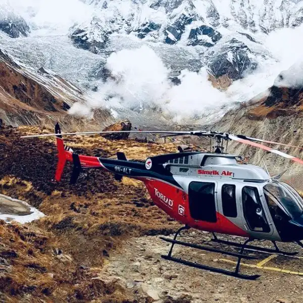
Even with these precautions, symptoms such as headache, body aches, nausea, and shortness of breath may still be prominent. As part of the sightseeing activity, we will walk down to a lower altitude. In severe conditions, we will arrange a helicopter rescue under your insurance policy.
Bedste tidspunkt at vandre Tilicho-søen
The best time to trek to Tilicho Lake is generally during spring and autumn. March through May offers more stable weather, with clear mountain views and warmer temperatures at lower altitudes. Another good season is September to November, when skies are clearer, and conditions are better for high-altitude trekking.
Vinteren kan bringe sne og frostgrader omkring Tilicho-søen og Thorong La. Monsunmånederne kan bringe regn, skyer, glatte stier og vejforsinkelser i lavereliggende områder.
| Måned | Vandringskondition | Anbefaling |
| Januar | Meget koldt med mulighed for sne i høje højder | Udfordrende |
| februar | Koldt med vinterforhold i højereliggende områder | Udfordrende |
| Marts | Varmere dage og forbedret sigtbarhed i bjergene | god |
| april | Stabilt vejr og klar udsigt over bjergene | Fantastike |
| Maj | Generelt egnet før monsunen | Fantastike |
| juni | Tiltagende regn i lavereliggende områder | Mindre velegnet |
| Juli | Monsunregn og overskyet vejr | Mindre velegnet |
| August | Våde stier og mulige vejforsinkelser | Mindre velegnet |
| September | Vejret begynder at blive bedre efter monsunen | god |
| oktober | Stabilt vejr og klar udsigt | Fantastike |
| November | Generelt tørt og klart, med koldere nætter | Fantastike |
| December | Kulde med stigende risiko for sne i højereliggende områder | Udfordrende |
Nepals turistråd angiver marts til maj og september til november som de vigtigste sæsoner for trekking i Annapurna-regionen.
Vejret under Tilicho-søvandringen
Weather changes considerably with increasing elevation. Lower sections around Dharapani and Chame can be relatively mild during the main trekking seasons, while Manang is cooler and drier. Conditions become colder around Tilicho Base Camp, Tilicho Lake, Thorong Phedi, and Thorong La.
Morgenforholdene er ofte mere egnede til vandreture i høje højder, fordi vejret kan ændre sig senere på dagen. Sne, stærk vind, tåge og lave temperaturer er mulige omkring Thorong La, især uden for de primære trekkingsæsoner.
Pack warm layers even when traveling during spring or autumn. A waterproof jacket, warm sleeping layer, gloves, hat, and suitable trekking footwear are useful for changing mountain conditions.
Tilladelser til vandreture på Tilicho-søen
The Tilicho Lake route passes through the Annapurna Conservation Area, so trekkers need the required conservation area entry permit and TIMS Card. Current Nepal Tourism Board information also lists the Annapurna Circuit and Mesokanto or Tilicho Pass routes as Annapurna region routes that require a guide and a TIMS Card.
| Tilladelse eller krav | Formål | Arrangement |
| Annapurna Conservation Area Tilladelse | Adgang til Annapurna-bevaringsområdet | Arrangeret før eller under vandreturen gennem den autoriserede kanal |
| TIMS kort | Trekker-registrering og sikkerhedsoplysninger | Arrangeret gennem et registreret vandrebureau |
| Begrænset områdetilladelse | Normalt ikke påkrævet for standardruten til Tilicho-søen | Kun påkrævet, hvis rejseplanen går ind i et område med begrænset adgang |
De nuværende oplysninger fra Nepal Tourism Board angiver entrégebyret for Annapurna Conservation Area separat og angiver, at TIMS er påkrævet for relevante vandreruter.
Din pakke indeholder allerede det nødvendige papirarbejde, adgangstilladelser til nationalparker eller beskyttede områder og TIMS, så agenturet bør håndtere de gældende arrangementer inden vandreturen.
Indkvartering og mad under den spændende Tilicho-søvandring
Indkvartering under Tilicho Lake Trek tilbydes hovedsageligt i lokale tehuse og lodges. Dharapani, Chame, Pisang, Manang, Yak Kharka, Thorong Phedi og Muktinath har etablerede trekking-indkvarteringsmuligheder. Faciliteterne bliver enklere, efterhånden som ruten bevæger sig mod Tilicho Base Camp og andre højereliggende områder.
Rooms generally have basic beds and blankets, and some villages have shared bathrooms. Hot showers may be available at selected lodges for an additional charge, but facilities can become limited at higher elevations.
Meals generally follow local teahouse menus. Commonly available options include dal bhat, noodles, pasta, rice, soup, potatoes, vegetables, eggs, bread, and other simple meals. Drinking water should be treated or filtered before consumption. Eating regular meals and drinking enough fluids becomes increasingly important as you gain altitude.
Transport
Standardrejseplanen starter med landtransport fra Kathmandu mod Dharapani og fortsætter til fods gennem Manang, Tilicho Base Camp, Tilicho-søen, Thorong Phedi, Thorong La og Muktinath. Returstrækningen fra Muktinath til Tatopani og derefter Pokhara bruger også vejtransport.
| Sektion | Transport | Hovedformål |
| Kathmandu til Dharapani | Vej | Nå frem til vandreturens startpunkt |
| Dharapani til Manang | gåture | Trek gennem Marsyangdi-dalen |
| Manang til Tilicho-søen | gåture | Nå Tilicho Base Camp og søen |
| Tilicho-området til Yak Kharka | gåture | Genoptag den højere Annapurna-rute |
| Yak Kharka til Muktinath | gåture | Kryds Thorong La-passet |
| Muktinath til Tatopani | Vej | Fortsæt mod den nedre Annapurna-region |
| Tatopani til Pokhara | Vej | Nå Pokhara |
| Pokhara til Kathmandu | Vej eller flyvning | Tilbage til Kathmandu |
The existing itinerary specifies ground transportation at the beginning, road travel from Muktinath to Tatopani, road travel from Tatopani to Pokhara, and either a drive or a flight from Pokhara to Kathmandu.
Mobilnetværk, internet og opladningsfaciliteter
Mobile network coverage is available in many villages along the Tilicho Lake Trek, although the signal becomes less reliable in remote and higher sections. Coverage varies by village, weather, terrain, and network provider.
Wi-Fi kan være tilgængeligt på nogle tehuse mod et ekstra gebyr, især i større bosættelser som Manang og Muktinath. Forvent ikke en stabil internetforbindelse under hele vandreturen.
Many lodges offer electricity, but charging facilities can be limited at higher elevations. Carry a power bank, and protect your electronic devices from cold temperatures. Some teahouses may charge an additional fee for charging.
Health and Safety During the Thrilling Tilicho Lake Trek
Den høje højde er den vigtigste sundhedsmæssige faktor på Tilicho Lake Trek. Ruten når 4,919 m ved Tilicho Lake og 5,416 m ved Thorong La Pass, så gradvis højdestigning, ordentlig hydrering, tilstrækkelig hvile og bevidsthed om højdesyge er vigtige.
Gå i et behageligt tempo, og undgå at haste til højereliggende områder. Fortæl det til din guide, hvis du udvikler vedvarende hovedpine, svimmelhed, kvalme, usædvanlig svaghed, vejrtrækningsbesvær eller andre bekymrende symptomer.
Weather can also affect trail conditions around Tilicho Lake and Thorong La. Your guide should check local conditions before the high-altitude sections and adjust the walking schedule as needed.
Travel insurance that covers high-altitude trekking and emergency evacuation is strongly recommended. The package itself excludes travel insurance and rescue costs, so trekkers should arrange suitable coverage before departure.
Forberedelse og fitness til Tilicho-søens vandretur
The Tilicho Lake Trek requires good physical preparation because the itinerary includes several long walking days and reaches high altitude. Previous trekking experience helps, but regular training can also prepare first-time trekkers for the route’s demands.
Start preparing several weeks before the trek with regular walking, hiking, stair climbing, or other cardiovascular activities. Gradually increase your training duration rather than doing only long sessions right before departure.
Styrketræning for ben og core kan også hjælpe med både op- og ned ad bakke. Hold et stabilt tempo under vandreturen og tag korte pauser i stedet for at gå for hurtigt og blive udmattet.
Mental forberedelse er også nyttig, fordi vejr, højde, simpel indkvartering og lange vandredage kan gøre de højere sektioner mere krævende end de lavere sektioner.
Tilicho-søen Trek vs. Annapurna Circuit Trek
The Tilicho Lake Trek and Annapurna Circuit Trek share several sections of the Annapurna region, particularly around Manang. The main difference is the route’s focus. The Tilicho itinerary includes a dedicated section toward Tilicho Lake before joining the route toward Thorong La and Muktinath.
The Annapurna Circuit generally covers a wider circuit around the Annapurna massif, while the Tilicho Lake itinerary focuses more on the lake and the surrounding high-altitude landscape.
| Feature | Tilicho Lake Trek | Annapurna Circuit Trek |
| Hovedattraktion | Tilicho-søen og Thorong La | Gennemfør Annapurna-kredsløbet og Thorong La |
| Tilicho søen | Inkluderet | Valgfri ruteudvidelse |
| Thorong La | Inkluderet i denne rejseplan | Inkluderet |
| Højeste punkt | 5,416 m ved Thorong La | Omkring 5,416 m ved Thorong La |
| Rutefokus | Tilicho-søen, Manang og Muktinath | Bredere rute omkring Annapurna |
| Vandreturens varighed | 15 dage i denne pakke | Varierer afhængigt af rejseplanen |
| Vanskelighed | Moderat til krævende i høj højde | Moderat til krævende i høj højde |
| Bedst til | Trekkere, der ønsker Tilicho-søen inden for en kortere, fokuseret rejseplan | Trekkere, der ønsker en bredere Annapurna-oplevelse |
Den nuværende pakke følger specifikt Kathmandu, Dharapani, Manang, Tilicho, Thorong Pass, Muktinath, Pokhara og Kathmandu over 15 dage.
Pakkeliste til vandreturen til Tilicho-søen
Pack for the season, and remember that temperatures can change significantly between the lower valleys and high-altitude sections.
Tøj
- Grundlag
• Varmt fleece eller isolerende lag
• Vandtæt jakke
• Varm dun- eller syntetisk jakke
• Vandrebukser
• Termobukser
• Varm hue og solhat
• Handsker
• Vandrestokker
Sko
- Komfortable vandrestøvler
• Campingsko eller sandaler
• Ekstra vandresokker
Trekking udstyr
- Rygsæk
• Sovepose egnet til kolde forhold
• Vandrestave
• Pandelampe
• Vandflasker eller væskesystem
• Vandrensningstabletter eller filter
• Solbriller
• Solcreme
• Personlige førstehjælpsartikler
Personlige ting
- Pas og nødvendige dokumenter
• Oplysninger om rejseforsikring
• Powerbank
• Opladningskabler
• Toiletartikler
• Personlig medicinering
• Lille håndklæde
• Genanvendelig vandflaske
Hold rygsækken så let som muligt. Pakken inkluderer portørservice, men du bør stadig medbringe en lille dagtursrygsæk med vand, varme lag, personlige dokumenter, snacks og andre ting, du skal bruge under dagens gåtur.
Spændende Tilicho-søvandring – ofte stillede spørgsmål
Hvad er afstanden fra Tilicho Base Camp til Tilicho-søen?
Fra Tilicho Base Camp til Tilcho-søen er der 5 km (luftdistance), og vandreområdet er omkring 8 km. Det tager omkring 5 timer at gå i Tilichos ujævne terræn. Fra Manang (en vigtig destination for Annapurna Circuit Trek) er der omkring 15.7 km.
Hvad er højden af Tilicho-søen?
Tilicho-søen ligger 4919 m over havets overflade. Den er dannet af isen fra den majestætiske Himalaya-bjergkæde og er en af de højest beliggende gletsjersøer i Nepal.
Er Tilicho den højest beliggende sø i verden?
Tilicho-søen i Nepal blev tidligere betragtet som en sø i en højere højde, dvs. 4,919 meter. I 2019 blev der dog opdaget en anden sø i Singarkharkha i Chame, som erstattede Tilicho på listen over verdens højest beliggende søer. Lige nu er verdens højest beliggende sø Kajin Sara-søen, 5,200 meter over havets overflade.
Hvad er dybden af Tilicho-søen?
Tilicho-søen er 85 m dyb i midten og har et overfladeareal på 4.9 km2. Shey Phoksundo-vandringen under Dolpo-vandringen er den dybeste sø i Nepal med sine 200 meter.
Kan man svømme i Tilicho-søen?
Nej, ikke. Det er ikke tilladt at svømme, dykke og sejle i Tilicho-søen. Da søen ligger meget højt oppe, og vandet er koldt, kan man svømme i Tilicho. Søen forbliver frossen i næsten halvdelen af året, og det er meningsløst at svømme i sådan en gletsjersø. Det er kun nærheden til de uberørte søer, der holder dig frisk.
Hvorfor er Tilicho-søen berømt?
Tilicho-søen er en af Nepals mest populære vandresøer. Den er primært berømt, fordi landskabet omkring søen er fantastisk. Det halvtørre land Manang er fyldt med farverige klipper og alpine græsarealer. Det faktum, at Tilicho-søen i lang tid forblev verdens højest beliggende sø, gjorde den også populær blandt turister. Dens uberørte blå vand og den omkringliggende sø gør den meget populær. Det er den næstmest populære vandretur i Nepal efter Gokyo-søvandringen.
Den naturlige skønhed omkring Tilicho-søen har været uberørt i århundreder og giver folk en ægte fornemmelse af dyrelivet verden over. Den rige biodiversitet og kultur på vandreruten i Tilicho gør den også populær.
970 USD pr. person
- 24 / 7 kundesupport
- Erfarent og professionelt team
- Problemfri og nem booking
- 99% kundetilfredshed
- Fair priser, exceptionel service
- Ingen skjulte omkostninger og sikre betalinger
- Skræddersyede og personlige rejseplaner

Live support døgnet rundt

Puru (+977-9851069558)
Relaterede ture


Seneste fra vores blog Attraktioner, rejsetips, nyheder og meget mere.
Annapurna
Sværhedsgraden af 14 dages Annapurna Circuit Trek?
Hvor svært er Annapurna Circuit Trek? Annapurna Circuit Trek er den næstmest…
Læs hele indlægget
Annapurna, Everest, nepal, Trekking i Nepal
5 bedste vandreruter i Nepal
Trekking i Nepal er ikke længere begrænset udelukkende til professionelle eller eventyrlystne. Uanset…
Læs hele indlægget
Annapurna
Annapurna Circuit Trek i maj
Annapurna Circuit er en af de bedste måder at udforske alle højdepunkter og lavpunkter i…
Læs hele indlægget