
11 Gün
Sadə Faktlar
Nepalda yerüstü nəqliyyat
Otellər və çay evlərində yerləşmə
Katmandu istisna olmaqla, bütün yeməklər
Səyahət boyunca bələdçi ilə tur və gəzinti
Payız, Yaz
Orta
Nepal
5,357 m
Katmandu - Lukla - Gokyo Ri - Lukla - Katmandu


Niyə 11 Günlük Everest Gokyo Ri Trek?
- Gokyo Ri-yə çatın (5,360 m) dörd 8,000 m zirvənin geniş mənzərələri üçün, Everest dağı (8848.86 m), Lhotse (8,516 m), Makalu (8,485 m) və Ço Oyu (8,188 m).
- Ziyarət uzaq kənd Gokyonun, 4,790 m-də yerləşir.
- Keçmək Ngozumpa buzlağı (22KM), Himalay dağlarının ən uzun buzlağı.
- Yalnız piyada gedə bilən Şerpa yaşayış məntəqələrini müşahidə edin.
- Meşələrdən alp dağlarına və buzlaq zonalarına qədər çətin mənzərələri yaşayın.
- Hündürlük uyğunlaşmasının vacib olduğu yüksəkliklərə çatın.
- Trek vasitəsilə Sagarmatha Milli Parkı, Bir YUNESKO-nun Dünya İrs Saytına.
- Kimi ucqar yaşayış məntəqələrindən keçin Sədəqə və Machhermo.
Səfərə baxış
Əgər Everestə dırmanmaq arzularınız siyahısında deyilsə, donma və ya iflas riski olmadan onun yanında dırmanmaq necə olar? Everest Gokyo Ri yürüşü yüksək hündürlükdə bir səyahətdir Gokyo gölləri və Gokyo RiBu yürüş dünyanın ən hündür dörd dağının yaxın mənzərəsini təqdim edir: Everest, Lhotse, Makaluvə Ço Oyu.
Bu yürüş Everest Baza Düşərgəsi marşrutuna macəra dolu və daha az izdihamlı alternativ istəyənlər üçün idealdır. Bu yürüş, ilk dəfə yürüşə çıxanların sayının azaldığı Qokyo Vadisindən keçən daha uzun və daha çətin bir marşrutu əhatə edir. Everest bölgəsinə səyahət edən yürüşçülərin təxminən 20-25%-i bu marşrutu seçir, əksəriyyəti isə klassik marşrutu izləyir. EBC cığır.
Bölgədə Şerpa kəndləri yerləşir Tibetli Buddist adət-ənənələr onların gündəlik həyatının bir hissəsidir. Dua bayraqları, mani divarları və xortenslər yolun kənarında düzülmüşdür və Gokyo gölləri həm Buddistlər, həm də Hindular tərəfindən müqəddəs hesab olunurEynilə, Dünya İrsi Siyahısına daxil olan Saqarmatha Milli Parkından keçəcəksiniz. Bura sizə Himalay tahr, müşk maralı və Himalay monal, qrandala və təpə göyərçini kimi alp quşları kimi vəhşi təbiəti görmək şansı verir.
Bu yürüş üçün Luklaya uçmaq lazım olduğundan, Luklanı tamamilə keçərək yeni məşhur bir marşrut var və tək gedirsinizsə, bu marşrutdan istifadə edə bilərsiniz. ITəyyarə ilə getmək əvəzinə, Katmandudan Phafluya maşınla gedə, sonra Surkhedən Phakdingə piyada gedə və daha sonra gedə bilərsiniz. Namche ÇarşıLakin, bu, trekinizə əlavə 2-3 gün əlavə edə bilər..
The Gokyo Trek Nepalın ən möhtəşəm və mükafatlandırıcı yerlərindən biridir Himalay macəralarıDaha az izdiham və nəfəskəsici mənzərə axtaran yürüşçülər üçün idealdır. Bu orta və çətin yürüş sizi gözəlliklərdən keçirəcək Şerpa kəndləri, firuzəyi rəngli Qokyo gölləri və möhtəşəm dağ mənzərələri. Ən yaddaqalan məqam yürüyüşdür Gokyo RiEverest, Lhotse, Makalu və Ço Oyu da daxil olmaqla, Everest bölgəsinin ən gözəl panoramik mənzərələrindən birindən zövq alacaqsınız. Kristal kimi təmiz göllər, əzəmətli buzlaqlar və unudulmaz gün doğuşu mənzərələri ilə Gokyo Trek Himalay dağlarının mərkəzində dinc, mənzərəli və həqiqətən həyatı dəyişdirən bir trekking təcrübəsi təqdim edir.
Əgər buzlaq vadiləri, müqəddəs göllər və cığırda daha az insan olan yüksək hündürlükdə yürüş istəyirsinizsə, budur. Everest Gokyo Gölü gəzintisi gəzmək, dırmaşmaq və araşdırmaq üçün maksimum yer təklif edir Everest Baza Düşərgəsi tələsin.
11 Günlük Everest Gokyo Ri Trek Marşrutu
Gün 01: Katmandudan Luklaya uçun, Phakdinqə trek edin
11 Günlük Everest Gokyo Ri Trek səyahətiniz Katmandudan Luklaya (2,800 m) səhər tezdən (6:00-10:00) uçuşla başlayır. Lukla, Everestin qapısı kimi tanınan kiçik bir şəhərdir.
Enişdən sonra yükdaşıyanlar qrupu qarşılamağa gələcəklər və siz Çheplung kəndindən keçməyə başlayacaqsınız və orada Kusum Kanqurunun (6,367 m) ilk mənzərələrini görəcəksiniz. Daha sonra Dudh Koşi çayını izləyəcək və Thado Koşidəki ilk asma körpüdən keçəcəksiniz.
Günorta saatlarında Qata çatacaqsınız, şam meşələrindən keçməyə davam edəcək və Kusum Xolanı keçməzdən əvvəl rənglənmiş mani divarlarından keçəcəksiniz. Phakdingə çatdıqda yaxınlıqdakı silsilədə Rimişung Monastırını görəcəksiniz. Bu qısa ilk gün bədəninizin hündürlüyə uyğunlaşmağa başlamasına kömək edir və buzlaqlar, göllər və yüksək dağ vadiləri boyunca səyahətinizin rəsmi başlanğıcını qeyd edir.
QeydMart, aprel, may, sentyabr, oktyabr və noyabr kimi pik aylarda. Hava nəqliyyatı səbəbindən Luklaya uçuşun Mantalidən (Rameçhap rayonu) həyata keçirilməsi ehtimalı yüksəkdir. Buna görə də Luklaya uçuşa çatmaq üçün səhər tezdən 5-6 saat maşın sürməli ola bilərsiniz.
Səhər yeməyi, Nahar, Şam yeməyi
Çayxana
9 km / 5.6 mil
2,800 m / 9,186 fut
3hrs
Gün 02: Phakding'dən Namche Bazaar'a trek
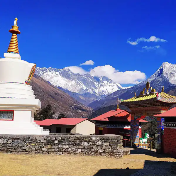
Günə təxminən 130 km uzunluğunda olan Dudh Koşi çayı boyunca gəzinti ilə başlayacaqsınız. Totok və Benkar kəndlərindən keçəcəksiniz, burada təpədəki Thamserku (6,608 m) dağını görə bilərsiniz. Asma körpüdən keçdikdən sonra giriş nöqtəsi olan Monjoya (2,835 m) çatacaqsınız. Sagarmatha Milli ParkıBurada, Jorsalle-dən keçməzdən əvvəl icazələriniz yoxlanılacaq.
Jorsalledən irəliləyərək cığırın ən hündür körpüsü olan Hillari Asma Körpüsündən keçəcək və rododendron meşəsindən dırmaşmağa başlayacaqsınız. Səma açıqdırsa, Everest dağını görə bilərsiniz. Günortadan sonra Xumbu bölgəsinin əsas ticarət və mədəniyyət mərkəzi və Everest Gokyo Ri səyahətinin əsas dayanacağı olan Namçe Bazarına çatacaqsınız.
Səhər yeməyi, Nahar, Şam yeməyi
Çayxana
10 km / 6.2 mil
3,440 m / 11,286 fut
5hrs
Gün 03: Namche Bazarında Aklimatizasiya Günü
Gokyo gölünə yürüşün bu günündə bədəninizin daha yüksək hündürlüyə uyğunlaşmasına kömək etmək üçün Namçe Bazarında (3,440 m) qalacaqsınız. Səhər isə dünyanın ən yüksək hündürlükdə yerləşən otellərindən biri olan Everest View Otelinə (3,880 m) qalxacaqsınız.
Yolda, kiçik təyyarələr üçün ehtiyat eniş yeri kimi xidmət edən Syangboche uçuş-enmə zolağından (3,780 m) keçəcəksiniz. Otelin baxış bucağından Everest, Lhotse, Ama Dablam və Thamserku da daxil olmaqla geniş dağ sistemini görəcəksiniz.
Gəzintidən sonra nahar etmək üçün Namçeyə qayıdacaqsınız və günün qalan hissəsini kəndi gəzməyə sərf edəcəksiniz. Everest bölgəsinin yerli adət-ənənələrini, coğrafiyasını və tarixini izah edən Şerpa mədəniyyət muzeyini və Milli Park Ziyarətçi Mərkəzini ziyarət edə bilərsiniz. Namçedəki mağazalar və çörək sexləri istirahət etmək və enerji toplamaq üçün yer təmin edir.
Səhər yeməyi, Nahar, Şam yeməyi
Çayxana
4 km / 2.5 mil
3,880 m / 12,730 fut
3hrs
Gün 04: Namche Bazarından Dhole'a qədər trek
Namçedə tam bir gün keçirdikdən sonra Kyanqjumaya doğru yürüşə başlayacaqsınız. Bir müddət sonra Sanasaya çatacaqsınız və Monq Laya (3,957 m) aparan yuxarı cığırdan keçəcəksiniz, oradan Ama Dablam və Kangtega (6,782 m) görünür. Dudh Koşi çayının kənarındakı çay kənarındakı ərazi olan Phortse Thengaya (3,680 m) enin. Bu nöqtə Gokyo Vadisinə giriş nöqtəsidir.
Phortse çayını keçdikdən sonra çayın üzərindəki taxta körpüdən keçib meşələrin arasından yoxuşa çıxacaqsınız. Tenqa yaşayış məntəqəsindən keçib Taboçe zirvəsini (6,495 m) görə biləcəyiniz Dhole kəndinə qədər piyada gedəcəksiniz. Gecəni Dholedə keçirəcəksiniz.
Səhər yeməyi, Nahar, Şam yeməyi
Çayxana
12 km / 7.5 mil
3,957 m / 12,982 fut
6hrs
Gün 05: Dhole-dan Machhermo-ya trek
Yürüşün beşinci günündə günə Dholedən (4,200 m) başlayacaq və kiçik Lhabarma yaşayış məntəqələrindən (4,330 m) keçən cığırı izləyəcək, sonra isə Luzaya (4,390 m) çatacaqsınız. Burada Ço Oyu (dünyanın altıncı ən hündür dağı) görə bilərsiniz. Yavaş-yavaş hündürlük qazandıqca yak otlaqlarını və kiçik çortenləri görəcəksiniz.
Günorta saatlarında 1974-cü ildə Yeti hadisəsi ilə tanınan Maçermoya çatacaqsınız. Burada günün qalan hissəsində dincələ və vadini araşdıra bilərsiniz. Maçermodakı Himalay Xilasetmə Assosiasiyasının postu həmçinin Everest Qokyo Ri trek marşrutunda vacib olan hündürlük təhlükəsizliyi barədə gündəlik məlumat verir.
Səhər yeməyi, Nahar, Şam yeməyi
Çayxana
10 km / 6.2 mil
4,470 m / 14,665 fut
5hrs
Gün 06: Maçhermodan Qokyoya trek
Səhər tezdən Maçermodan yürüşə başlayacaqsınız və Dud Koşi çayını izləyəcəksiniz. Qısa bir enişdən sonra Pangkadan (4,390 m) keçəcəksiniz. Buradan Nepalın ən uzun buzlağı olan və təxminən 36 km uzunluğunda olan Nqozumpa buzlağının son morenini görəcəksiniz. Daha sonra çayın üzərindəki körpüdən keçib Longpongo Tsho (4,690 m) kimi tanınan ilk Gokyo gölünə qədər yuxarı qalxacaqsınız.
İkinci göl olan Taboçe Tşodan (4,710 m) keçəcəksiniz və günorta saatlarında yanında Qokyo kəndi yerləşən üçüncü göl olan Dudh Pokhariyə (4,790 m) çatacaqsınız. Bu yaşayış məntəqəsi Ço Oyu dağının altında yerləşir və buradan Nqozumpa buzlağının yuxarı hissəsini görə bilərsiniz.
Səhər yeməyi, Nahar, Şam yeməyi
Çayxana
12 km / 7.5 mil
4,790 m / 15,715 fut
4-5 saat
Gün 07: Gokyo Vadisini araşdırın, Gokyo Riyə dırmaşın və beşinci gölə yürüş edin
Bu gün Gokyo bölgəsini araşdırmaqla bağlıdır. Səhər tezdən Gokyo Riyə (5,360 m) dırmaşmaqla başlayacaqsınız. Zirvədən dünyanın ən yüksək dörd zirvəsinin - Everest, Lhotse, Ço Oyu və Makalunun, eləcə də Nqozumpa buzlaqının mənzərələrini görəcəksiniz. Zirvədə bir müddət keçirdikdən sonra Gokyoya geri enəcəksiniz.
Günorta saatlarında şimala doğru dördüncü göl olan Thonak Tshoya (4,840 m) doğru yürüş edəcək və sonra beşinci göl olan Ngozumpa Tshoya (4,980 m) çatacaqsınız. Buradan Ço Oyu-nun yaxın mənzərələrini görəcəksiniz. Göllər yuxarı Ngozumpa hövzəsindən gələn buzlaq əriməsi ilə qidalanır.
Ərazini araşdırdıqdan sonra gecələmək üçün Gokyo kəndinə qayıdacaqsınız. Everest Gokyo Ri trek marşrutunun bu günü sizə bir gün ərzində həm yüksək hündürlük mənzərələrini, həm də buzlaq-göl tədqiqatını təqdim edir.
Səhər yeməyi, Nahar, Şam yeməyi
Çayxana
14 km / 8.7 mil
5,360 m / 17,585 fut
7hrs
Gün 08: Gokyodan Dhole'ya yürüş
Bu gün Gokyodan enməyə Dudh Pokhari gölünün yanında eyni cığırı izləyərək başlayacaqsınız və sonra Ngozumpa buzlağının qərb hissəsindən aşağı enəcəksiniz. Yüksəklikdən aşağı düşdükcə, Gokyo daş divarlı otlaqdan keçib Phangkaya çatacaqsınız.
Phangkadan Machhermoya doğru davam edəcək və şimaldakı Ço Oyu-nun gözəl mənzərələrini seyr edəcəksiniz. Machhermodan Luzadan daha da aşağı enərək Dhole-a (4,200 m) çatacaqsınız. Everest Gokyo Ri trek marşrutunun bu hissəsi yüksək alp zonasından çıxmağa və daha aşağı hündürlüklərə hazırlaşmağa imkan verir.
Səhər yeməyi, Nahar, Şam yeməyi
Çayxana
15 km / 9.3 mil
4,790 m / 15,715 fut
7hrs
Gün 09: Dhole'dən Namche Bazaar'a trek
Dholedən Dudh Koşi üzərindəki cığırları keçərək Luzaya doğru enin. Qısa bir gəzintidən sonra iki çayın, Dudh Koşi və onun qollarının birləşdiyi Phortse Tenqaya çatacaqsınız. Cığır sizi Ama Dablam və Thamserku kimi zirvələri son dəfə yaxından müşahidə edə biləcəyiniz Mong Laya aparır.
Monq Ladan Kyanqjumaya çatmaq üçün meşədən keçəcəksiniz. Buradan Tenqboçe və Everest Baza Düşərgəsinə gedən cığırların qovuşduğu yerin şahidi olacaqsınız. Daha sonra Namçe Bazarına (3,440 m) doğru davam edəcək və orada yenidən Everest bölgəsinin məşhur marşrutlarına qoşulacaqsınız.
Səhər yeməyi, Nahar, Şam yeməyi
Çayxana
14 km / 8.7 mil
3,957 m / 12,982 fut
6hrs
Gün 10: Namche Bazarından Lukla'ya gediş
Şerpa mərkəzindən çıxdıqdan sonra Hillari Asma Körpüsünə doğru enəcəksiniz. Körpünü keçdikdən sonra Monjo və Jorsalle kimi kəndlərdən keçəcəksiniz və orada Sagarmatha Milli Parkının girişində yoxlayacaqsınız. Larja Dobhan yaxınlığında Bhote Koşi və Dudh Koşi çaylarının qovuşma nöqtəsini yenidən görəcəksiniz.
Günorta saatlarında Phakdingə çatacaqsınız və bir neçə asma körpüdən keçərək Ghat və Thado Koshi-dən keçəcəksiniz. Everest Gokyo Ri yürüşünün dövrəsini tamamladığı Luklaya çatmazdan əvvəl Çheplung-u keçəcəksiniz.
Səhər yeməyi, Nahar, Şam yeməyi
Çayxana
19 km / 11.8 mil
3,440 m / 11,286 fut
7hrs
Gün 11: Katmanduya uçun
Səhər tezdən Lukladan Katmanduya təyyarə ilə uçacaqsınız. Uçuş qısa müddət çəkir və Dudh Koşi Vadisini izləyir, sizə gəzdiyiniz Himalay mənzərələrinə son bir nəzər salmağa imkan verir.
Katmandudakı Tribhuvan Beynəlxalq Hava Limanına eniş etdikdən sonra yürüşünüz rəsmi olaraq başa çatır. Oteldə qeydiyyatdan keçdikdən sonra günün qalan hissəsi boş olacaq. Bir çox yürüşçü bu vaxtdan istirahət etmək, Asan və ya Thamel kimi yerli bazarları araşdırmaq və ya Boudhanath və ya Pashupatinath kimi mədəni yerləri ziyarət etmək üçün istifadə edir.
Səhər yeməyi
otel
2,800 m / 9,186 fut
11 Günlük Everest Gokyo Ri Trek Xəritəsi
Nə gözləmək olar?
Daxil olanlar
Hava limanında qarşılama və yola salma xidmətləri
- Beynəlxalq gəlişdən götürmə
- Oteldən daxili hava limanına yola düşmə (Traisin başlanğıcı)
- Daxili hava limanından qarşılama və otelə transfer (Traveldən sonra)
- Sonuncu yola düşmə gününüzdə beynəlxalq çatdırılma
Yerləşmə Xidmətləri
- Dağlarda yerli çay evlərində 10 gecə (iki nəfərlik qonaqlama əsasında)
Trekking icazəsi
- Yerli Hökumət Giriş İcazəsi (Trek Kartı)
- Sagarmatha Milli Parkı İcazəsi (Everest İcazəsi)
Daxili uçuşlar
- Katmandu – Lukla təyyarəsinə biletlər
- Lukla – Katmandu təyyarəsinə biletlər
Lukla Uçuşu Ramechhap vasitəsilə olduqda
- Katmandudan Ramechhapa nəqliyyatla ortaq nəqliyyatla getmək
- Rameçhap – Lukla daxili aviabiletlər
- Lukla – Rameçhap daxili aviabiletlər
- Rameçhapdan Katmanduya bir Cip paylaşmaqla
Katmandu/Trekking zamanı yemək
- 10 Səhər yeməyi: Çay evi menyusundan yerli və kontinental seçimlər
- 10 Nahar: Nahar düşərgəsindəki çay evlərində sadə və yüngül nahar
- 10 Şam yeməyi: Seçdiyiniz tərəvəz və tərəvəzsiz yeməklər, yerli çay evi menyusundan Nepal və kontinental yeməklər
Bələdçi/Daşıyıcı Xidmətləri və Onların Öhdəlikləri
- Komandamız tərəfindən gətirilən ilk yardım dəsti qutusu
- Trekking bələdçisi – 10 ildən çox təcrübəsi olan ingilisdilli lisenziyalı bələdçi.
- Bələdçi və Daşıyıcı üçün Sığortalar (Təcili evakuasiya və təsadüfi tibbi xərclər)
- Bələdçi/Daşıyıcı üçün bütün yeməklər
- Şirkətin standart dərəcəsinə uyğun əmək haqqı (turizm sənayesinin müvafiq assosiasiyası tərəfindən tövsiyə olunur)
- Maksimum 20 kq-a qədər baqajınızı daşımaq üçün yerli şerpa (1 porter paylaşan 2 qonaq)
- Səyahət və Xilasetmə Təşkilatları
Nələr xaricdir
- Katmanduda trekdən əvvəl və sonra yeməklər,
- Səyahət sığortanız (Xilasetmə)
- Nepala giriş vizasının rüsumu.
- Trekking işçiləri və sürücü üçün məsləhətlər
- İçkilər (isti, soyuq və spirtli)
- Şəxsi alış-veriş, camaşırxana və s.
- Şəxsi trekking avadanlığı.
Tripadvisor rəyləri
Google Reviews
11 Günlük Everest Gokyo Ri Trek Əlavə Məlumat
Gokyo Riyə getmək nə qədərdir?
The 11 günlük Qokyo Ri yürüşü adambaşına 1,000-1,550 ABŞ dollarına başa gəlirIlə qrup endirimləri mövcuddurQiymətə yürüş zamanı bütün zəruri xərclər, o cümlədən Katmandu və Lukla arasında daxili uçuşlar, çayxanalarda yerləşmə, bütün yeməklər, Saqarmatha Milli Parkına giriş icazələri və Xumbu Pasanq Lhamu Kənd Bələdiyyəsinə giriş icazələri daxildir. heç bir gizli ittiham yoxdurVə qiymət dövlət ƏDV və bütün tətbiq olunan vergilər daxildir.
Ödənişiniz həmçinin bələdçilərin və yükdaşıyanların əmək haqqını, Everest Gokyo Ri trek marşrutunun saxlanılmasına kömək edən ətraf mühit haqlarını və təhlükəsiz və rahat bir trek təmin etmək üçün logistikanı da əhatə edir. Bu xərc bölgüsü hər şeyi əhatə edir, buna görə də əlavə və ya gözlənilməz xərclər olmadan səyahətə diqqət yetirə bilərsiniz.
Everest Gokyo Ri Trek-də nə gözləmək olar?
Gokyo Riyə səyahət, müxtəlif mənzərələr, yüksək hündürlük mənzərələri və müxtəlif imkanlarla hər addımda heyrətamizdir. Gokyo Ri yürüşündə nə gözləyə bilərsiniz:
5,357 m hündürlükdə yerləşən Gokyo Ri, 8,000 m hündürlükdə olan dörd zirvənin mənzərələri ilə tanınır.
Gözləyə bilərsiniz ki, Gokyo Riyə dırmanmaq, qərbdəki trekinq zirvəsi Ngozumpa buzlağıZirvəsindən görə bilərsiniz Everest (8,8848.86 m), Lhotse (8,516 m), Makalu (8,481 m) və Ço Oyu (8,188 m) tək bir görünüşdəGokyo kəndindən dırmaşma təxminən 2-3 saat çəkir və cığır yavaş temp tələb edən dik, qayalı hissələrdən ibarətdir.
1974-cü ildə baş verən tarixi Yeti hadisəsi ilə məşhur olan Maçermo
Bu Gokyo Gölü gəzintisi zamanı Machhermodan keçəcəksiniz. O, yerləşir 4,470 m və 1974-cü ildə Yeti hücumu ilə yadda qalıbYerli mənbələrə görə, hadisə zamanı üç yak öldürülüb, bir Şerpa qadını isə yaralanıb. Bu hekayə kəndin yaddaşında qorunub saxlanılıb və bələdçilər tərəfindən tez-tez paylaşılır.
Everestin şimal üzünə açılan mənzərələri ilə məşhur olan 4,980 m hündürlükdə yerləşən Beşinci Gokyo Gölü
Siz ora piyada gedə bilərsiniz beşinci Gokyo Gölü, Gökyo kəndinin şimalında yerləşir və Ngozumpa Tsho kimi də tanınır. Buna yan yoldan keçmək olar. Ngozumpa buzlağıSahillərindən Everestin şimal üzünə və digər zirvələrə baxa bilərsiniz. Gyachung Kang (7,953 m). Bu göl bölgəsi yürüyüşçülər tərəfindən daha az ziyarət edilir və tez-tez daha sakit əsas kənd ərazisindən daha çox.
Çubuq başlı qaz kimi mövsümi quşlar Gökyo gölləri yaxınlığında köç edir
Gökyo gölləri ətrafındakı bataqlıqlar köçəri quşlar üçün istirahət nöqtəsinə çevrilir. barbaşlı qaz, qara boyunlu durnavə tünd qırmızıBu miqrasiyalar mussondan əvvəlki (aprel-may) və mussondan sonrakı (sentyabr-oktyabr) dövrlərdə müşahidə olunur. Yüksək hündürlükdəki göllər qida və sığınacaq təmin edir və müşahidələr yürüşə ekoloji bir cazibə qatır.
Trek ətrafındakı çay evləri
Gokyo Ri yürüşü ilə Everest baza düşərgəsi son bir neçə onillikdə böyüyən yaxşı inkişaf etmiş çayxana şəbəkəsi tərəfindən dəstəklənir. Namçe Bazar, Phakding, Machhermo və Gokyo kimi kəndlərdə il boyu yürüşçüləri qəbul edə biləcək kifayət qədər çayxana var. Çayxana təcrübələri 1960-cı illərdə təqdim edilmişdir, bölgədə trekinq daha populyarlaşdıqda. Bu lojalar əsas sığınacaq və istirahət dayanacaqları təmin edir ki, bu da yüksək hündürlüklərdə iqlimləşmə və təhlükəsizlik üçün çox vacibdir.
Çayxanalar təxminən bir-birindən aralıda yerləşir 3 6 saat üçün Hündürlük artımına uyğunlaşa bilən idarəolunan gündəlik trek seqmentləri yaratmaq üçün ayrıca. Gokyo kəndi və Machhermodakı çayxanalar dünyanın ən hündür trekinq lojaları arasında 4,400 m-dən yuxarıda yerləşir. Onların mövcudluğu sizə təravətləndirici bir fasilə verməyə və qidalı evdə hazırlanmış yeməklərlə enerji almağa imkan verir.
Everest Gokyo Ri Trek-i çətinləşdirən nədir
Everest Gokyo Ri yürüşü yüksək hündürlükləri əhatə edir, bunlardan 2,860 m Luklada 5,357 m Gokyo Ri zirvəsində. 5,300 m hündürlükdə, oksigen səviyyəsi təxminən 50%-ə düşür dəniz səviyyəsində olanların bədənə yük salması və artırması hündürlük xəstəliyi riskiBu marşrut üzrə orta gündəlik trekinq məsafəsi arasındadır. 8 və 12 km, tez-tez əhatə olunur 5 7 saat üçün qayalı, qeyri-bərabər cığırlardan keçin ki, bu da yürüşü çətinləşdirir.
Fiziki hazırlıq trekinqlə məşğul olmaq üçün yaxşı ürək-damar və ayaq gücü tələb edir təxminən 7 ilə 10 kiloqram ağırlığında bel çantasıAşağı oksigen səviyyəsində sabit bir temp saxlaya və uzun günlərdən sonra yaxşı sağala bilməlisiniz. Gokyo yaxınlığındakı hava şəraiti ... arasında dəyişir. 5 ° C ilə -15 ° C arasında, qar yağışı və ya fırtınalar tez-tez olur. Beləliklə, oksigen azlığı, çətin ərazi, dəyişkən hava və uzun yürüş saatlarının birləşməsi bu yürüşü bir qədər çətinləşdirir.
Gokyo Trek üçün ən əlverişli vaxt
The ən yaxşı vaxt Everest Gokyo Ri trekinin tarixi sentyabrın sonundan noyabra qədər və Martdan may ayının əvvəlinə qədərBu ay ərzində regionda daha az yağıntı müşahidə olunur, ayda orta yağıntı miqdarı 30-50 mm, rütubət səviyyəsi 40 ilə 60% arasında, bulud örtüyü isə orta hesabla 30%-dən azdır. Bu şərtlər... aydın səma, gözəl dağ mənzərələri, və daha çox sabit hava by görünürlük və təhlükəsizliyin yaxşılaşdırılması cığırda.
Bunun əksinə olaraq mavi mövsüm iyundan avqusta qədər güclü yağış gətirir, tez-tez ayda 300 mm-dən çox olur, rütubət isə 80%-dən yuxarı qalxır. Dekabrdan fevral ayına qədər qış aylarında az yağıntı olur, lakin Qokyo yaxınlığında temperatur tez bir zamanda -15°C-dən aşağı düşə bilər. Bu, donma riskini artırır və yürüşləri daha da çətinləşdirir. Buna görə də, payız və yaz yürüşü başa çatdırmaq üçün ən etibarlı hava şəraitini təklif edir və idarəolunan şərtlər mövcuddur.
Everest Gokyo Trek İcazəsi
Everest Gokyo Ri yürüşü tələb edir iki əsas icazə: Bu Sagarmatha Milli Parkı İcazəsi və Khumbu Pasang Lhamu Kənd Bələdiyyəsi İcazəsi1976-cı ildə Nepalın Milli Parklar və Vəhşi Təbiəti Qoruma Departamenti tərəfindən təsis edilmiş Sagarmatha Milli Parkı İcazəsi, Xarici vətəndaşlar üçün 30 ABŞ dolları və SAARC vətəndaşları üçün 15 ABŞ dolları. Eynilə, Khumbu Pasang Lhamu icazəsi təxminən 25 ABŞ dolları xərcləyir və Xumbu bölgəsində trekinq fəaliyyətlərini tənzimləmək üçün yerli hökumət tərəfindən verilir.
Hər iki icazə verilə bilər Katmanduda əldə edildi yürüşdən əvvəl və ya parkın girişinə yaxın ofislərdəməsələn, Monjoda. Bu icazələri səyahət boyunca özünüzlə aparmalısınız, çünki onlar Jorsalle, Machhermo və Namche kimi yoxlama məntəqələrində yoxlanılır. Bu icazələr turizmin idarə olunmasında, təbiətin mühafizəsi səylərinin dəstəklənməsində və Everest bölgəsindəki yerli icmalara kömək etməkdə mühüm rol oynayır.
Niyə bizimlə 11 günlük Gokyo Trek-i seçməlisiniz?
Bizimlə birlikdə Gokyo Trek-i seçməyiniz üçün bəzi səbəblər:
- Everest Gokyo Ri trekində 10 ildən çox təcrübəsi olan peşəkar bələdçilərimiz var.
- Gokyo və Machhermo da daxil olmaqla bütün dayanacaqlarda çayxanalarda zəmanətli yaşayış.
- Trekking zamanı hündürlük xəstəliyi riskini azaltmaq üçün akklimatizasiya cədvəlinə ciddi şəkildə əməl edin.
- Bütün lazımi icazələr daxildir: Sagarmatha Milli Parkı və Khumbu Pasang Lhamu.
- İdarəolunan temp üçün gündəlik 8 ilə 12 km arasında trekking məsafələri planlaşdırılır.
- Lukla və Namçe Bazarında 24/7 təcili yardım və təxliyə tədbirləri.
- Gizli ödənişlər və ya gözlənilməz vergilər olmadan şəffaf qiymətlər.
- Ətraflı marşrut və avadanlıq tövsiyələri ilə əhatəli trek öncəsi brifinq.
Gokyo Ridən hansı zirvələri görə bilərsiniz?
Gokyo Ri zirvəsindən bir neçə əsas Himalay zirvəsini görə bilərsiniz. Bu dağlar Everest bölgəsindəki hündürlüyü və coğrafi əhəmiyyəti ilə diqqət çəkir. Gokyo Ridən görünən əsas zirvələrin siyahısı:
- Everest dağı (8,848.86 m): Kimi tanınır "Sagarmatha" Nepal dilində və "Xomolunqma" Tibet dilində Yer kürəsindəki ən hündür dağdır.
- Lhotse (8,516 m): Çağırıldı "Cənubi Zirvə", bu, dünyanın dördüncü ən yüksək dağ.
- Makalu (8,485) m): Dırmaşması ən çətin 8,000 m-lik zirvələrdən biri hesab olunur.
- Ço Oyu (8,188 m): Ləqəbli "Firuzəyi ilahəsi", bu zirvə daha asan dırmanma marşrutuna görə alpinistlər arasında populyardır.
- Gyachung Kang (7,952 m): Bu ən az dırmaşan dağ və on beşinci ən yüksək dağ dünyada.
- Tawoche (6,462 m): Qokyo yaxınlığındakı görkəmli bir dağ.
- Ngozumpa Kang (7,206 m): A əsas su mənbəyi Everest bölgəsi üçün.
Mövsümlərarası dövrdə Everest Gokyo Ri dağına gedə bilərikmi?
Bəli, mövsümdənkənar dövrdə Everest Gokyo Ri dağını gəzə bilərsiniz və bunu etməyin bir sıra unikal üstünlükləri var. Qışda və ya mussonda yürüş etmək təcrübə qazanmaq şansı verir. kimi festivallar Mani RimduPayızda keçirilir, lakin hazırlıqlar və kiçik mərasimlər qeyri-iş aylarında da müşahidə edilə bilər. cığırlar daha sakit və daha az izdihamlıdır, bu da kəndlərdə gündəlik həyatı müşahidə etmək üçün daha çox fürsət deməkdir. Mövsümdənkənar yürüşlər həmçinin dəyişən mənzərələri, məsələn, Qışda donmuş göllər or Musson dövründə yaşıl vadilər.
İllik ümumi yürüyüşçülərin təxminən 10-15%-i mövsümdənkənar dövrdə Qokyo Riyə baş çəkir. Lakin nəzərə alın ki, mövsümdənkənar yürüyüşlər güclü hazırlıq tələb edir üçün soyuq hava, dəyişən yol şəraitivə məhdud sayda çayxana xidmətləriMövsümlərarası dövrdə daha macəralı bir səyahət yaşamaq istəyirsinizsə, sınayın Everest Ço La Aşırımı yürüşü. Buraya Ço La kimi yüksək dağ aşırımları daxildir və daha böyük fiziki və naviqasiya çətinlikləri tələb edir.
Yüksəklik Səviyyəsi və Ümumi Məsafə
Gokyo Ri-nin ümumi məsafəsi konkret marşrutdan asılıdır götürülmüşdür. Lakin, Lukladan başlayaraq Gokyo Ri ilə bitənə qədər, bu, davam edir 40-45 km (25–28 mil) dairə səfərMüddət ərzində trekkerlər aşağıdakı kimi müxtəlif yüksəkliklərdə yerləşən görkəmli yerlərdən keçirlər:
| SN | Yer | Yüksəklik |
| 1 | Lukla | 2,800 m / 9,184 fut |
| 2 | Fakdinq | 2,652 m / 8,700 fut |
| 3 | Namche Çarşı | 3,440 m / 11,283 fut |
| 4 | Dhole | 4,110 m / 13,480 ft |
| 5 | Machhermo | 4,470 m / 14,663 fut |
| 6 | Gokyo Vadisi | 4,800 m / 15,744 fut |
| 7 | Gokyo Ri | 5,357 m / 17,570 fut |
Gokyo Ri Trek-ə necə hazırlaşırsınız?
Gokyo Ri yürüşünə hazırlıq fiziki hazırlıq, zehni hazırlıq və diqqətli yığışma tələb edir. Bu, yürüş zamanı təhlükəsizliyin, rahatlığın və daha yaxşı ümumi təcrübənin təmin edilməsinə kömək edir. Səyahətə hazırlaşmaq üçün əsas addımlar aşağıda verilmişdir.
- Fiziki fitnessDözümlülüyü artırmaq üçün qaçış, velosiped sürmə və ya üzgüçülük kimi ürək-damar məşqlərinə diqqət yetirin. Çətin ərazilərin öhdəsindən gəlmək üçün ayaqlar, gövdə və bel üçün güc məşqləri edin. Yürüş şəraitini simulyasiya etmək üçün yüklü bir çanta ilə yürüyüş məşqləri edin.
- Ruh hazırlığıHündürlük xəstəliyi və onun simptomları haqqında məlumat əldə edin ki, erkən əlamətləri müəyyən edə biləsiniz. Dəyişən hava və cığır şəraitində səbirli və uyğunlaşa biləsiniz.
- Qablaşdırma əsasları-15°C-dən 10°C-yə qədər temperatura uyğun, çoxqatlı geyimlər, o cümlədən istilik keçirməyən geyimlər və suya davamlı gödəkçələr gətirin. Yaxşı ayaq biləyi dəstəyi olan trek çəkmələri geyin. Yataq torbası, trek dirəkləri, ilk yardım dəsti, su təmizləyici tabletlər və günəşdən qorunma kimi zəruri ləvazimatları özünüzlə götürün.
- Akklimatizasiya planıBədəninizin hündürlük dəyişikliklərinə uyğunlaşmasına imkan vermək üçün tövsiyə olunan cədvələ əməl edin, Namçe Bazarı kimi əsas nöqtələrdə istirahət günləri keçirin.
- Səyahət logistikasıXüsusilə Katmandu-Lukla sektoruna uçuşları erkən sifariş edin, hava ilə əlaqəli mümkün gecikmələrə hazır olun və ya paketi bizdən götürün; hər şeyi biz həll edəcəyik.
Yerli Bələdçi və Daşıyıcılar
Everest səyahətimin unikal cəhətlərindən biri də budur ki, Müştərilərimizə yerli bələdçi və yükdaşıyan xidmət göstəririk onların səfəri üçün. Biz əsasən təklif edirik yerli Şerpa bələdçiləri Himalay dağlarında ekspedisiyalar üçün təcrübəli mütəxəssislər və cəsarətləri ilə tanınan şəxslər. Onlar bölgənin cığırları, mənzərəsi və mədəniyyəti ilə tanışdırlar. Bələdçilərimizin əksəriyyəti yürüşün keçirildiyi ərazilərdə doğulub böyüyüblər. Onlar ərazinin tarixi, müxtəlif ekosistemi və mədəniyyəti haqqında tam məlumat verirlər.
Bundan əlavə, yükdaşıyanlarımız, xüsusən də kələ-kötür ərazilərdə yorucu ola biləcək yürüşçülərin keçməli olduğu ərazidən gəlirlər. Onlar mehriban və çalışqandırlar və yürüşdə diqqətinizi cəmləməyiniz üçün bütün çantalarınızı daşıyırlar. Yükdaşıyanlarımız yerli olduğundan, onları işə götürməklə yerli iqtisadiyyatı dəstəkləməyi hədəfləyirik.
Əgər belə bir səyahəti birləşdirmək istəyirsinizsə Gokyo Ri Everest Baza Düşərgəsi Yürüşü, biz bunu sizin üçün fərdiləşdirə bilərik.
Everest Gokyo Ri Trek zamanı yemək seçimləri
Ərzində Gokyo Ri yürüşü, cığır boyunca çayxanalarda və lojalarda bir neçə yemək seçimi təqdim olunur. Dal Bhat, Tibet çörəyi, pancake, yumurta, kartof, çay və s. kimi yeməklər. qəhvə tez-tez hər yaşayış yerində verilir. Budur, trek boyunca təqdim ediləcək yeməklər haqqında aydın bir cədvəl.
| Səhər yeməyi | Günorta yeməyi | Nahar |
|---|---|---|
|
|
|
11 Günlük Everest Gokyo Ri Trek Tez-tez Verilən Suallar
"Gokyo" adının mənşəyi nədir?
"Gokyo" sözü Şerpa dilindən götürülmüşdür və mənası "beş müqəddəs göl" deməkdir. Yürüş yerli Şerpa icması üçün dini əhəmiyyət kəsb edən buzlaq gölləri ilə tanınan bu vadidən keçir.
Gokyo bölgəsi yaxınlığında nəsli kəsilməkdə olan hər hansı bir növ görə bilərəmmi?
Bəli, ərazi qar bəbiri və Himalay mavi qoyunu (bharal) kimi nəsli kəsilməkdə olan növlərə ev sahibliyi edir. Görməli yerlərə getmək nadir haldır, lakin onların mövcudluğu bölgənin ekoloji əhəmiyyətini təmsil edir.
Nqozumpa buzlağının regional hidrologiyada əhəmiyyəti nədir?
Nqozumpa buzlağı, Koşi çay sisteminin əsas qolu olan Dudh Koşi çayını ərimiş su ilə təmin edir. Həcmindəki dəyişikliklər kənd təsərrüfatı, içməli su və su elektrik stansiyaları üçün çaydan asılı olan minlərlə insanın aşağı axındakı suyun mövcudluğuna təsir göstərir.
Qışda Qokyo yaxınlığında qeydə alınan ən aşağı temperatur hansıdır?
Qışda Qokyo yaxınlığında qeydə alınan ən aşağı temperatur gecələr -20°C (-4°F) ətrafında olub. Yüksək hündürlükdə güclü küləklər soyuğu artırır və bu da soyuq havada hipotermiya və donvurmanın qarşısını almaq üçün müvafiq geyim və avadanlıq tələb edir.
Geologiya və qayalıq növləri Qokyo Ri trekindəki cığır vəziyyətinə necə təsir edir?
Cığır buzlaq fəaliyyəti nəticəsində əmələ gələn çöküntü və metamorfik süxurlarla kəsişir. Boş qayalar, daşlı yamaclar və morena silsilələri geniş yayılmışdır ki, bunlar bəzən qeyri-sabit cığır hissələri yaradır. Bu şərait yaxşı ayaqqabı və düzgün planlaşdırma tələb edir.
Cığırın ətrafında nəsli kəsilməkdə olan dərman bitkiləri tapa bilərəmmi?
Bəli, cığırın ətrafında nəsli kəsilməkdə olan dərman göbələyi olan Yarsagumba (Cordyceps sinensis)-ə rast gəlmək olar. Ənənəvi tibbdə çox tələbat var, lakin hazırda həddindən artıq yığım səbəbindən problemlərlə üzləşir.
Everest Gokyo Ri trekində hündürlük və ultrabənövşəyi radiasiya necə qarşılıqlı təsir göstərir?
Daha yüksək hündürlüklərdə atmosfer daha nazikdir və bu da dəniz səviyyəsinə nisbətən UB radiasiyasına məruz qalmanı 50%-ə qədər artırır. Bu, günəş yanığı və göz zədələnməsi riskini artırır; buna görə də, belə yüksək hündürlükdə yürüş edən hər kəs üçün günəşdən qorunma vacibdir.
Gokyo Ri zirvəsinin ən aydın mənzərəsini günün hansı vaxtında görə bilərəm?
Gokyo Ri zirvəsində aydın görünürlük üçün ən yaxşı vaxt səhər tezdən saat 6:00 ilə 8:00 arasındadır. Bu saatlarda küləyin sürəti daha aşağı və bulud örtüyü minimaldır ki, bu da dağ mənzərəsi və fotoqrafiya üçün şəraiti yaxşılaşdırır.
Gökyo Vadisi icmalarında yak otlaqçılığı hansı rol oynayır?
Yak otlaqçılığı ət, süd və nəqliyyat təmin edir. Yaklar ucqar kəndlərə və yaşayış yerlərinə təchizatın daşınması üçün vacibdir. Otlaqçılıq Everest bölgəsinin yerli dolanışıqlarını və mədəni təcrübələrini dəstəkləyir.
Mikroplastiklərin Everest Qokyo Ri trek mühitinə təsiri nədir?
Mikroplastiklərin Everest Qokyo Ri trek mühitinə təsiri su mənbələrinin və trek marşrutlarının yaxınlığındakı torpağın çirklənməsini əhatə edir. Bu plastik hissəciklər atılan tullantılardan əmələ gəlir və yerli vəhşi təbiət və ekosistemlər üçün təhlükə yaradır.
Everest Gokyo Ri bölgəsində hava proqnozları nə dərəcədə etibarlıdır?
Bölgədəki hava proqnozları peyk məlumatlarından və yerli müşahidələrdən istifadə edir, lakin dağ hava şəraitinin sürətli dəyişməsi səbəbindən gözlənilməz ola bilər. Hava proqnozu açıq olsa belə, fırtınalara və temperatur dəyişikliklərinə hazırlaşmalısınız.
Gokyo Ri yaxınlığında rastlaşa biləcəyim ən çox yayılmış hündürlük xəstəliyinin simptomları hansılardır?
Baş ağrısı, başgicəllənmə, ürəkbulanma və yorğunluq kimi simptomlarla qarşılaşa bilərsiniz. Bunlar 4,500 m-dən yuxarı yüksəkliklərdə oksigen səviyyəsinin azalması səbəbindən yaranır və idarə etmək üçün düzgün istirahət və uyğunlaşma tələb olunur.
Everest Gokyo Ri trekindən əvvəl hansı peyvəndləri vurdurmalıyam?
Hepatit A və B, tif, tetanoz və uşaqlıq dövründə adi peyvəndlər qəbul etməyiniz tövsiyə olunur. Bəzi yürüyüşçülər qrip peyvəndi də alırlar və sarı qızdırma peyvəndi yalnız yoluxmuş ölkələrdən gəldikdə tələb olunur. Peyvənd yürüyüş zamanı ucqar ərazilərdə ümumi infeksiyaların riskini azaltmağa kömək edir.
Everest Gokyo Ri trekində hansı ümumi xəstəliklərə diqqət yetirməliyəm?
Tənəffüs yoluxucu xəstəlikləri, mədə-bağırsaq pozğunluqları, yüksəklik xəstəliyi və yüngül xəsarətlər kimi ümumi problemlərdən xəbərdar olmalısınız. Bu riski minimuma endirmək üçün əsas dərmanlarla birlikdə ilk yardım dəstini gəzdirin və gigiyena qaydalarına əməl edin.
Səyahət zamanı sağlamlıq problemləri üçün hansı təcili protokollar mövcuddur?
Yerli bələdçilərin və agentliklərin vertolyotla xilasetmə də daxil olmaqla təxliyə planları var. Səhiyyə məntəqələri ilə radio və ya peyk telefonu vasitəsilə əlaqə saxlamaq mümkündür. Təcili yardım əlaqə nömrələriniz və yüksək hündürlükdə təxliyəni əhatə edən sığortanız olmalıdır.
ABŞ dolları 1,250 adam başına
- Best Qiymət Zəmanət
- Təhlükəsiz Ödəniş Sistemi
- Xüsusi və Fərdiləşdirilmiş Marşrut
- 70% təkrar müştərilər
24 X 7 Canlı Dəstək

Puru (+977-9851069558)
Əlaqədar Səfərlər
Bloqumuzdan Son Xəbərlər Görməli yerlər, səyahət tövsiyələri, xəbərlər və daha çox.

Everest, Blog, gokyo, Gokyo Trek, Nepalda trekinq
Everest Gokyo Ri Trek haqqında bilməli olduğunuz şeylər
Gokyo Vadisi onu "Ölüm Vadisi" adlandırır və belə də olmalı idi...
Tam yazını oxuyun
Nepal, Nepalda Tur
Nepaldakı 7 Ən Gözəl Göl
Nepaldakı ən yaxşı göllər sizə heyrətamiz təbii gözəllik və mədəni immersiya təklif edir. Bəzilərinə Rara daxildir...
Tam yazını oxuyun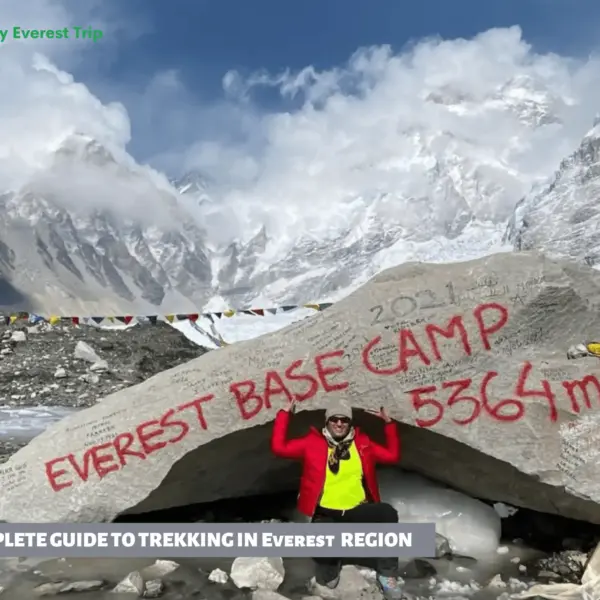
Everest, Blog, Nepalda trekinq
Tam Everest Trekking Bələdçisi
Everest Trekking Bələdçisi Tam Everest Trekking Bələdçisi dünya miqyasında bir çox trekləri əhatə edir, lakin heç biri...
Tam yazını oxuyun