Будь ласка, подивіться на наш Манаслу Circuit Trek карта дізнатися про головні зупинки, визначні пам'ятки та красу регіону. Для любителів трекінгу регіон Манаслу набирає популярності серед ентузіастів трекінгу. Незвичайні стежки, ізольована природа та приголомшлива краса приваблюють туристів з усього світу. Під час походу відкриваються захоплюючі краєвиди на гору Манаслу, 8-му за висотою гору у світі.
Карта треку Манаслу містить детальну інформацію про всі важливі місця, відстань та висоту, яку ви набиратимете, а також маршрут, яким ви будете йти. Наявність карти означає, що у вас буде гід. Також дуже рекомендується взяти карту в подорож. Це забезпечить вам правильний напрямок та допоможе в навігації.
Команда Кольцевий маршрут Манаслу менш людно, тобто менше людей на стежці. Таким чином, звертатися за допомогою до інших досить складно під час подорожі. Якщо ви хочете зрозуміти рівень складності пригоди, карта також може вам у цьому допомогти. Хочете дізнатися більше про Кольцевий маршрут МанаслуЦей посібник для вас.
Зміст
Найцікавіші моменти поїздки по колу Манаслу
- Отримайте крупний план гори Манаслу, восьмої за висотою гори, а також найвищих вершин Аннапурни, Ганеш Гімал, Чео Гімал та Нгаді Чілі.
- Насолоджуйтесь тибетською культурою та традиціями народів Гурунг та Магар.
- Пройдіться незвичайними стежками та насолоджуйтесь тихою стежкою, яка наблизить вас до природи.
- Кинути собі виклик під час походу та отримати відчуття досягнення після його завершення.
- Велике відчуття досягнення через перемогу Ларк'я Ла (5,160m)
- Ви матимете можливість побачити такі види дикої природи, як червоні панди, снігові барси, орли, кабарги та гімалайські тар, а також різноманітну флору.
- Чи не могли б ви пройти через алею та заповідну зону Манаслу? Будхі Гандакі В.
Маршрут Манаслу
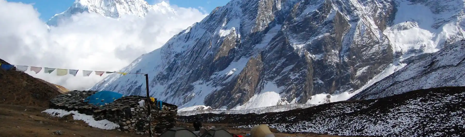
Трек по колу Манаслу починається з пригодницькою поїздкою з Катманду до Соті-Холи. Піший похід розпочнеться другого дня. Перше село, де ми зупинимося, — Мачха-Хола, потім Джагат і Денг. Під час нашого шляху ми підемо берегом річки Будхі-Гандакі, перетнемо підвісні мости та пройдемо через пишні ліси та терасовані поля.
Коли ми рухаємося вище з цього місця, Стежка стає складнішою, особливо з наближенням села Самагаон та Самдо. Протягом усього походу ми насолоджуватимемося захоплюючими краєвидами Манаслу та інших вершин. Якщо вам пощастить, ви також зможете побачити рідкісну фауну регіону. Перетин Ларк'я Ла Пасс, найвища точка походу на висоті 5,106 метрів, буде найскладнішою частиною, але вона винагородить нас приголомшливими гірськими краєвидами.
Досягнувши перевалу, розпочнеться наша подорож спуском. Ми спустимося через такі села, як Бімтханг і Тілідже, крізь мальовничі ландшафти та ліси. Подорож завершиться в Дхарапані, звідки ми повернемося до Катманду. Пригода триває приблизно 12 днів, що дозволить вам завершити її за 12 днів та створити чудові спогади про культурні зустрічі, природну красу та видатні досягнення.
12-денний маршрут трекінгу по колу Манаслу
Якщо ви забронюєте у нас, ми пропонуємо вам 12-денний трек по колу Манаслу за 920 доларів США з особи. Ось розклад нашого маршруту. Ви також можете налаштувати його для своєї зручності.
День 01: Поїздка з Катманду до Макча-Кхола
- Висота Катманду: 1400 м
- Висота над рівнем моря Мачча Хола: 900 м
- Перепад висоти: 500 м
- Тривалість в дорозі: 8-9 годин
День 02: Трекінг від Макча-Кхола до Джагат
- Висота над рівнем моря Мачча Хола: 900 м
- Висота Джагат: 1410 м
- Підйом висоти: 510 м
- Тривалість походу: 6-7 годин
День 03: Трекінг з Джагата до Денга
- Висота Джагат: 1410 м
- Висота Ден: 1804 м
- Підйом висоти: 394 м
- Тривалість походу: 6-7 годин
День 04: Трекінг від Денга до Намрунга
- Висота Ден: 1804 м
- Висота Намрунга: 2630 м
- Підйом висоти: 826 м
- Тривалість походу: 6-7 годин
День 05: Трекінг з Намрунгу до Лхо
- Висота Намрунга: 2630 м
- Висота Лхо: 3180 м
- Підйом висоти: 550 м
- Тривалість походу: 5-6 годин
День 06: Трекінг з Лхо до Самагаона
- Висота Лхо: 3180 м
- Висота Самагаона: 3530 м
- Підйом висоти: 350 м
- Тривалість походу: 4-5 годин
День 07: Акліматизація в Самагаоні
День 08: Трекінг з Самагаона до Самдо
- Висота Самагаона: 3530 м
- Висота Самдо: 3860 м
- Підйом висоти: 330 м
- Тривалість походу: 4-5 годин
День 09: Трекінг із Самдо до Дхарамсали
- Висота Самдо: 3860 м
- Висота Дхарамсали: 4460 м
- Підйом висоти: 600 м
- Тривалість походу: 4-5 годин
День 10: Трекінг від Дхарамсали до Ларкья Ла до села Бімтанг
- Висота Дхарамсали: 4460 м
- Висота над рівнем моря Ларк'я Ла: 5160
- Підйом висоти: 700 м
- Висота Бімтанга: 3720 м
- Тривалість походу: 8-9 годин
День 11: Трекінг від села Бімтханг до Дхарапані
- Висота Бімтанга: 3720 м
- Висота Дхарапані: 2300 м
- Перепад висоти: 1420 м
- Тривалість походу: 7-8 годин
День 12: Автомобільний проїзд з Дхарапані до Катманду
- Висота Дхарапані: 2300 м
- Висота Катманду: 1400 м
- Перепад висоти: 900 м
- Загальна тривалість: 8-9 годин
Висота та загальна відстань на трасі Манаслу
| день | Маршрут | Висота | відстань | Тривалість |
| 1 | Поїздка з Катманду до Макча-Кхола | 900 м | 120 км | 8-9 год |
| 2 | Похід від Макча-Кхола до Джагат | 1410 м | 14 км | 6-7 год |
| 3 | Похід від Джагата до Денга | 1804 м | 19 км | 6 до 7, |
| 4 | Похід з Денга до Намрунга | 2630 м | 19 км | 6-7 год |
| 5 | Похід з Намрунга до Лхо | 3120 м | 10 км | 5-6 год |
| 6 | Похід з Лхо до Самагаона | 3530 м | 13 км | 4-5 год |
| 7 | Акліматизація в Самагаоні | 3530 м | - | - |
| 8 | Похід з Самагаона до Самдо | 3860 м | 10 км | 4-5 год |
| 9 | Похід з Самдо до Дхарамсали | 4460m | 13 км | 4-5 год |
| 10 | Похід від Дхарамсали до Ларкья Ла до Бімтанга | 5160 м (Ларк'я Ла) | 24 км | 8-9 год |
| 11 | Похід від села Бімтанг до Дхарапані | 2300m | 19 км | 7-8 год |
| 12 | Поїздка з Дхарапані до Катманду | 1400m | 170 км | 8-9 год |
Головна визначна пам'ятка маршруту Манаслу-Круговий трек
Гора Манаслу
Цей похід приведе вас близько до 8-ма за висотою гора у світі, гора Манаслу, 8,163 метри. Під час цієї пригоди ви стоятимете біля підніжжя цієї вершини. Крім того, ви також побачите інші гори, такі як Аннапурна, Ганеш Гімал, Чео Гімал та Нгаді Чілі.
Ларк'я Ла Пасс
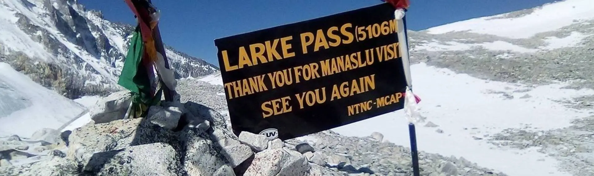
Перевал Ларкх'я Ла, о. 5,106 метрів – найвища точка, якої ви досягнете в цій подорожіЗупинившись там, ви побачите панорамний вид на Гімалаї. Це вважається найдовшим перевалом у Гімалаях у Непалі, розташований між Дхармашалою та Бімтхангом.
Заповідник Манаслу
Похід проходить через заповідну зону Манаслу. Ця місцевість пропонує вам можливість побачити різноманітну флору та фауну регіону. Ви можете побачити такі види диких тварин, як червоні панди та гімалайські тар. Отримання дозволу на перебування в заповідній зоні Манаслу є важливим, оскільки похід проходить через цю територію.
Традиційні села та культура
Ви проїдете через такі села, як Мачча Хола, Намрунг, Самагаун, Самдо, Бхімтанг та інші. Ці села дозволять вам познайомитися з культурою та традиціями тибетського народу. Люди тут доброзичливі та нададуть вам теплу та гостинну гостинність.
Наскільки важкий маршрут Манаслу?
Порівняно з іншими треками в Непалі, трек по колу Манаслу є помірно складним.ly складні пригода в Гімалаях. віддаленість походу та високогір'я створюють численні труднощі для туристівДля завершення походу потрібна добра фізична підготовка, оскільки вам доведеться годинами йти крутими стежками вгору та вниз. Маршрут включає пересічені стежки, переправи через річки та випадкові зсуви, що вимагає зосередженості та обережних кроків.
Складний перевал Ларк'я-Ла, що розташований на висоті 5160 метрів, також пролягає вздовж маршруту. Ця ділянка є найскладнішою частиною маршруту через розріджене повітря та низькі температури. Однак поступова акліматизація та належна підготовка роблять похід посильним для більшості туристів. Незважаючи на труднощі, похід виправдовує всі зусилля, з прекрасними гірськими краєвидами та багатим культурним досвідом.
Заключні думки
Перш ніж розпочати пригоду, вам слід ознайомитися з картою маршруту Манаслу. Це гарантує, що ви добре поінформовані про місцевість, а також матимете уявлення про труднощі, з якими зіткнетеся під час подорожі. Це допоможе вам підготуватися до викликів, забезпечуючи безпечний та приємний трекінг у регіоні Манаслу. Під час цього треку ви не лише побачите природну красу Гімалаїв, але й матимете можливість зануритися в унікальну культуру людей.
Поширені запитання
Чи складніший маршрут Манаслу, ніж трек Аннапурна?
Трек-кільце Манаслу, як правило, складніший, ніж трек-кільце Аннапурни. Стежки тут більш віддалені, пересічені та менш розвинені, з обмеженими можливостями порівняно з Аннапурною. Перевал Ларк'я-Ла, заввишки 5,106 метрів, також є складнішим за перевал Торонг-Ла з точки зору рельєфу та висоти.
Яка тривалість походу по колу Манаслу?
Похід по колу Манаслу зазвичай триває від 12 до 14 днів. Загальна пройдена відстань становить близько 177 кілометрів (110 миль), залежно від обраного маршруту. Тривалість включає один або два дні акліматизації в таких селах, як Самагаон або Самдо.
Які дозволи потрібні для походу по колу Манаслу?
Для походу по колу Манаслу вам знадобляться три дозволи: дозвіл на перебування в обмеженій зоні Манаслу (MRAP), дозвіл на перебування в природоохоронній зоні Манаслу (MCAP) та дозвіл на перебування в природоохоронній зоні Аннапурни (ACAP). Наявність цих дозволів гарантує відповідальне подорожування регіоном Манаслу.
Коли найкращий час для походу по колу Манаслу?
Найкращий час для походу по маршруту Манаслу – весна (з березня по травень) та осінь (з вересня по листопад). Ці пори року пропонують стабільну погоду, чіткі гірські краєвиди та комфортні умови для походів. Взимку та під час мусонів можливі походи, але вони пов'язані з такими труднощами, як сніг та дощ.
Чи є варіанти проживання вздовж маршруту Манаслу?
Так, вздовж маршруту є чайні будиночки та лоджії, де пропонують базове харчування та проживання. Зручності простіші та обмеженіші, ніж на трасі Аннапурна. У пік сезону вам потрібно буде бронювати житло заздалегідь.