17 Days
Quick Facts
Ground transportation in Nepal
Hotels & tea-house accommodation
All meals except in Kathmandu
Guided tour & trek throughout the trip
Autumn, Spring
Moderate
Nepal
5,545
Kathamandu - Lukla - Namche - Kongma La - EBC - Cho la -Gokyo - Ranjola - Lukla - Kathamndu


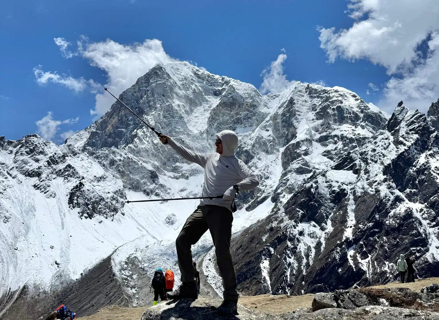
Why 17 Days Everest Three Pass Trek?
- Experience the adrenaline-pumping challenge of crossing Kongma La (5,535m), Cho La (5,420m), and Renjo La (5,360m)—a true test of endurance
- Witness spectacular vistas of Mount Everest, along with Lhotse, Makalu, and Cho Oyu, from some of the most scenic viewpoints on Earth.
- Stand at the legendary Everest Base Camp and feel the powerful energy of mountaineering history.
- Discover the turquoise beauty of Gokyo Lakes and hike up Gokyo Ri for panoramic sunrise views that are simply unforgettable.
- Immerse yourself in the warm hospitality of the Sherpa people and visit ancient monasteries in villages like Namche Bazaar and Tengboche.
- Unlike standard Everest treks, this route offers serene trails, untouched landscapes, and a true wilderness experience.
- Trek through Sagarmatha National Park, home to rare wildlife, glaciers, and dramatic alpine terrain.
Trip Overview
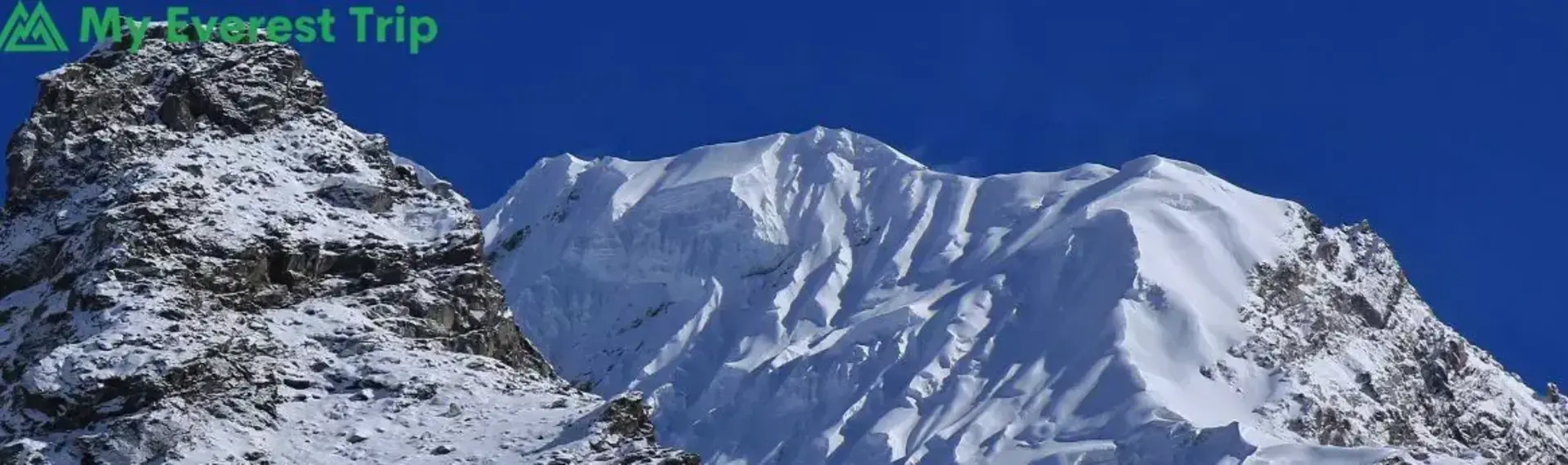
The Everest Three Pass Trek is one of the most challenging treks in the Khumbu region, designed for trekkers who want to experience everything the Everest trails offer. Over about 17 to 20 days, you’ll cross three high passes-Renjo La at 5,360 m, Cho La at 5,420 m, and Kongma La at 5,535 m.
Your journey starts with a short flight to Lukla and an ascent through Phakding and Namche Bazaar, the lively Sherpa hub. From Namche, you’ll head toward Tengboche and Dingboche before climbing Chhukung Ri (5,550 m). From the summit, you are rewarded with panoramic views of several of the world’s highest mountains like Everest (8,848.86 m), Lhotse (8,516 m), Makalu (8,485 m), Baruntse (7,162 m), Ama Dablam (6,812 m), and Nuptse (7,861 m).
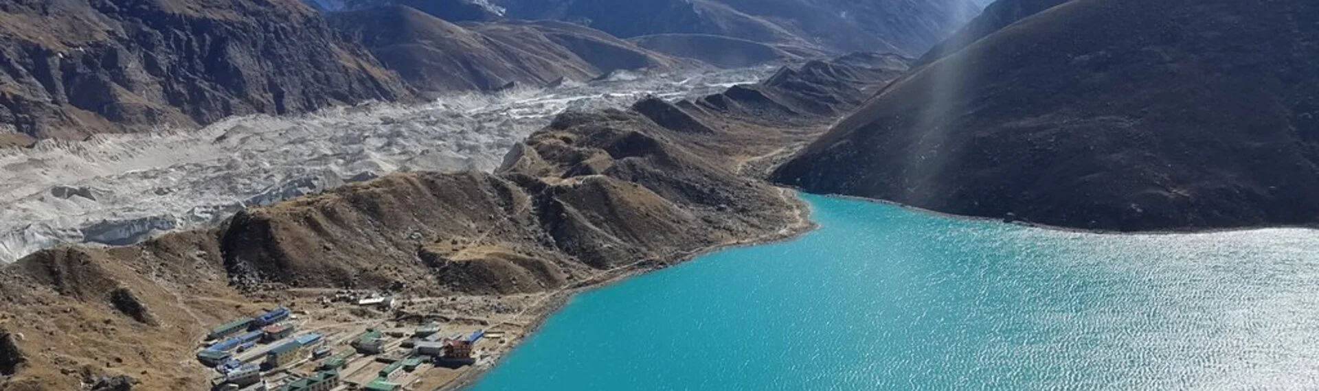
The first major challenge comes with Kongma La Pass. Here, you’ll cross glacial terrain en route to Lobuche. From there, you’ll hike to Gorakshep and stand on Kala Patthar before returning through Lobuche. The trek continues across Cho La Pass into Dzongla and onward to the Gokyo Valley. In Gokyo Valley, you’ll take one rest day to climb Gokyo Ri and explore Gokyo Lakes. For Hindus, the lakes are considered the dwelling place of the Snake God, or Nag Devata, and are believed to be the tears of Lord Shiva. A temple to Lord Vishnu and Lord Shiva is located at the western corner of the main lake, Dudh Pokhari.
The journey then crosses Renjo La Pass to Marlung, before returning to Namche Bazaar, Lukla, and finally back to Kathmandu. Along the way, you’ll walk across glaciers like Ngozumpa and Khumbu, visit Tengboche Monastery, and rest in traditional Sherpa villages. The trek demands good fitness and acclimatization, but it offers you unique Himalayan diversity- alpine lakes, glaciers, valleys, and cultural encounters with the Sherpa people.
The Ultimate Everest Three Pass Trek Guide for 2026 introduces trekkers to an epic, legendary, and thrilling adventure through the heart of the Himalayas. Known as one of Nepal’s most challenging and rewarding routes, this unforgettable journey combines high-altitude passes, remote Sherpa villages, and spectacular mountain landscapes.
Discover the Legendary Everest Three Pass Trek and witness extraordinary, incredible, and breathtaking views of Everest, Lhotse, Makalu, and Cho Oyu. Our Epic Everest Three Pass Trek: Complete Adventure Guide provides everything you need, including the Best Everest Three Pass Trek Itinerary & Cost, route details, and preparation tips.
Whether you’re seeking an Unforgettable Everest Three Pass Trek Experience or searching for an Expert Everest Three Pass Trek Guide: Routes, Tips & Costs, this comprehensive resource is perfect. Explore the Top Everest Three Pass Trek Package & Planning Guide and experience the Ultimate Everest Three Pass Trek Adventure in Nepal with confidence.
It’s not just about reaching Everest Base Camp; it’s about seeing the entire Everest region on a single journey, where every pass opens a new horizon.
17 Days Everest Three Pass Trek Itinerary
Day 01: Fly to Lukla, trek to Phakding
Your Everest Three Pass Trek begins with a scenic flight to Lukla from Kathmandu. Most trekkers take a short domestic flight from Tribhuvan International Airport in Kathmandu to Tenzing-Hillary Airport in Lukla. Flights sometimes connect via Manthali Airport in Ramechhap due to weather conditions or airline schedules. The route through Manthali is chosen to avoid delays at Kathmandu and to provide safer takeoffs during early morning winds.
The flight to Lukla is itself a highlight of the trek. As you ascend, you’ll see the Kathmandu Valley, the Langtang Himalayan range, and green river valleys. Snow-capped mountains like Gauri Shankar and Thamserku are also visible. The plane lands on a short, sloping runway surrounded by mountains and hills.
From Lukla, the trek to Phakding is short and beautiful. The trail follows the Dudh Koshi River, crosses the suspension bridge, and passes through Chaurikharka. Closer to Phakding, you’ll get your first view of Nuptse, Khumbila, and Kongde Ri. If you’re early, then you can go for a visit to Rimishung Monastery in Phakding.

Breakfast, Lunch, Dinner
Lodge
8 km / 5 miles
2,840 m / 9,318 ft
3hrs
Day 02: Phakding to Namche Bazaar
Dudh Koshi River is what you’ll follow on this day. You’ll cross the Hillary suspension bridge and trek towards Monjo Village. Monjo serves as the official gateway to Sagarmatha National Park, a UNESCO Heritage Site. Here, your permits are checked by officials from the national park, which is managed by the Nepalese government’s Department of National Parks and Wildlife Conservation. If you are starting your trek from an alternative route like Jiri or Salleri, this will be your first opportunity to purchase the Khumbu permit.
As you approach Namche Bazaar, you enter a Sherpa town at 3,440 m. The colorful streets are full of shops, teahouses, and prayer flags. Reaching Namche is a rewarding feeling. It is your first major stop for rest and acclimatization.

Breakfast, Lunch, Dinner
Guesthouse
10 km / 6 miles
3,438 m / 11,280 ft
5hrs
Day 03: Namche Bazaar: Rest and acclimatization
On this day, you’ll rest to acclimatize. If your rest day at Namche is on Saturday, then consider yourself a lucky one. Because on Saturday, locals and traders from surrounding villages and even Tibet gather to buy and sell goods. You can find everything from food and yak cheese to traditional artifacts and trekking gear. You can explore the town’s market, cafes, and local handicraft shops.
You can also take short hikes to nearby viewpoints such as the Everest View Hotel (3,880 m). It offers stunning views of Everest, Lhotse, Ama Dablam, and Thamserku. You can also visit Khumjung village and the Sherpa Culture Museum to learn about the history of the region and mountaineering legends like Apa Sherpa, Tenzing Norgay Sherpa, and Kami Rita Sherpa.
Staying hydrated, eating light meals, and walking short acclimatization trails around Namche helps to reduce the risk of acute mountain sickness. It’s an important day that prepares you for the challenges of Tengboche, Dingboche, and the three high passes ahead.
Breakfast, Lunch, Dinner
Guesthouse
4 km / 2.5 miles
3,926 m / 12,881 ft
3hrs
Day 04: Namche Bazaar to Tengboche
The trek towards Tengboche starts with a climb through pine and rhododendron forests. You’ll cross suspension bridges over tributaries of the Dudh Koshi River. Small Sherpa villages like Phunki Tenga appear along the trail. Phunki Tenga serves as a common resting and lunch spot after the descent from Namche Bazaar. After a short trek, you’ll reach Tengboche (3,867 m).
Tengboche is famous for the Tengboche Monastery. It is the largest monastery in the Everest region. The monastery is famous for hosting the Mani Rimdu festival, a three-day celebration of rituals, masked dances (cham), and lessons that symbolize the victory of good over evil.
The monastery was destroyed twice, first by an earthquake in 1934 and then by a fire in 1989. But it was subsequently rebuilt with the help of the local community and international support. Many trekkers stop to explore the monastery and participate in the daily prayer rituals performed by the resident monks.

Breakfast, Lunch, Dinner
Lodge
9 km / 5.5 miles
3,860 m / 12,664 ft
4hrs
Day 05: Tengboche to Dingboche
Today’s trek is going to be scenic. The trail ascends through alpine forests and rocky paths from where you can see Ama Dablam and Kangtega. You’ll pass Debuche, where mani walls and prayer flags reflect the traditional Sherpa culture.
Dingboche (4,410 m) lies in an alpine valley. It is surrounded by peaks such as Island Peak (Imja Tse, 6,189 m) and Lobuche (8,516 m). Teahouses in Dingboche provide hot meals and cozy bedrooms. This section of the Everest Three High Passes trek marks a noticeable change in terrain and climate. Trees become sparse, the air thinner, and the landscape more rugged.
Breakfast, Lunch, Dinner
Lodge
10 km / 6 miles
4,360 m / 14,304 ft
5hrs
Day 06: Dingboche to Chhukung
The next day, we continued our trek to Chhukung. You’ll pass hamlets like Dingboche Extension and Imja Khola. The primary source of Imja Khola is Imja Tsho, a glacial lake formed in the mid-20th century by the melting of the Imja Glacier and the Lhotse Shar Glacier. Heading forward, the landscapes change as trees disappear, and the air becomes thinner. Peaks like Cholatse (6,440 m) and Taboche (6,495 m) follow you the entire day.
Finally, you’ll reach Chhukung (4,730 m), a small settlement at the base of Chhukung Ri. Chhukung is the primary launchpad for climbers attempting to summit Island Peak (Imja Tse) and Chhukung Ri. The village provides teahouses for lodging and shops for renting or purchasing last-minute gear. It is a perfect place to spend a night or two, following the principle of “climb high, sleep low.”
Breakfast, Lunch, Dinner
Lodge
5 km / 3 miles
4,750 m / 15,584 ft
3hrs
Day 07: Climb Chhukung Ri
From Chhukung, you start the climb to Chhukung Ri, a peak at 5,550 m that offers some of the best views in the Everest region. You’ll also witness Imja Glacier and its turquoise glacial ponds. Chhukung Ri is a common warm-up hike for those attempting to summit Island Peak (Imja Tse) or crossing the challenging high passes like Kongma La.
Classified as a trekking peak by the Nepal Mountaineering Association, Chhukung Ri is non-technical and accessible to beginners with good fitness levels. Its rocky terrain requires stamina, but not extensive climbing skills. As you ascend, the peaks of Lhotse, Island Peak, Ama Dablam, and Nuptse appear larger and clearer. After enjoying the views, you descend carefully back to Chhukung village, where teahouses offer a perfect place to recover.
Breakfast, Lunch, Dinner
Lodge
6 km / 3.5 miles
5,546 m / 18,196 ft
4hrs
Day 08: Cross to Kongma La pass
From Chhukung, you’ll begin the climb towards Kongma La Pass (5,535 m), the highest pass of the trek. The trail follows moraine ridges and glacial streams before reaching Kongma La. You can see Island Peak and Ngozumpa Glacier (the largest glacier in Nepal) on the way.
Reaching the summit of Kongma La is a proud moment. The name “Kongma La” is derived from the Sherpa language, with “La” meaning “pass”. This pass serves as an important access point for climbers aiming for peaks like Pokalde Peak (5,806 m). From the pass, you can see Everest, Lhotse, Makalu, and Cho Oyu.
The pass also provides a clear view of the trail descending towards the Khumbu Valley, including Chhukung, Lobuche, and Dzongla. The descent from Kongma La leads you to Lobuche (4,940 m). The village has several teahouses where you can rest and enjoy Pumori (7,161 m), Nuptse (7,861 m), and Khumbutse (6,636 m) peaks.
Breakfast, Lunch, Dinner
Lodge
12 km / 7.5 miles
5,535 m / 18,159 ft
6hrs
Day 09: Lobuche to Gorak Shep
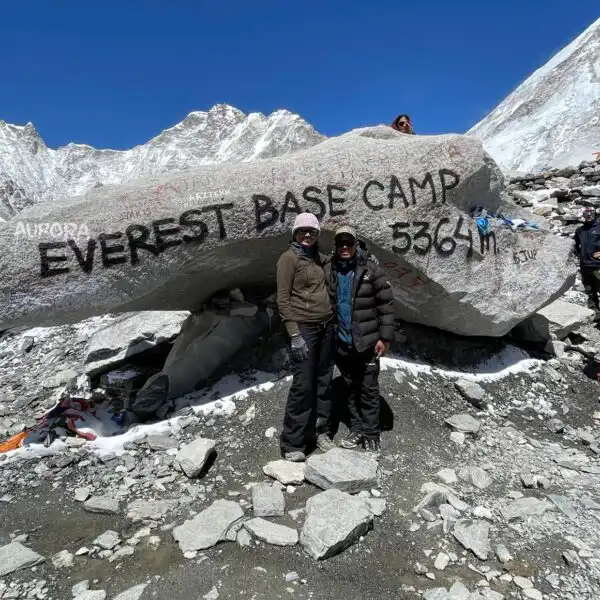
Starting with a perfect meal at Lobuche, the trail follows the Khumbu Glacier and heads directly towards Gorakshep. As you approach Gorakshep, you’ll get clear views of Mount Pumori, which means “the Unmarried Daughter” in Sherpa. Pumori is often called Everest’s daughter. After several hours, you’ll reach Gorak Shep (5,164 m), the last settlement before Everest Base Camp. The village is small, with only a few lodges.
Gorakshep holds historical significance as the original Everest Base Camp, used by expeditions in the 1950s, including Sir Edmund Hillary and Tenzing Norgay in 1953. From Gorakshep, the north face of Nuptse is clearly visible. Staying overnight here prepares you for the climb to Kala Patthar the next morning.
Breakfast, Lunch, Dinner
Lodge
15 km / 9 miles
5,170 m / 16,962 ft
7hrs
Day 10: Gorak Shep to Kala Patthar
Early morning from Gorakshep, the trail climbs towards Kala Patthar (5,545 m). The air is thin, and the ground is rocky, with prayer flags marking the way. As you ascend, the mountains come closer into view- Pumori, Lingtren, and the dark pyramid of Mount Everest itself.
At the summit of Kala Patthar, you’ll see Everest’s south face, Nuptse, and Changtse on the Tibetan side. You can also see the Khumbu Icefall and the expanse of Everest Base Camp. Kala Patthar is the highest point reached by most trekkers without requiring a climbing permit. This site has also been used for scientific research and has even hosted a web camera to monitor Everest conditions.
After observing the scenery, the descent leads back to Gorak Shep for breakfast. From here, the trek continues towards Lobuche, retracing the trail along the Khumbu Glacier.
Breakfast, Lunch, Dinner
Lodge
10 km / 6 miles
5,550 m / 18,209 ft
5hrs
Day 11: Lobuche to Dzongla
On this day, you’ll prepare for another beautiful trek. You’ll walk near the Khumbu Glacier and cross several streams created by melting ice. As we are trekking in a counter-clockwise direction, this section is a critical part and the least followed upward path of the entire high pass trek.
After a few hours of ascent, you’ll reach Dzongla (4,830 m). It is an important point for trekkers attempting to cross the Cho La Pass. It is the last settlement you’ll pass through before the demanding ascent to this high-altitude pass. The village connects the main Everest Base Camp trail (from Lobuche) with the Gokyo Lakes valley. Here you’ll rest and prepare yourself for the next high-altitude challenge.
Breakfast, Lunch, Dinner
Lodge
6 km / 3.7 miles
4,940 m / 16,207 ft
3hrs
Day 12: Trek to Gokyo
Today you’ll cross another main high pass of the Everest region- Cho La Pass (5,420 m). It is one of the most difficult parts of the trek. You need to start early to avoid afternoon winds and poor visibility. Depending on snow and ice conditions, it can be slippery and may require technical gear like crampons.
From the top of the pass, you will see the beautiful Khumbu Valley, Everest, Lhotse, Makalu, and Ama Dablam. After descending from Cho La Pass to Thangnak, you’ll continue your journey by traversing the Ngozumpa Glacier, the longest glacier in Nepal. After crossing the glacier, the landscape transforms drastically, and you’ll reach the Gokyo Valley and the lakes. The village itself is located on the eastern shore of Dudh Pokhari, the largest of the Gokyo Lakes.
Breakfast, Lunch, Dinner
Lodge
6 km / 3.7 miles
4,940 m / 16,207 ft
3hrs
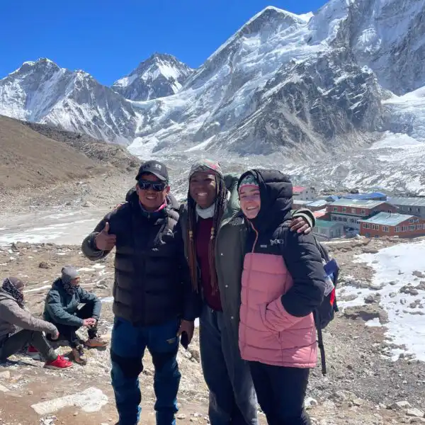
Day 13: Rest day in Gokyo: Climb Gokyo Ri
Gokyo is surrounded by peaks like Cho Oyu, Gyachung Kang, and Ngozumpa Glacier. Today is a rest and acclimatization day; your body needs to adjust to the thinner air. The most popular activity on this day is to go for a sunrise view on Gokyo Ri (5,357 m). You’ll trek before dawn to make the challenging 2 to 3-hour climb to the top of Gokyo Ri. The reward is a 360-degree panorama of four 8,000-meter peaks: Mount Everest, Lhotse, Makalu, and Cho Oyu. Many trekkers consider the view of the Everest range from Gokyo Ri superior to that from Kala Patthar.
If you have extra energy, a half-day excursion to the Fourth and Fifth Gokyo Lakes is highly recommended. The Fifth Lake, Ngozumpa Tsho, is a more remote and peaceful spot with views of Mount Everest’s north face. After enjoying the views, you’ll descend back to Gokyo Village for rest. Short walks around the village, drinking plenty of water, and light meals help your body recover.

Breakfast, Lunch, Dinner
Lodge
9 km / 5.6 miles
5,360 m / 17,585 ft
4hrs
Day 14: Gokyo to Marlung
Today, we tackle our final pass of the trip. You’ll climb towards Renjo La Pass (5,360 m), the third and final pass of the Everest High Pass trek. From the top of it, you can see Cho Oyu, Gyachung Kang, Lhotse, and Mount Everest. It also provides a vantage point for the Gokyo Lakes and the Ngozumpa Glacier. Renjo La pass also connects the old trade route between Nepal and Tibet.
After the descent from Renjo La, you’ll reach Marlung, a small settlement in the alpine valley. The village is situated on the route that connects the high Gokyo valley to the historically important Sherpa village of Thame. Thame is home to renowned mountaineers like Tenzing Norgay Sherpa and Apa Sherpa. At Marlung, you’ll rest at a teahouse and prepare for the descent to Namche tomorrow.
Breakfast, Lunch, Dinner
Lodge
15 km / 9.3 miles
5,360 m / 17,585 ft
7hrs
Day 15: Marlung to Namche Bazaar
The trek from Marlung to Namche involves a substantial descent. The descent allows your body to recover after the three high passes. The air becomes thicker and the vegetation denser as you return to the lower Khumbu valleys. You may also pass through small hamlets like Thame and Phunki Tenga.
Reaching Namche Bazaar feels like completing a major section of the trek. Here you can buy souvenirs, explore the markets for the last time, and enjoy a panoramic view of the snow-capped mountain before the final leg to Lukla.
Breakfast, Lunch, Dinner
Lodge
12 km / 7.5 miles
4,210 m / 13,812 ft
5hrs
Day 16: Namche Bazaar to Lukla
From Namche Bazaar, you’ll cross the Dudh Koshi River over a high suspension bridge as you head towards Lukla. You’ll pass through Monjo, Phakding, and Chheplung. The route is busy with fellow trekkers, porters, and yaks carrying supplies.
The climb back into Lukla marks the end of the trekking journey. Here, you can celebrate with your team and enjoy your final evening in the Khumbu region. Our team will be busy arranging your Kathmandu flight tickets. If any problems occur during the flight booking, then you may have to spend another day here. But we’ll make sure you won’t face such problems.
Breakfast, Lunch, Dinner
Lodge
19 km / 12 miles
3,438 m / 11,280 ft
8hrs
Day 17: Lukla to Kathmandu
Flights from Lukla’s Tenzing-Hillary Airport return you to either Kathmandu or, in peak seasons, via Manthali Airport in Ramechhap. Morning flights offer a clear view of the Himalayan range, including Everest, Lhotse, Makalu, and Gauri Shankar. Once in Kathmandu, you’ll return to the city’s comforts. It marks the completion of the Everest Three Pass Trek – a journey through three high passes, sacred lakes, glaciers, and Sherpa villages. We’ll gather for a farewell dinner in the evening to celebrate our journey.
Breakfast, Lunch, Dinner
Hotel
1,400 m / 4,593 ft
17 Days Everest Three Pass Trek Map
What To Expect?
What's Included
Airport Pickup and Drop-off Services
- Please arrange for pickup from the international airport and transfer to your hotel or hostel when you arrive.
- After the trip, drop-off at the international airport is also included.
- Domestic airport drop-off from hotel (Start of trek)
- Domestic airport Pick-up and transfer to the hotel (After the trek)
Accommodations Services
- 16 nights at local tea houses in the mountains (on a twin-sharing basis). For luxury accommodation in Kathmandu, we would like to discuss options with our travel specialist.
- If you Need Private room accommodation during the trek, it can be arranged for an additional cost. Please consult with our expert.
Domestic Flights
- Kathmandu to Lukla flight ticket
- Lukla to Kathmandu flight ticket
Food During Kathmandu/Trekking
- 16 Breakfast: Local and continental choices from the tea house Menu
- 16 Lunch: A Simple and light lunch in the lunch camp tea houses
- 16 Dinner: Veg and Non-Veg Meals of your choice, domestic and continental foods from the local tea house Menu
Guide/Porter Services and Their Liabilities
- Trekking guide – English-speaking licensed guide with 10 + years of experience.
- Local sherpa for carrying your luggage up to 20 kg Maximum (2 guests sharing 1 Porter)
- Insurances for Guide & Porter (Emergency evacuation and accidental medical expenses)
- All meals for the Guide/Porter
- Salary as per the company standard rate (which is recommended by the concerned association of the tourism industry)
Permits and Taxes Included:
- Everest National Park Entry Permit,
- Pasang Lhamu Rural Municipality Trekking Card Fee:
- All agency service charges, government taxes, and VAT
Complimentary Inclusions for the Everest Base Camp Trek:
- Trekking maps of the Everest Base Camp route
- Oximeters for monitoring oxygen levels during the trek
- First-aid kit box carried by our team
- Water purifying tablets for safe drinking water
- Emergency rescue service arrangement (Note: Please ensure you have travel insurance from your home country that covers medical emergencies and evacuation)
- Four-season sleeping bag provided upon request by My Everest Trip (must be returned after the trek)
- Complimentary duffel bag for your belongings (carried by a porter if required)
- Certificate of achievement upon completion of the trek
What's Excluded
- Meals in Kathmandu before and after trekking, allowing US$15 – US$20 per day.
- Your travel insurance ( Rescue )
- Nepal entry visa fee.
- Tips for trekking staff and driver
- Drinks (hot, cold, and alcoholic)
- Personal shopping and laundry, etc
- Personal trekking equipment.
Tripadvisor Reviews
Google Reviews
17 Days Everest Three Pass Trek Additional Information
Everest Three Passes Trek Cost
The Everest Three Pass trek cost ranges from USD 1,865 to 3,500, depending on the level of service and season. The price covers domestic flights between Kathmandu and Lukla, trekking permits like the Sagarmatha National Park entry and Khumbu Pasang Lhamu fee, accommodation in tea houses, three daily meals, and the salary of a licensed trekking guide and porter.
You’ll also need to factor in personal costs such as travel insurance (about USD 150-200 for high altitude coverage), gear rentals or purchases, snacks, Wi-Fi, hot showers, and tips for guides and porters, which range from 10-15% of the trip price. International flights to Nepal are not included, and these can add another USD 800-1,200 depending on where you fly from.
What Are The Three High Passes?
Kongma La Pass (5,535 m /18,159 ft)
It lies at the easternmost pass along the Everest region and is known for its challenging terrain. At 5,5305 m, it is the highest of the three passes, making it a significant milestone for trekkers. Situated just above Dingboche and southwest of Everest, it offers breathtaking panoramic views of the mountains and glacial lakes.
From this vantage point, Trekkers can see awe-inspiring peaks like Thamserku, Ama Dablam, and Kongtega. Reaching Kongma La rewards adventurers with unforgettable views that make the challenging journey worthwhile.
Cho La Pass (5,420 m / 17,782 ft)
Standing at 5,420 meters, it is the second stop on this trek. It connects two popular trekking valleys: Everest Base Camp and Gokyo. This pass is like a hidden treasure in the Everest region, known for its rugged beauty. Heading west from here takes you to the stunning Gokyo Lakes, crossing the challenging Ngozumpa glacier. On the east side, the trail joins the famous EBC route. It offers adventurers a fantastic journey through the breathtaking Himalayan scenery.
Renjo La Pass (5,340 m / 17,520 ft)
This pass marks the western end of the Everest region and is the easiest of the three passes. At 5,360 meters, it’s the lowest in altitude. The mystical Gokyo Lakes route incorporates this pass, offering trekkers stunning views without the challenge of glaciers.
From the pass, adventurers are treated to breathtaking views of the Himalayas, adding an extra layer of magic to the journey. Moreover, it is the nearest trail to Nangpa-La Pass, which connects Nepal to Tibet. This makes the journey scenic and culturally significant, allowing adventurers to explore nature and history.
Community & Language Spoken Around This Region
In the Everest region, the main communities you will encounter are the Sherpas. They are known for their mountaineering skills and strong connection to the Himalayas. The Sherpas have their language, known as “Sherpa” or “Khumbu,” but most also speak Nepali, Nepal’s national language. In addition to the Sherpas, you may come across other ethnic groups, such as the Tamang and Rai people, who also live in the region.
Thrilling Everest High Pass Trek, you will find that many locals can speak some English, especially in the main trekking areas like Namche Bazaar and Lukla. Although English is commonly understood, learning a few basic words in Nepali, such as “Namaste” (hello) and “Dhanyabad” (thank you), will be greatly appreciated. Most locals, particularly Sherpas, speak the Sherpa language, which can spell differently for village names. This may lead to variations like Dzonglha, Dzongla, or Zonglha.
Aside from language, you will notice that the locals are very friendly and eager to interact with trekkers. The village children, especially, are curious and may greet you with smiles or simple questions. They often know a bit of English but enjoy practicing with trekkers. Even if you don’t speak the same language, using simple phrases will help create a positive connection with the people you meet along the trail.
Transportation Option For the Three Passes Trek
The primary option for the Everest Three Pass trek involves either flying into Lukla or taking a multi-day overland approach with trekking. Let’s discuss both of them.
Flying to Lukla:
- Flights from Kathmandu (TIA): The 25-40 minute flights from Kathmandu are available only during the non-peak seasons like January, February, June, July, and December.
- Flights from Ramechhap (Manthali Airport): Due to higher air traffic in Kathmandu during peak trekking seasons, flights ot Manthali are often redirected to Manthali Airport in Ramechhap. This requires a 4 to 5-hour pre-dawn bus or jeep ride from Kathmandu to catch the early morning flight.
- Helicopter: A more expensive but reliable option is to book a helicopter flight directly from Kathmandu to Lukla. This avoids the long drive to Manthali during peak seasons and is less affected by unfavorable weather conditions.
Overland and Trekking Approach:
- From Jiri: You can take a bus or a private jeep from Kathmandu to Jiri and then trek several days to reach Lukla. This was the traditional route used by early mountaineers.
- From Phaplu or Salleri: A more time-efficient option is to take a bus or jeep from Kathmandu to Phalpu or Salleri. From there, you’ll trek for a few days to connect with the main trail near Lukla.
- Newer road access: Roads have been extended further into the region towards Surkhe or Thamdanda. From the end of the road, it’s a shorter trek to join the main route.
Clockwise Over Counterclockwise Itinerary | Which to Choose?
Counterclockwise, i.e, Kongma La (5,535 m) to Cho La (5,420 m) and Renjo La (5,360 m) is a perfect choice for the Everest Three Pass Trek. The most critical factor on any high-altitude trek is preventing Acute Mountain Sickness (AMS), and the counter-clockwise is designed to do this more effectively. This route allows for two crucial acclimatization stops before the demanding passes: one in Namche Bazaar and a second in Chhukung. But the clockwise route offers fewer acclimatization opportunities before tackling the first pass.
Approaching Kongma La from the direction of Chhukung is physically less strenuous and challenging than the long, steep climb required when coming from the opposite (clockwise) direction near Lobuche. If heavy snow or dangerous conditions stop you from crossing Kongma La, you can easily turn around and join the main EBC trail to Gorak Shep to visit Everest Base Camp and Kala Patthar. Therefore, choosing the counterclockwise itinerary is the better option.
Best Season For the Everest 3 Passes Trek
The best time for the Everest High Pass Trek is Pre-Monsoon (March to May) and post-monsoon (September to November). During these seasons, you will get clear skies, moderate temperatures, and stable weather. Aside from these two, we generally do not recommend trekking during the summer and winter months. Here is a brief explanation:
- Pre-monsoon (Spring: March to May): The temperature ranges from 5 – 10°C at lower villages to -2 to -6°C near the passes. You can enjoy blooming rhododendrons with clear views of Everest, Gokyo, and Ngozumpa glacier.
- Post monsoon (Autumn: September to November): During this season, the temperature is 8 –18 °C in lower areas, to 0 – 6°C at higher camps. It offers the clearest skies and the most reliable conditions for witnessing 8,000 m peaks.
- Summer (Monsoon: June to August): The temperature in this season ranges from 12 – 20 °C in valleys to 0 – 8°C at higher points, with heavy rainfall of about 150 – 250 mm monthly. Trails are lush and quiet, but often slippery with limited mountain views.
- Winter (December to February): The temperature drops to -2 – 6 °C at lower villages and -15 to -30°C around the passes, with heavy rainfall above 3,500, and deep snow on passes over 5,400 m.
Necessary Permits and Documents
The permits required for the Everest Three Pass trek are the Sagarmatha National Park (SNP) entry permit and the Khumbu Pasang Lhamu Rural Municipality Permit. You will not need to purchase any additional or special permits like TIMS or the Gokyo Lake Area Permit beyond these two standard ones.
| Permit Type | Price (NPR / USD) | Where to Get It |
|---|---|---|
| Sagarmatha National Park Entry Permit | 3,000 / 23 | Nepal Tourism Board or Monjo |
| Pasang Lhamu Rural Municipality Permit | 2,000 / 15 | Nepal Tourism Board or Trekking Agency, like “My Everest Trip” |
Necessary documents for permits
- Passport Copy
- Passport-sized Photographs
- Visa Copy
- Trekking Agency Letter
- Itinerary Details
Accommodation around the Three Pass Trek
Accommodation options range from basic tea houses to more comfortable lodges. The basic tea houses offer simple rooms with shared facilities. You will usually find a bed with a thick mattress, but please note that there may not be a private room or bathroom. Some tea houses have communal bathrooms, and the shower may be cold, especially at higher altitudes. Electricity is available in most places, but power is limited. The cost for a night in these basic tea houses can range from NPR 500 to NPR 1,500 ($4 to $12), depending on the location.
Some lodges offer private rooms and sometimes attached bathrooms for those seeking a bit more comfort. The rooms here are more spacious and comfortable, although hot showers may incur an extra charge. These lodges tend to have better facilities, such as charging points for electronics and Wi-Fi (at an additional cost). The price for a night in these lodges can range from NPR 2,000 to NPR 5,000 ($17 to $42). However, we will handle all your accommodations if you book with us.
Food Options Around the Three Passes Trek
On the Everest Three Pass trekking, you’ll find a variety of food options like Dal bhat, Sherpa stew, Momos, Thukpa in teahouses and lodges. These accommodations offer a variety of food that provides the carbohydrates and protein necessary for high-altitude trekking. Here’s what you’ll get for breakfast, lunch, and dinner.
| Beakfast | Lunch | Dinner |
|
|
|
Travel Insurance
Insurance is essential to preparing for any trek, especially in remote areas like the Everest region. Trekking in high-altitude environments can be unpredictable, and accidents or health issues can occur. Insurance ensures you are financially protected in emergencies, such as medical evacuations, hospital treatment, or other unforeseen circumstances. This is especially important in the Everest region, where medical facilities are limited and evacuation costs can be extremely high.
Travel insurance is recommended that covers trekking at high altitudes, emergency evacuation, and any potential medical treatment. Some well-known providers, such as World Nomads, Allianz, or Trek Protect, offer specialized policies for trekkers. These policies can cover various issues, including accidents, injuries, lost gear, or flight cancellations. Insurance gives you peace of mind, knowing you are protected if something goes wrong during your trek.
It is strongly recommended for all trekkers, regardless of experience, to secure appropriate insurance before embarking on a high-altitude adventure.
Everest 3 High Pass Trekking Difficulty
- The trek covers about 166KM over 17 -20 days and average walking time of 6-8hrs. This makes it one of the longest routes in the Everest region.
- You’ll cross three passes above 5,300 m, Kongma La, Cho La, and Renjo La, which demand strong stamina
- Navigating glaciers, such as the Khumbu Glacier near Kongma La and the Ngozumpa Glacier near Cho La, involves crossing rocky moraines, ice, and unstable surfaces.
- Oxygen levels drop to nearly 50% lower than at sea level above 5,000 m, increasing the risk of altitude sickness
- In winter (December–February), heavy snowfall can block the passes entirely; therefore, you may need to change the route or, in severe cases, halt the trek.
- While technical climbing skills are not required, you’ll need excellent cardiovascular fitness, stamina, and muscular strength to handle the long distances and high altitudes.
- Proper acclimatization days, hydration, and physical fitness are the key factors that reduce difficulty and increase success rates.
Acclimatization at Namche, Chhukung and Gokyo
Acclimatization during the Everest Three Passes Trek is done at Namche Bazaar (Day 3), Chhukung (Day 7), and Gokyo (Day 13). At Namche Bazaar, acclimatization includes a hike to the Everest View Hotel at 3,880 m, where you’ll see Everest, Lhotse, and Ama Dablam clearly for the first time. Another side trip is to Khumjung village, home to the famous monastery that preserves a “yeti scalp” and the Hillary School built by Sir Edmund Hillary.
In Chhukung, you’ll often hike up Chhukung Ri. It is a steep but short climb where you can witness Island Peak, Lhotse, and Makalu. The climb pushes your body to a higher altitude for acclimatization and prepares you for the upcoming Kongma La Pass. At Gokyo, the side hike is to Gokyo Ri, where you’ll see Everest, Cho Oyu, and the turquoise Gokyo Lakes. Some trekkers also walk along the Ngozumpa Glacier, the longest glacier in Nepal, to explore the upper lakes- Thonak Tsho and Ngozumpa Tsho.
It would be best if you were accompanied by an expert at MyEverestTrip and had a well-planned Everest 3 High Pass Trek itinerary. If you want an easier option, go for the Everest Short Trek.
Can a beginner take a 3-pass trek?
Yes, a beginner can take the Everest High Pass Trek. Although this trek involves some challenges, you do not require prior trekking experience to attempt it. You must have good physical fitness, as the trek involves long days of hiking at high altitudes. You can complete the trek with proper preparation and pacing if you are in good shape. Train your body to become strong and boost your stamina. It will help you face the stricter parts of the trek more easily when crossing the three passes.
Although prior trekking experience is not necessary, it is essential to be mentally prepared for the trek’s challenges. The high-altitude environment can be demanding. However, you can enjoy the stunning views and remote villages along the way by staying fit and acclimatizing properly. It is best to go slow, drink plenty of water, and listen to the body for a safer and happier experience.
Views From Everest Three High Passes Trek
During your Three Pass Trek route, you’ll witness stunning mountain scenes. Kongma La Mountain, at 5,535 meters, offers a view of Mt. Everest, Lhotse, and Makalu. Then, Everest Base Camp provides a close-up view of the towering Everest. Next, the challenging Cho La Pass, at 5,420 meters, offers a spectacular mountain passage. As you descend into the scenic Gokyo Valley, you’ll find lakes with striking blue waters and the Gokyo Ri peak providing panoramic views of Everest and Cho Oyu mountains.
Continuing, you’ll encounter Renjo La Pass, standing at 5,388 meters and offering breathtaking views of Everest, Cho Oyu, and Nuptse. Along the way, the impressive Khumbu Glacier adds to the beauty of your journey, leaving you in awe of the natural wonders around you. Finally, your trek leads to Thame, a traditional Sherpa village renowned for its rich cultural heritage, marking the completion of your unforgettable adventure in the Everest region.

Trekking during winter is drastically challenging due to heavy snowfall, which blocks the route. We recommend avoiding this location during the winter. The difficulty level is minimal during the spring; this season, you will get the opportunity to please your eyes with the scenic beauty of blooming wildflowers.
Everest Base Camp Trek vs. Three Passes Trek
The Everest Base Camp Trek and the Everest Three Pass Trek are two of the most popular adventures in the Khumbu region. Both take you to Mount Everest, but the experience is different. One is shorter and more direct, while the other is longer, harder, and more adventurous. Here’s a detailed comparison to help you decide:
| Category | Everest Base Camp Trek | Everest Three Pass Trek |
| Duration | 12-14 days | 17-20 days |
| Total Distance | ~130KM (80 miles) | ~166KM (103 miles) |
| Highest Point | Kala Patthar-5,545 m | Kongma La-5,535 m |
| Difficulty Level | Moderate to Challenging | Highly Challenging and Strenuous |
| Daily Walking Hours | 5-7hrs | 6-10hrs (longer on pass-crossing days) |
| Acclimatization Stops | Namche Bazaar, Dingboche | Namche Bazaar, Chhukung, Gokyo |
| Crowd Level | Busier and more popular | Less crowded, more remote sections |
| Route Type | A straightforward “out and back” route | A comprehensive, circular “loop” route. |
| Accessible to | Trekkers with good fitness levels and moderate experience | Trekkers with good fitness, stamina, and previous high-altitude trekking experience |
How do you prepare for the 3 High Passes Trek in the Khumbu Region?
- Build physical fitness: Train in aerobic activities like running, cycling, or swimming 3–4 times per week for 30–60 minutes to strengthen your heart and lungs.
- Practice long hikes: Do weekend hikes with backpacks of 8-10 kg to imitate trekking conditions. Focus on steep ascents and descents, as the passes involve rocky climbs and glacier crossings.
- Follow the itinerary: Choose a counter-clockwise route (Kongma La, Cho La, and Renjo La) to adjust your body easily
- Stay hydrated and eat well: Drink at least 2-3 liters of water daily and consume a carbohydrate-rich diet. Avoid alcohol and caffeine.
- Use rest days properly: Do not spend rest days being idle. Take shorter, higher-altitude day hikes to help your body adapt to thin air.
- Know the symptoms: Be aware of signs of altitude sickness (headache, nausea, dizziness) and communicate them immediately to your guide.
- Face the challenge: Be prepared for long days, unpredictable weather, and basic accommodations. A positive and patient mindset is very important.
Things to Know before Trekking to Three Passes
ATM & Currency Exchange
ATMs are only available in Kathmandu and Namche Bazaar during the Everest Three Pass trek. However, they may not always be reliable due to power outages or technical issues, and no ATMs are available beyond Namche. Money exchange services are primarily located in Kathmandu and offer better exchange rates than those in Namche.
It is essential to carry enough cash because most lodges, shops, and services in the Khumbu region do not accept cards, and prices for food, water, and other essentials increase as you go higher. Cash ensures you can cover unexpected expenses like additional food, hot showers, or emergency supplies.
Visa
A Nepal tourist visa is required for entry into the country, making it mandatory to undertake the trek. You can get it on arrival at the Kathmandu airport or online before you arrive. Visa durations include 15 days (USD 30), 30 days (USD 50), and 90 days (USD 125), depending on how long you plan to stay in Nepal.
Since the trek and acclimatization require about 3 weeks, many trekkers opt for the 30-day visa. Please ensure your passport is valid for at least six months, and carry extra passport-sized photos for trekking permits.
Sustainable Trekking
Sustainable trekking is essential to preserve the ecosystem of the Khumbu region. You should carry a reusable water bottle and use purification tablets or a portable water filter instead of bottled water.
Avoid littering and pack out all non-biodegradable waste, as waste disposal is challenging in remote areas. Respect local customs and wildlife, support eco-friendly lodges, and consider using trekking agencies that prioritize sustainability to minimize your environmental impact.
Luggage and Backpack Weight
Managing your luggage weight is crucial for a comfortable trek and to make sure porters are not overburdened. Your main luggage, which porters will carry, should weigh between 10 and 12 kg and include essentials such as warm clothing, a sleeping bag, and toiletries.
Your daypack, which you will carry, should weigh between 5 and 7 kg and hold essentials such as water, snacks, a rain jacket, sunscreen, and a first-aid kit. Packing efficiently and keeping your load light allows you to move comfortably and focus on enjoying the trek.
Everest Three High Passes Trek Packing Checklist
Clothing
Base Layer (Top and Bottom)
- Moisture-wicking long-sleeve shirt and pants (avoid cotton)
- Light fleece or wool fabric
Mid Layer (Top and Bottom)
- Insulating fleece or down jacket
- Thermal pants for colder days (optional)
- Light fleece vest or jacket for layering
Outer Layer
- Waterproof and windproof jacket
- Waterproof and breathable pants
- Raincoat (optional)
Pants
- Trekking pants (light, quick-drying material)
- Convertible pants (zip-off for shorts)
- Insulated pants (optional)
Other
- Warm hat or beanie
- Buff or neck gaiter
- Sun hat
- Lightweight gloves
- High SPF sunscreen
- Lip balm with SPF
- Sunglasses with UV protection
Footwear
- Waterproof trekking boots (sturdy, ankle-supportive)
- Gaiters
- Camp shoes
- Wool or synthetic socks (3-4 pairs)
- Extra pairs of thick socks
Backpack
- 40-50L trekking backpack
- Waterproof rain cover for the backpack
- Daypack for shorter treks or day hikes
Other Gears
- Sleeping bag rated to -15°C to -20°C (4°F to -4°F)
- Liner for added warmth and comfort
- Trekking Poles
- LED headlamp with extra batteries
- A small flashlight (optional)
- UV-protective sunglasses
- Camera, memory cards, and spare batteries
- Portable power bank
- Travel adapter for charging
First Aid Kit
- Personal medication (if needed)
- Pain relievers (ibuprofen, paracetamol)
- Anti-diarrheal tablets
- Antiseptic cream or wipes
- Band-aids and blister pads
- Tweezers and scissors
- Sunscreen and lip balm with high SPF
- Rehydration salts
- Bandage, gauze, and tape
Toiletries
- Biodegradable soap and shampoo
- Toothbrush, toothpaste, and floss
- Tissues or wet wipes
- Hand sanitizer
- Feminine hygiene products (if needed)
Water System
- Reusable water bottles (1-2 liters)
- Water purification tablets or filters
- Insulated water bottle sleeves
Snack
- Energy bars or trail mix
- Chocolate or other high-energy snacks
Miscellaneous
- Passport and photocopies
- TIMS Card
- Sagarmatha National Park permit
- Insurance details
- Emergency contact numbers
- Cash in Nepali rupees
- Credit/debit card for emergencies
Why Choose MET for Everest Three Passes Trek
- Cost-effective packages: MET (My Everest Trip) offers affordable treks with transparent pricing, including permits, guide fees, and accommodation.
- Experienced guides: Our guides have years of experience in the Manaslu, Langtang, Annapurna, and Everest regions. They are trained in high-altitude safety and first aid.
- Customized itineraries: MET provides flexible schedules, including acclimatization days and optional side hikes, to suit your fitness and trekking goals.
- Comfortable accommodations: Stay in organized tea houses and lodges. We provide safety and comfort even in remote high-altitude areas..
- Full Logistical support: MET handles all permits, transport from Kathmandu to Lukla, and baggage management, so you can focus on enjoying the trek.
- Sustainable trekking: We practice eco-friendly tourism, supporting local communities and minimizing environmental impact in the Everest region.
17 Days Everest Three Pass Trek FAQs
Can We Do the Everest Three-Pass Trek Solo?
Many people choose the Everest Three Pass Trek for a once-in-a-lifetime experience, especially those seeking a thrilling solo adventure. However, we strongly suggest against trekking alone for this journey. Unpredictable weather conditions and snowy terrain can make it easy to get lost. The trek involves navigating through various peaks and glaciers, so getting lost without any misstep can lead to significant problems. Therefore, it is recommended that you don’t try the Three Pass Trek solo.
How Hard is the Everest Three Pass Trek?
The Everest Three Pass Trek is challenging, with all three passes above 5,000 meters. It’s one of the most difficult treks, testing trekkers with high altitudes and harsh weather. Despite being a challenging trek, it offers an unforgettable experience.
What should I do in case of an emergency during the trek?
Having a guide can help in emergencies, as they are well trained for these situations. However, if you do not have one, you must stay calm, assess the problem, and seek help from locals or other fellow travelers. You can contact your guide or the nearest village for help, and in critical cases, arrange for a helicopter evacuation.
Can I trek the Everest Three Passes in winter?
It is possible to trek the Everest Three Passes in winter, but it is more challenging due to extreme cold and snow-covered trails. You must be well prepared for subzero temperatures and possible snow-related trail obstructions. Winter treks also mean fewer crowds, but facilities may be limited in some areas.
Is there cell phone coverage along the trek route?
Cell phone coverage is available in certain parts of the Everest Three Passes Trek, primarily in higher towns like Namche Bazaar, Dingboche, and Gorak Shep. However, it can be intermittent in remote areas. A satellite phone is recommended for more reliable communication, especially in emergencies.
How do I stay connected with family or friends during the trek?
You can stay connected through satellite phones rented in Kathmandu or Lukla. Some tea houses also offer Wi-Fi services, though it may be slow and unreliable. It is good to inform family and friends of your itinerary so they know when to expect updates.
How cold does it get at high passes?
At Kongma La (5,535 m), Cho La (5,420 m), and Renjo La (5,360 m), the night temperature can drop to -10 °C to -20°C, while daytime temperature may reach -2°C to 5°C. Strong winds can make it feel colder, so layered clothing, insulated gloves, and thermal protection are essential.
What is the total elevation gain of the trek?
The total elevation gain of the trek is approximately 11,000-12,000 m. It includes passes, side hikes, and daily climbs. Kongma La involves a 900 m ascent from Chhukung, Cho La about 600 m from Dzongla, and Renjo La around 500 m from Thangnak.
How are lodges and tea houses distributed?
Teahouses and lodges are distributed every 3-6KM along the trail. High-altitude passes like Cho La and Kongma La require full-day crossings. Please carry snacks, water, and emergency supplies, as no lodges are available directly on the passes.
Are there rare high-altitude plants along the route?
Yes, you may see Rhododendron campanulatum, Himalayan blue poppy, and edible sea buckthorn in alpine meadows between 4,000 and 5,000 m. The plants survive extreme cold, strong winds, and UV radiation, which reflects a high-altitude ecosystem.
How much oxygen is available at the high passes?
At Kongma La, oxygen levels are around 50% lower than at sea level, Cho La is about 52% lower, and Renjo La is about 53% lower. This reduction affects stamina, breathing, and energy, emphasizing the need for acclimatization and slow ascent.
How do Sherpa communities adapt to high-altitude farming?
Villages like Chhukung and Thangnak practice barley and potato farming using terraced fields. Crops are grown at 4,000-4,800 m with short growing seasons. Farmers also herd yaks and use glacial streams for irrigation by reflecting sustainable adaptation to extreme environments.
Which villages are available for pre-pass meals?
Dzongla, Thangnak, and Chhukung are key stops before high passes. You can eat high-carbohydrate meals like Dal Bhat and noodles, which provides continuous energy. These villages are located 1-2hrs below the passes and provide sufficient rest before challenging climbs.
How does snow condition affect pass crossings?
Snowfall can vary seasonally. In spring (March-May), snow may still cover Cho La and Kongma La. It requires microspikes or crampons. In autumn (September – November), passes are mostly dry but icy patches remain, so proper gear is essential for safe trekking.
How do I navigate in fog or low visibility?
Guides use GPS, trekking poles, and marked cairns to navigate passes in fog. Visibility can drop below 10 meters on windy or snowy days. Following experienced guides is important, as veering off trails on high passes can be dangerous.
US$ 1,865 per person
- Best Price Guarantee
- Secured Payment System
- Tailored and Personalized Itinerary
- 70% repeat customers
24 X 7 Live Support

Puru (+977-9851069558)
Related Trips

Recent From Our Blog Places of attractions, travel tips, news and more.

Everest, Blog
Best Things To Do During The Everest Base Camp Trek
What are the best things to do during the Everest Base Camp trek, explorer? We’ve…
Read the full post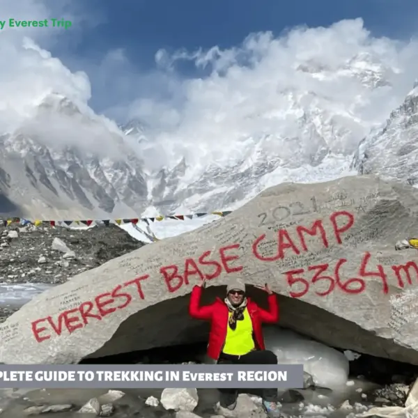
Everest, Blog, Trekking in Nepal
A Complete Everest Trekking Guide
Everest Trekking Guide A Complete Everest Trekking Guide is many treks globally, but none are…
Read the full post
Blog, Everest, Trekking
Everest Base Camp Elevation Guide
Everest Base Camp Elevation is always on top of anyone’s mind; everyone dreams of being…
Read the full post