14 Days
Quick Facts
Ground transportation in Nepal
Hotels & tea-house accommodation
All meals except in Kathmandu
Guided tour & trek throughout the trip
Autumn, Spring
Moderate
Nepal
5,416 m
Kathamndu - Dharapani - Throngla Pass - Pokhara - Kathamndu


Why 14 Days Annapurna Circuit Trek?
- Witness the transition from subtropical forests to high-altitude desert landscapes as you circle the Annapurna Massif
- Cross the famous Thorong La Pass (5,416 m), one of the highest trekking passes in the world
- Visit Muktinath Temple, an important pilgrimage site for both Hindus and Buddhists, known for its 108 water spouts
- Visit traditional Gurung and Thakali villages like Manang, Pisang, and Yak Kharka
- Walk beside the Marsyangdi and Kali Gandaki Rivers, passing through the world’s deepest gorge – the Kali Gandaki Gorge (5,571 m)
- Savor local dishes like Thakali Khana Set and apple pie in Marpha village, known as the “Apple Capital of Nepal.”
- Capture panoramic views of Annapurna I, Dhaulagiri, Manaslu, and Machhapuchhre (Fishtail) throughout the journey
- Enjoy the natural hot spring at Tatopani.

Trip Overview
Step into a world where every turn of the trail unveils a new destination-welcome to the Annapurna Circuit trek! This classic Himalayan trail circles the Annapurna massif, crosses one of the world’s highest passes, and connects lush valleys to dry mountain deserts. It’s a 160-230KM journey full of challenges, adventures, and rewards.
The trek begins upon arrival in Kathmandu and passes through Dharapani, Chame, and Pisang. You continue to Manang, Yak Kharka, and Thorong Phedi before crossing to Muktinath. Then descend to Tatopani, Ghorepani, and Poon Hill, ending in Pokhara and returning to Kathmandu.
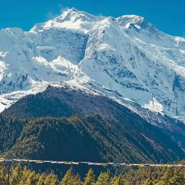
You’ll see Annapurna I, II, III, and IV, Dhaulagiri (8,167 m), and Machhapuchhre (6,993 m) peaks in the distance. The route passes the Marsyangdi and Kali Gandaki rivers and crosses the high Thorong La Pass. Villages like Manang and Marpha show the mountain life in its true form.
Local people in this area enjoy their normal life with energy. Gurung, Thakali, and Manangi communities keep old traditions alive. Festivals like Lhosar (December, January, February), Dashain (September-October), and Tihar (October-November) are full of color, music, and joy.
You’ll trek inside the Annapurna Conservation Area during this journey. This conservation area protects wildlife such as blue sheep, Himalayan Tahr, langurs, and many birds. Forests change from pine and oak to juniper and rhododendron as you move higher. It is one of Nepal’s richest biodiversity zones.
In recent years, road expansion has reached parts of the circuit. Now you can reach as far as Manang from the start, and from Muktinath to Jomsom and beyond, on the other side of the pass. However, we stick to the classic traditional route for a more remote adventure. The Thorong La Pass remains open for most months except in heavy winter snow. The trek attracts around 20,000 trekkers each year, helping sustain its enduring appeal.
Is Annapurna Circuit right for you?
Before you commit to this trek, it’s important to know whether it truly aligns with your travel style, fitness level, and expectations. The difficulty level is moderate to challenging for this trek. The Annapurna Circuit demands both strength and spontaneity. You will walk 6-7 hours a day on steep hills, rocky trails, and changing altitudes. The highest point, Thorong La Pass, tests endurance and patience. On average, trekkers burn around 2,000-3,000 calories per day, so every step feels earned. This trek is for those who enjoy both effort and reward.
Couples find it a bonding journey, sharing tea house stories under the stars. Solo trekkers meet friends from across the world, and even families with older kids can join if prepared. Every day takes your energy, but the views return it tenfold. Snow peaks like Manaslu (8,163 m), Gangapurna (7,455 m), Tilicho Peak (7,134 m), Lamjung Himal (6,983 m), Nilgiri (7,061 m), and rivers like Marsyangdi River (150KM) and Kali Gandaki River (204KM) guide you through the center of the Himalayas.
14 Days Annapurna Circuit Trek Itinerary
Day 01: Arrival in Kathmandu
Your journey to the Annapurna Circuit trek begins in Kathmandu (1,400 m), Nepal’s capital. The flight descends from the green hills of the Kathmandu Valley, surrounded by Langtang Lirung (7,227 m). Upon arrival at Tribhuvan International Airport (TIA), a representative from our travel agency will meet you and transfer you to the hotel.
At the hotel, you’ll meet with your guide and the trekking agency to go over the itinerary, discuss safety measures, and ask any final questions you may have. We’ll also assist you with the permits, such as the Annapurna Conservation Area Permit (ACAP) and Trekkers’ Information Management System (TIMS) card. If you need to handle permits by yourself, the Nepal Tourism Board Office is in Kathmandu, Bhrikuti Mandap.
Hotel
1,400 m / 4,593 ft
Day 02: Drive from Kathmandu to Dharapani
The day begins early with a drive from Kathmandu to Dharapani. The route follows the Trishuli River, then joins the Marsyangdi River, which flows from the Manang region. The first half of the journey takes you west from Kathmandu by bus along the Prithvi Highway. This part of the drive is relatively smooth, though traffic can be heavy when leaving the Kathmandu Valley.
After a long drive, you’ll pass through towns like Besisahar, the traditional gateway to many Annapurna region treks. From here, the road narrows and climbs into the Marsyangdi Valley. You can see waterfalls and Lamjung Himal (6,983 m) during this climb.
You’ll pass Syange (1,100 m) and Jagat (1,300 m) villages before reaching Dharapani. Dharapani is a small village surrounded by pine forests and traditional stone houses. You’ll check into a teahouse for a night and prepare for the next day’s trek.
Breakfast, Lunch, Dinner
Teahouse
230 km
1,960 m / 6,430 ft
8-10 hours
Day 03: Dharapani to Chame

The trek begins in Dharapani (1,960 m) and follows the Marsyangdi River, which flows through the Marsyangdi Valley for nearly 150 km. The trail passes terraced fields and pine forests, with clear views of Lamjung Himal and Manaslu that follow you along the way. The path is mostly uphill, with small suspension bridges crossing tributaries of the Marsyangdi.
You’ll cross several traditional villages like Bagarchhap, Danakyu, Timang, and Koto on the way. At Timang, you can stop for lunch. It offers beautiful views of Annapurna I and Mt.Manaslu. Villagers are often seen carrying supplies or guiding trekkers on the trail.
As you gain altitude and approach Chame, the landscape becomes slightly more rugged, and the air gets cooler. You’ll see more signs of Tibetan Buddhist culture, such as mani walls and prayer wheels. The day ends in Chame, the district headquarters of Manang. Lodges are available for overnight stays, where you can rest and enjoy a fresh meal.
Breakfast, Lunch, Dinner
Teahouse
15 km
2,670 m / 8,760 ft
5-6 hours
Day 04: Chame to Pisang
The trail today takes you to a dense pine and rhododendron forest away from the jeep road. Distant peaks such as Pisang Peak (6,091 m) and Chulu East (6,584 m) are visible along the route. You’ll pass Bhratang (2,850 m), a village with an apple farm and cafe, and then Dhikur Pokhari (3,060 m), where the valley begins to open up.
By afternoon, you’ll reach Pisang (3,200 m), a village at the base of Pisang Peak. Pisang is split into two main settlements: Lower Pisang (3,200 m) and Upper Pisang (3,300 m), and you are most likely to stay at Upper Pisang. Upper Pisang is located just above the lower village, which is Tibetan-influenced. It offers arguably the best panoramic views of the Annapurna range and the Pisang Peak.
Breakfast, Lunch, Dinner
Teahouse
14 km
3,200 m / 10,499 ft
5-6 hours
Day 05: Pisang to Manang
For this day trek, there are two routes to Manang. First, the lower route (easier and faster), and second, the high route via Ghyaru and Ngawal (recommended). Most trekkers and guides highly recommend taking the high route for its views, richer cultural experience, and the benefits of altitude gain for acclimatization. Let’s discuss both in brief.
The Lower route follows the dusty jeep road, and it is flatter, faster, and has fewer steep climbs. It is less physically demanding, less scenic, has more traffic, and offers fewer traditional village experiences.
The High route ascends away from the river and the road, taking you through ancient, traditional Tibetan-style villages. From this route, you can see Annapurna II, Annapurna III, Annapurna IV, Gangapurna, and Tilicho Peak closely and clearly. Stone-built villages like Ghyaru (3,730 m) and Ngawal (3,680 m) offer a glimpse into traditional Bhotiya culture.
Either way, you’ll reach Manang by evening. Lodges and teahouses are available for overnight stays. You and the rest will acclimate here before crossing the Thorong La Pass.
Breakfast, Lunch, Dinner
Teahouse
20 km
3,540 m / 11,614 ft
6-7 hours
Day 06: Acclimatization Day at Manang
Today is a day of rest and acclimatization in Manang. The golden rule for high-altitude trekking is “climb high, sleep low”. This means you should spend your day hiking to a higher elevation to challenge your body, then return to a lower altitude of Manang to sleep.
There are several options for a day hike around Manang. The first one is a hike to the viewpoint above Gangapurna Lake. It is a relatively easy walk to a viewpoint overlooking the turquoise Gangapurna Lake and glaciers. This is a good option for those feeling the altitude more severely.
Secondly, you can hike to the Himalayan Rescue Association (HRA) Clinic viewpoint. The HRA clinic runs daily talks (usually at 3 PM) on altitude sickness prevention and treatment. The hike to the clinic’s viewpoint offers good views and essential medical information. Attending the talk is highly recommended.
The day also allows time to explore Manang village, its Braga Monastery, mani walls, and stone houses. Local shops and lodges offer meals and supplies. Here you can rest, hydrate, and prepare for the climb to Yak Kharka and, eventually, Thorong La Pass.
Breakfast, Lunch, Dinner
Teahouse
3,540 m / 11,614 ft
Day 07: Manang to Yak Kharka
On this day, the trail leaves Manang and continues northward up the Marsyangdi Valley. Small streams run beside the path, and the air feels thinner as you move higher. Peaks like Annapurna III (7,555 m) and Gangapurna (7,455 m) follow you the entire trek. You’ll pass small villages like Gunsang (3,930 m), which typically has a few teahouses and yak pastures. Views of Tilicho Peak appear as the route follows the upper course of the river.
By afternoon, you’ll reach Yak Kharka. The area around it is home to herds of yaks and blue sheep. You’ll spend the night here in the teahouse. Amenities here are more basic than in Manang, but sufficient for a comfortable night’s rest.
Note: Instead of heading directly to Yak Kharka, you can divert towards Khangsar village and continue up to the valley towards Tilicho Base Camp. This leads to the stunning Tilicho Lake detour.
4-5 hours
Teahouse
12 km
4,050 m / 13,287 ft
Breakfast, Lunch, Dinner
Day 08: Yak Kharka to Thorang Phedi
Day 8 is a challenging but relatively short trek that brings you to the foot of the Thorong La Pass. The trail follows the upper course of the Marsyangdi River, crossing wooden bridges over glacial streams. Peaks like Chulu West (6,419 m) and Chulu East (6,584 m) stay visible throughout the walk.
After a short climb, you’ll pass Ledar (4,200 m). You’ll cross several screes and landslide-prone areas. This section requires caution and focus, but the path is well-worn and manageable. Yaks and blue sheep are often seen grazing in the fields. By mid-afternoon, you’ll arrive at Thorong Phedi, the base camp before crossing Thorong La Pass.
Breakfast, Lunch, Dinner
Teahouse
7 km
4,540 m / 14,895 ft
3-4 hours
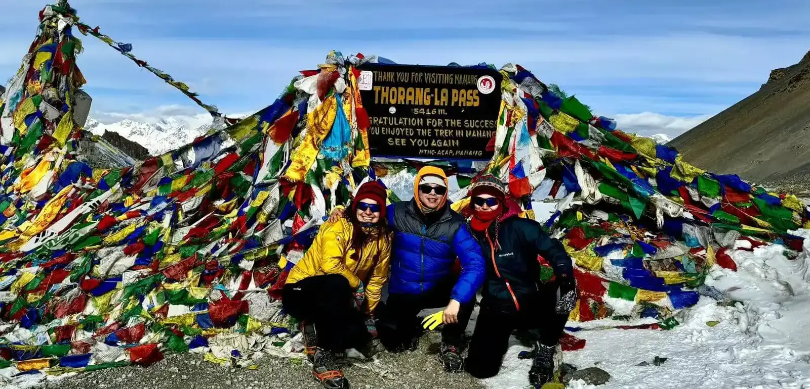
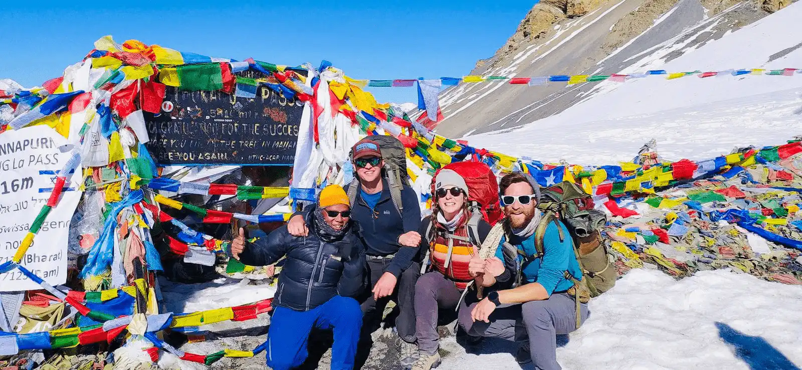
Day 09: Thorong Phedi to Thorong La Pass to Muktinath

You’ll begin your day very early (around 4:00 AM and 5:00 AM) to cross the pass before strong afternoon winds pick up and while the snow is still firm. You’ll cross frozen streams and rocky slopes before reaching Thorong La Pass (5,416 m), the highest point of the Annapurna Circuit trek. Mountain peaks like Thorong Peak (6,144 m), Yakawa Kang (6,482 m), and Khatung Kang (6,484 m) can be seen around the pass.
Himalayan ranges like Annapurna and Dhaulagiri are the prominent mountains visible from the top of the pass. Prayer flags cover the pass signboard, marking a major achievement for every trekker. After spending some time on the top, you’ll drop towards Muktinath, a sacred place for both Hindus and Buddhists.
Muktinath Temple, with its 108 water spouts and eternal flame, lies at the heart of the village. The day ends with a sense of relief because the hardest climb of the journey is done.
Breakfast, Lunch, Dinner
Teahouse
20 km
3,800 m / 12,467 ft
10-12 hours
Day 10: Trek or Drive from Muktinath to Tatopani
The journey from Muktinath to Tatopani involves descending a huge amount of elevation through the Kali Gandaki gorge. Due to road construction, this section is now commonly done by jeep or local bus, but seasoned trekkers can still find alternative trekking trails that avoid much of the main, dusty road.
You’ll pass Kagbeni (2,804 m) and Jomsom (2,720 m). Jomsom is the district center of Mustang and has an airstrip with daily flights to Pokhara. The Nilgiri Himal (7,061 m) rises to the east, and apple orchards are found all over Marpha (2,670 m), known for its apple brandy and Thalaki culture. The route continues past Ghasa (2,010 m) as the landscape becomes greener.
By late afternoon, you’ll reach Tatopani, meaning “hot water” in Nepali. The village is known for its natural hot springs beside the Kali Gandaki River. You’ll relax here after the long descent, soaking in the warm pools. It is a perfect place to rest before climbing again toward Ghorepani.
Breakfast, Lunch, Dinner
Teahouse
110 km (if driving) / 35 km (if trekking)
1,190 m / 3,904 ft
6-8 hours
Day 11: Tatopani to Ghorepani

The day begins by leaving the hot spring of Tatopani and crossing a suspension bridge over the Kali Gandaki River. After that, you’ll pass several traditional Magar and Gurung villages like Sikha (1,935 m) and Chitre (2,930 m). The route passes oak and rhododendron forests that bloom red and pink in spring. The Annapurna South (7,219 m) and Dhaulagiri (8,167 m) peaks appear from the open ridge along the trail.
By afternoon, you’ll reach Ghorepani, a popular stop on the circuit. The village sits beneath Poon Hill and is surrounded by thick forest. It has many teahouses and lodges that offer comfortable accommodation with Wi-Fi and hot showers at a slightly higher cost.
Breakfast, Lunch, Dinner
Teahouse
35 km
2,860 m / 9,383 ft
7-8 hours
Day 12: Ghorepani to Poon Hill to Pokhara
We’ll wake up early in the morning (around 4:00 AM -4:30 AM) to begin the hike in the dark to reach the viewpoint in time for sunrise. From the top, wide views open toward Dhaulagiri I (8,167m), Annapurna I (8,091m), Annapurna South, Nilgiri, Machhapuchhre (Fishtail Peak), and Tukuche Peak. The sunrise turns the peaks golden as clouds move across the Kali Gandaki Valley far below.
After enjoying the views and taking photos, you’ll hike back down to Ghorepani for breakfast and start the descent toward Banthanti (2,210 m). The trail consists largely of numerous stone steps, which can be strenuous on the knees. Villages like Ulleri (2,050 m) and Hile (1,430 m) appear on the route, with fields of rice and millet spread all over.
By afternoon, you’ll reach Nayapul (1,070 m), where the trek ends. From here, a drive of 6-7 hours takes you to Pokhara (827 m), the city beside Phewa Lake. You can check into your hotel and enjoy a well-deserved rest, a warm shower, and a healthy meal. If time allows, you can go boating on Phewa Lake, visit the Tal Barahi Temple, enjoy the lakeside area, and explore caves like Mahendra and Bat Cave.
Breakfast, Lunch, Dinner
Teahouse
50 km
822 m / 2,697 ft
1-2 hours
Day 13: Drive from Pokhara to Kathmandu
This day is scenic but a potentially long drive back from Pokhara to Kathmandu on the Prithvi Highway, marking the final travel leg of the Annapurna Circuit trek itinerary. The journey runs beside the Seti River at first, which flows from the Annapurna region, and later joins the Trishuli River, known for its strong current and rafting routes.
The drive passes hill towns like Damauli, Muglin, and Malekhu with views of terrace fields and local markets along the way. After about 6-7 hours, you’ll arrive in Kathmandu Valley, surrounded by the hills of Shivapuri and Phulchowki.
Note: For those short on time or who prefer to avoid a long road journey, a 25-min flight from Pokhara to Kathmandu is available.
Breakfast, Lunch, Dinner
Hotel
200 km
1,400 m / 4,593 ft
6-8 hours
Day 14: Final Departure
Your Annapurna Circuit adventure comes to a close today. After breakfast, it’s time to pack your bags and head to Tribhuvan International Airport for your final departure. Depending on your flight schedule, you may have a few moments to stroll near your hotel to buy any final souvenirs or local crafts.
We’ll arrange a taxi or pre-booked private transfer to TIA. Traffic in Kathmandu is unpredictable, so it is we’ll leave with ample time (at least 3-4 hours before your flight departure time). The trek may have ended, but the spirit of the Annapurna region-its trails, villages, and mountains stays with you long after you fly home.
Breakfast
1,400 m / 4,593 ft
14 Days Annapurna Circuit Trek Map
What To Expect?
What's Included
- Airport/hotel pick up and drop off by private car.
- At least two nights’ hotel in Kathmandu and 1 night’s hotel in Pokhara with bed and Breakfast plan
- Meals on the entire board (breakfast, lunch, and dinner) during the whole trekking
- Transportation details:
Kathmandu to Dharapani by local bus, and Pokhara to Kathmandu by tourist bus.
If you prefer a jeep or a flight, those can be arranged upon request at an additional cost:
Kathmandu to Dharapani by jeep: USD 250
Pokhara to Kathmandu by flight: USD 106
Pokhara to Kathmandu by car: USD 150
Pokhara to Kathmandu by jeep: USD 250
- Trekking map
- An experienced Government license holder guide
- Trekking porter/Sherpa who will carry your bags during the trek. (2 people per 1 porter)
- Insurance, salary, equipment, transportation, and local tax for the guide.
- Group medical supplies (a first aid kit will be available)
- All necessary paperwork and national park entry permits
- Travel and rescue arrangement
- TIMS (Trekkers’ Information Management System)
- All government taxes and tourist service charges
What's Excluded
- Meals in Kathmandu before and after trekking.
- Your travel insurance ( Rescue )
- Tips for trekking staff and driver
- Drinks (hot, cold, and alcoholic)
- Personal shopping and laundry, etc
- Personal trekking equipment.
Tripadvisor Reviews
Google Reviews
14 Days Annapurna Circuit Trek Additional Information
Annapurna Circuit Trek 14 Days Route
The route of the Annapurna Circuit includes a drive at the beginning and end of the trip to make it possible in a shorter timeframe. The journey starts with a drive from Kathmandu to Dharapani via Besisahar, where the road is paved up to Besisahar but becomes bumpy and off-road as you climb toward Dharapani. From Dharapani to Chame and Pisang, the trail turns more scenic but rocky, with sections of landslide-prone terrain.
The route from Pisang to Manang passes through valleys and alpine meadows. Roads are partially marked here, but walking trails are well-marked. Continuing upward, the trail from Manang to Yak Kharka is all yak pastures and juniper shrubs. The air thins, and the terrain becomes more rocky. From Yak Kharka to Thorong Phedi, the trail is steep and narrow, often dusty, and can be icy depending on the season.
The toughest day is crossing Thorong La Pass, where the trail is rocky and covered with snow or glacier ice in colder months. After the pass, the route descends to Muktinath, where the path becomes gravelly but easier. From Muktinath to Pokhara, the trail is almost covered in forest, and paved roads resume as soon as you reach near Pokhara.
Typical Day in the 14-Day Annapurna Circuit Trek
A typical day on the Annapurna Circuit Trek in Nepal includes an early morning breakfast, followed by trekking in the midday, and arriving at the next teahouse destination in the late afternoon or evening. Enjoy Nepal begins with where you will have dinner and stay overnight. On a typical day, you can explore many things on the Annapurna Round Trek.
The day begins early with a delicious breakfast between 6:00 and 7:00 AM. After waking up, you will freshen up and then prepare breakfast. Once you complete your breakfast, you are now ready for the early morning trek. The morning trek begins from 8 AM to around 12 to 1 PM. After four to five hours of sleep, it’s time for lunch. Your guide will take you to one of the restaurants around the area where you can have your lunch and take a breather.
Once you have lunch, it’s time to continue trekking towards the next destination or teahouse. As the sun starts setting, the environment becomes chilly, so reaching your next village before sunset is essential. You will get to the next town around the evening of 5 to 6 P.m. After strolling around the village a bit, it’s dinner time. You will have dinner in the teahouse, around 8 to 9 PM. After dinner, you can stay up for a bit, but don’t stay up too late, as you need enough rest for the next trek. Hence, this is a typical day in the Annapurna Circuit Trek.
Annapurna Circuit Elevation
The Annapurna Circuit Trek offers a wide range of elevations. The Annapurna Circuit trek distance starts from the small village of Besisahar at 760m. The trek continues to Dharapani at 1800m and Chame at 2710m until you reach Upper Pisang at 3,300m. Trekkers ascend to Ngawal at 3,650 m before descending slightly to Manang at 3540m. Returning to Manang follows an acclimatization hike from Manang to Kincho Tal at 4,620 meters.
The trek continues to Yak Kharka at 4,018 meters and Thorong Phedi at 4,450 meters. The most challenging section is the climb from Thorong Phedi to the Thorong La Pass, the trek’s highest point at 5,416 meters, followed by a descent to Ranipauwa at 3.965 meters.
Location |
Elevation (m) |
Elevation Change (m) |
| Besisahar | 760 | – |
| Dharapani | 1800 | +1040 |
| Chame | 2710 | +910 |
| Upper Pisang | 3300 | +590 |
| Ngawal | 3650 | +350 |
| Manang | 3540 | -110 |
| Kincho Tal | 4620 | +1080 (acclimatization hike) |
| Yak Kharka | 4018 | -602 |
| Thorong Phedi | 4450 | +432 |
| Thorong La Pass | 5416 | +966 |
| Ranipauwa | 3965 | -1451 |
Annapurna Circuit Trek Accommodation and Food
ACT Trek is one of the most challenging treks in Nepal, which is why factors like Accommodation and Food are essential. When you are on a high-altitude, arduous trek, you need a whole night’s rest in proper accommodation, and you must eat enough food filled with nutrients, so planning for these factors is essential. So let’s get into it.
Accommodation
Despite the area’s remoteness, the Annapurna Trek offers a range of accommodation options, from teahouses to guesthouses, spanning from Besisahar to Jomsom, that provide comfort and suitable accommodation facilities. Each teahouse offers a twin-share bed with ample space. As you ascend, facilities become simpler but remain cozy. Hot, solar-powered showers are available until Manang for a fee, which is worthwhile given the cold, high-altitude conditions. You can charge devices at the reception for a small cost, but a solar charger is a great alternative to utilize the abundant sunshine on the trail.
Foods
You can also have food services in the teahouses or lodges you will stay in during your ACT trek. Each day of the trek, the trekkers will have Breakfast, Lunch, and Dinner. Breakfast is the early morning meal, which is very important. After the first installment of trekking, the trekkers will have their lunch around midday, and in the evening, before going to bed, the trekkers will have their dinner. Here are some of the options for Breakfast, Lunch, and Dinner.
- Breakfast: Toast, Bread, Boiled Eggs or Omelets, Tea, Coffee, Hot Chocolate, and Cereals
- Lunch and Dinner: Local Dal Bhat, Ghundruk, Dhido, Pizzas, Burgers, Momos, Dumplings, Thukpa, Chowmein, Pasta, Macaroni, Spaghetti, and others.
How Difficult is the Annapurna Circuit Trek
The crux of Annapurna Circuit Trek difficulty can be simplified through the following points:
- Age and Fitness: The trek is best suited for people aged 16 to 55. Children below 12 and elderly trekkers above 60 may find high-altitude sections like Thorong La Pass challenging.
- Altitude Challenges: The trek starts around 1,000 m and climbs up to 5,416 m, where oxygen levels drop by about 50%. Altitude sickness is a major concern here.
- Health conditions to consider: If you are a patient of heart disease, asthma, chronic lung disease, or high blood pressure, then you may face serious problems above 3,500 m. So, consult with a doctor before attempting the trek.
- Remoteness and Limited Connectivity: Villages above Manang have limited or no Wi-Fi and weak mobile signals. Communication with family, friends, and relatives becomes difficult for several days.
- Trail Conditions: Landslide-prone and steep sections between Chame and Pisang or near Thorong Phedi can be tough for beginners.
- Limited Medical Help: Health posts are available only in Manang and Muktinath, while other areas rely on basic first-aid. In case of emergencies, a helicopter rescue is the only option, which can be expensive.
Remedies for Altitude Sickness During the Annapurna Circuit Trek
Proper Acclimatization:
One of the best remedies for altitude sickness is adequate acclimatization. The appropriate acclimatization method is to increase the altitude, trek at high altitudes gradually, and then descend to sleep. Acclimatization is necessary to adapt to the weather, climate, and low oxygen levels.
Hydration:
Your body needs adequate water to reduce the possibility of altitude sickness. The air pressure is high at high altitudes, which causes the body to dry out and removes liquid much faster. So, every day, make sure you drink water or other drinks like tea and energy drinks, and you can also drink a few cups of coffee. The lack of water in your body will invite the possibility of altitude sickness.
Medicines:
Another way to remedy altitude sickness is by taking the appropriate medicines whenever you feel the symptoms of altitude sickness. Medicines like Diamox, Nifedipine, and Dexamethasone are the common medicines trekkers use during high-altitude treks. So whenever you feel uneasy or suffer from the symptoms, you can take the medicine to feel relief in your body.
Annapurna Circuit Trek Permit
The permits required for the Annapurna Circuit trek are the ACAP (Annapurna Conservation Area Permit) and TIMS. Introduced in 1992, the permit ensures the protection of the region and its biodiversity. You can obtain it at Kathmandu, Pokhara, or at the entry points to the Annapurna Conservation Area before starting the trek. The permit must be carried at all times during the trek.
- ACAP: USD 21.14 per person for foreign nationals and USD 7.05 for SAARC Nationals. Needed for entry into the Annapurna Conservation Area.
- TIMS Card: USD 21.14 per person for individual trekkers, USD 10 per person for groups. Required for all foreigners trekking in Nepal for safety tracking.
Note: If you book a package through Himalayan 360, we’ll manage all your permits and required documents from our side.
What makes the Annapurna Circuit Trek special?
The Annapurna Circuit trek stands out as a special trekking destination in Nepal due to its geographical diversity, rich culture, and panoramic mountain views. Here are some key features that make it special.
Jwala Mai Temple at Muktinath
The Jwala Mai Temple lies at an altitude of 3,800 m in Muktinath, Mustang. It is one of the most sacred pilgrimage sites for both Hindus and Buddhists in Nepal. The temple is famous for its eternal natural flame and 108 cow-headed water spouts that pour icy water from the Kali Gandaki River. Hindus see Muktinath as the home of Lord Vishnu, while Buddhists honor it as the site visited by Guru Rinpoche (Padmasambhava) in the 8th century. Many pilgrims visit to wash away karma and seek Moksha, or liberation.
Braga Monastery and Ancient Cave Dwelling of Manang
The Braga Monastery is located at 2,845 m above the village of Braga in the Manang region. It is over 500 years old and is one of the oldest Buddhist monasteries in the Annapurna Circuit. The monastery houses ancient murals, prayer wheels, and statues of Buddha and local deities. Nearby, the ancient cave dwellings show how early settlers adapted to harsh high-altitude conditions. People lived in these caves for protection from snow, cold winds, and avalanches. The monastery and caves together reflect traditional Himalayan life and Buddhist heritage.
Constantly Changing Gangapurna Glacier
The Gangapurna Glacier is located near Manang at an altitude of around 3,500-4,000 m. It feeds the Gangapurna Lake, which changes color and size depending on the season and melting rate. Its surface shifts constantly due to melting, snowfall, and movement. The area is important for the local water supply, feeding rivers that support villages downstream.
Sunset and Sunrise over Dhaulagiri from Poon Hill
Poon Hill (3,210 m) is a popular viewpoint on the Annapurna Circuit from where you can clearly see Dhaulagiri, Annapurna I, and Machhapuchhre. Trekkers wake early to reach the top for sunrise, when the peaks are illuminated in golden light. In the evening, the sunset paints the mountain in red and orange. This viewpoint is reachable after a short hike from Ghorepani, making it accessible for most trekkers.
Preparation and Training for the Annapurna Circuit Trek
Proper preparation and training are essential to complete the Annapurna Circuit trek safely and comfortably. Here are the things you need to figure out.
- Walk, jog, or cycle 5-7 days a week for 45-60 min to improve heart and lung capacity for long daily treks.
- Focus on legs, core, and back with squats, lunges, step-ups, and weighted exercises to handle rocky trails and heavy backpacks.
- If possible, hike or stay at high altitude locations above 2,500 m to help the body adapt to thin air.
- Include yoga, stretching, or balance exercises to prevent injuries and improve stability on rocky or icy trails.
- Practice eating high-energy foods, nuts, and hydration strategies similar to trekking conditions to maintain energy and avoid dehydration.
- Train with an actual trekking backpack carrying essential items to adjust muscles and improve posture.
- Prepare for cold, fatigue, and long walks by visualizing the trek and setting small daily goals to build mental strength.
Best Time For Annapurna Circuit Trek
The best time for the Annapurna Circuit trek is when the weather is stable, the skies are clear, and the trails are safe for walking. Trekking is most comfortable during Spring (March to May) and Autumn (September to November). Winter and monsoon seasons are less ideal due to snow, rain, and slippery trails.
Annapurna Circuit Trek in May might just be your best plan if you want to enjoy the best of spring with less freezing cold. Since May falls in the late spring, you can leverage the seasonal benefits while keeping your backpack light.
| Season | Day/Night Temperature | Visit Recommendation |
|---|---|---|
| Spring (March – May) |
|
Perfect |
| Summer (June – August) |
|
Not Ideal (heavy rain, landslides) |
| Autumn (September – November) |
|
Perfect |
| Winter (December – February) |
|
Moderate (cold, snow at high altitude) |
We recommend Annapurna Circuit Trek in October if you want to witness the Himalayas at their peak with fellow trekkers sharing the same craving as yours. It’s more than just a peak nature experience; it’s witnessing the best while in the company of like-minded people.
Packing List for Annapurna Circuit Trek
Packing for the Everest Base Camp trek is all about being smart and simple. The weather in the Himalayas changes quickly-sunny mornings, cold evenings, and sometimes even snow. Ao, carrying the right gear keeps you safe, warm, and comfortable. You don’t have to buy the same brands listed below, but they are well-tested and ideal for this trek.
| Category | Items & Recommended Brands |
|---|---|
| Clothing |
|
| Headwear & Handwear |
|
| Footwear |
|
| Bags & Storage |
|
| Personal Care & Toiletries |
|
| Electronics & Documents |
|
| Health & Safety |
|
| Optional Items |
|
Annapurna Circuit Trek Cost
The Annapurna Circuit trek cost ranges from USD 970 70 1,500 per person, depending on the style of trekking, service chosen, and season. Most of this cost goes toward permits, accommodation, and meals during the trek. Lodges and tea houses provide basic rooms and local food, which adds to daily expenses. Transportation from Kathmandu to Dharapani, and later Pokhara back to Kathmandu, is also included.
Additional expenses include gear, personal equipment, guide and porter fees, as well as tips if wanted. High altitude areas like Manang, Thorong Phedi, and Muktinath have slightly higher prices for food and lodging due to remoteness and supply challenges. Insurance covering trekking at high altitude, medical emergencies, and evacuation is another necessary factor. The trek also requires a minimum of two to three weeks, so longer stays or slower paces can affect overall costs.
Can I do the Annapurna Circuit without a Guide?
No, solo trekking is not permitted for international trekkers on the Annapurna Circuit. The Nepalese government implemented this rule on April 1, 2023, to improve safety, emergency response, and environmental management within the Annapurna Conservation Area.
Hiring a guide is important for several reasons. Guides know the trail, weather patterns, and high-altitude risks, which helps to prevent altitude sickness and navigation errors. They can communicate with local communities, manage permits, and arrange accommodations. Guides also provide cultural insights, explaining local traditions, monasteries, and historical sites along the route.
Many trekkers recommend hiring guides. Some shared that guides helped navigate trails in Manang and assisted with altitude sickness at Thorong La Pass. Overall, a guide is not just required by law but is essential for a safe, well-informed, and enjoyable Annapurna Circuit trek.
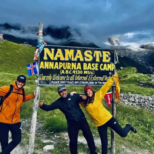
Annapurna Circuit Trek vs Annapurna Base Camp Trek
The Annapurna Circuit Trek and the Annapurna Base Camp Trek are two of the most famous trekking routes. Both revolve around Annapurna Sanctuary and Massif but differ in length, challenge, scenery, and overall experience. Here’s a simple comparison to help you understand which treks suit your travel style.
| Factor | Annapurna Base Camp Trek | Annapurna Circuit Trek |
|---|---|---|
| Total Duration | 11-12 days | 13-14 days |
| Maximum altitude | 4,130 m | 5,416 m |
| Difficulty Level | Moderate | Moderate to Difficult |
| Main Highlight | Annapurna Sanctuary, clear views of Annapurna I and Machhapuchhre | Thorong La Pass, diverse landscapes, Tibetan-style houses |
| Best For | Beginners and trekkers with limited time | Experienced trekkers who want a long, varied adventure |
| Crowd Level | Busy in peak season | Busy but spread out over a long route |
| Starting Point | Pokhara region (Nayapul) | Manang region (Dharapani) |
| Required Permits | ACAP + TIMS | ACAP + TIMS |
| Weather Sensitivity | Less weather risk | More affected by wind and snow at the high pass |
Why You Should Trek With My Everest Trip (MET)
- Trek with guides who have grown up in the Himalayas and know Nepal like the back of their hand.
- Licensed professionals with 24/7 assistance from our Kathmandu office.
- Clear cost with no hidden charges or middlemen.
- Customize your trek to match your pace, interests, and schedule.
- Thousands of trekkers have recommended our services and returned for more adventures.
- Support local communities and follow eco-friendly practices throughout the trek
- Treks are designed by people who love the mountains and sharing stories of Nepal.
- Airport transfers, hotel stays in Kathmandu and Pokhara, full board meals, local transport, trekking map, licensed guide, porter service, insurance, permits, and emergency support are all included.
14 Days Annapurna Circuit Trek FAQs
Can you see Everest from ACT?
No, you cannot see Everest from the Annapurna Circuit Area. Since the Annapurna region lies in the western north of Nepal, and Everest is in the eastern north of Nepal, these two mountains lie in different locations. You can see Everest from Nagarkot in Kathmandu, take an Everest Helicopter Tour to Namche, or even camp.
Why is the Annapurna Circuit called a “circuit”?
It’s called a “circuit” because the route forms a complete loop around the Annapurna massif. You’ll start from the east and end on the west, passing through valleys, passes, and diverse landscapes before returning to the lower regions, completing a full circle.
What is the quietest place on the circuit?
Just above Manang, near Gangapurna Lake, mornings are completely silent. You can only hear the wind and glacier cracks. It’s a perfect spot for resting or journaling. Many trekkers say it’s the first time they’ve ever heard “nothing,” a peaceful kind of emptiness found only in the Himalayas.
Can I pay for accommodation with a card during the trek?
No, you can’t use cards in most teahouses. Only a few hotels in Pokhara or Jomsom accept cards. Carry enough Nepalese rupees from Kathmandu or Pokhara. Cash is the main way to pay for food, rooms, and extras like charging or hot showers.
What happens if I run out of cash mid-trek?
If you run out of money, some teahouse owners may allow you to pay later using online transfer or by contacting your guide. However, this is rare. Always keep emergency cash in a safe place, as ATM access is unreliable in remote villages.
I got mild headaches in Manang. Is it normal or serious?
Yes, mild headaches are common as your body adjusts to altitude. Drink more water, rest, and avoid alcohol. If it worsens or comes with nausea or dizziness, descend immediately. It could be the start of Acute Mountain Sickness (AMS). Never push higher if symptoms persist.
What if I twist my ankle on a rocky trail?
Stop immediately and rest your foot. Use a bandage or ankle support if you have one. If swelling or pain is severe, ask your guide to arrange a horse or emergency transport to the nearest health post. Always carry basic first aid and trek in sturdy boots.
I forgot my sunscreen. Will it really matter at high altitude?
Yes, it matters a lot. The sun is extremely strong above 3,000 meters, and UV rays can cause burns quickly. Use SPF 50+ sunscreen, sunglasses, and a hat. Even cloudy days can damage your skin at high altitude.
Are yaks or animals on the trail dangerous?
Not really, but keep a distance when they pass. Yaks carry heavy loads and can push you off narrow trails if you stand on the wrong side. Always move to the inner side of the path when a yak caravan approaches.
Can I fly directly to Jomsom from Pokhara?
Yes, you can. There are short 20–25 min flights from Pokhara to Jomsom. But they often get delayed or canceled due to strong winds or bad weather in the Kali Gandaki Valley. Always keep a spare day for flight changes.
Can the Annapurna Circuit Trek be done in 10 days?
Yes, the Annapurna Circuit Trek will be completed in 10 days. It is considered the short Annapurna Circuit Trek because the average days range from 15 to 18 days for the complete ACT trek. The shore trek of 10 days can cause altitude sickness problems as there are fewer days for acclimatization.
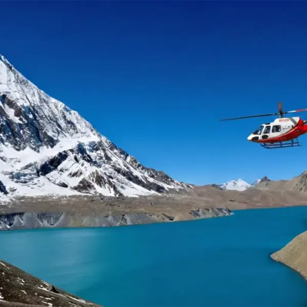
Are helicopter flights available in the Annapurna region?
Yes, but mostly for rescue or private charter. You can charter one from Pokhara to Manang, Muktinath, or even Jomsom, but it’s expensive, around USD 400–700 per person. Helicopters are mainly used for emergencies or luxury treks.
Can I rent a bike or motorbike for the Annapurna route?
Yes, you can ride motorbikes from Muktinath up to Pokhara. However, the road is rough, steep, and dusty between Tatopani and Jomsom. You’ll need off-road experience and a valid international license. It’s adventurous but not recommended for beginners.
I lost my ACAP permit halfway. What should I do?
If you lose it, visit the nearest checkpoint or police post. They’ll issue a replacement if you show your passport and photos. You might need to pay a small fee. It’s smart to keep a digital photo of your permits on your phone as backup.
Can I apply for ACAP and TIMS online?
Currently, both permits are obtained in person at the Tourism Board offices in Kathmandu or Pokhara. Online systems aren’t yet reliable for foreign trekkers. Bring two passport-size photos, your passport, and cash for the fees. The process takes about 30–45 min, and we’ll do it.
My passport is about to expire in two months. Can I still trek?
It’s risky. Nepal immigration requires your passport to be valid for at least six months beyond your entry date. You might be allowed in, but renewing it before traveling avoids problems during permit registration and check-ins.
I entered the wrong nationality or date on my permit. Will it cause issues?
Minor spelling errors are usually fine, but wrong nationality or passport numbers can cause issues at checkpoints. Report it immediately to the agency member or issuing office in Pokhara or Kathmandu for correction. It’s free if done the same day.
Do children also need trekking permits?
Yes, everyone entering the conservation area needs an ACAP permit, even kids. But for minors under 10, it’s often issued at a reduced rate or free, depending on the local office. Parents should carry both the child’s passport and a photo.
US$ 970 per person
- Best Price Guarantee
- Secured Payment System
- Tailored and Personalized Itinerary
- 70% repeat customers

24 X 7 Live Support

Puru (+977-9851069558)
Related Trips

Recent From Our Blog Places of attractions, travel tips, news and more.
Annapurna
14 Days Annapurna Circuit Trek difficulty?
How Difficult Is the Annapurna Circuit Trek? The Annapurna Circuit Trek is the second-most…
Read the full post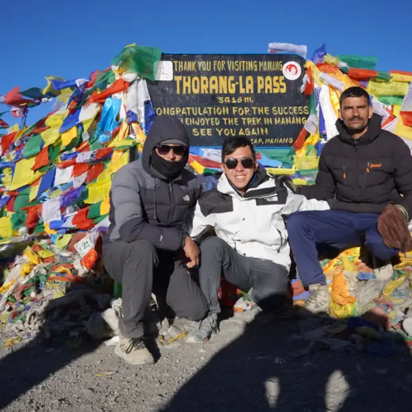
Annapurna
Annapurna Circuit Trek in October
Annapurna Circuit Trek in October? The Annapurna region is a popular trekking destination in the…
Read the full post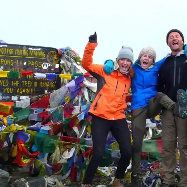
Annapurna
Annapurna Circuit Trek in September
Annapurna Circuit Trek in September is an ideal period to embrace the second most renowned…
Read the full post