
15 Days
Quick Facts
Ground transportation in Nepal
Hotels & tea-house accommodation
All meals except in Kathmandu
Guided tour & trek throughout the trip
Autumn, Spring
Moderate
Nepal
5364
Kathmandu - Salleri - Phakding - Namche - everest base camp - Salleri - Kathmandu


Highlights Everest Base Camp Trek by Road
- Overland travel in rural Nepal before the high Himalaya.
- Slow increase in altitude, which promotes safer acclimatization.
- Cross exciting suspension bridges on the river Dudh Koshi.
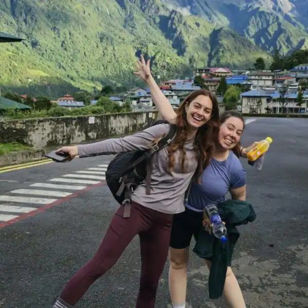
- Visit Namche Bazaar, the colorful Sherpa village of the region.
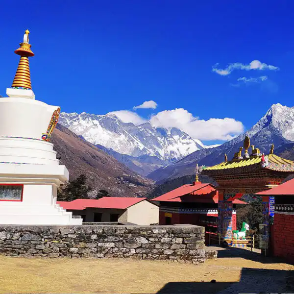
- Witness Tengboche Monastery, a spiritual hub with mountain views.
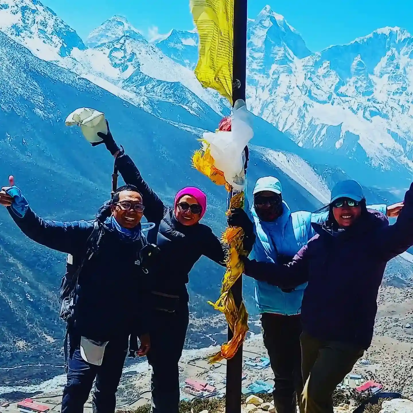
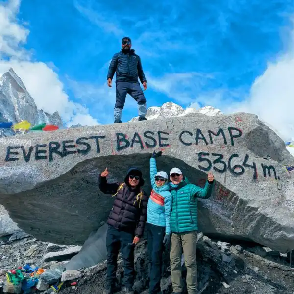
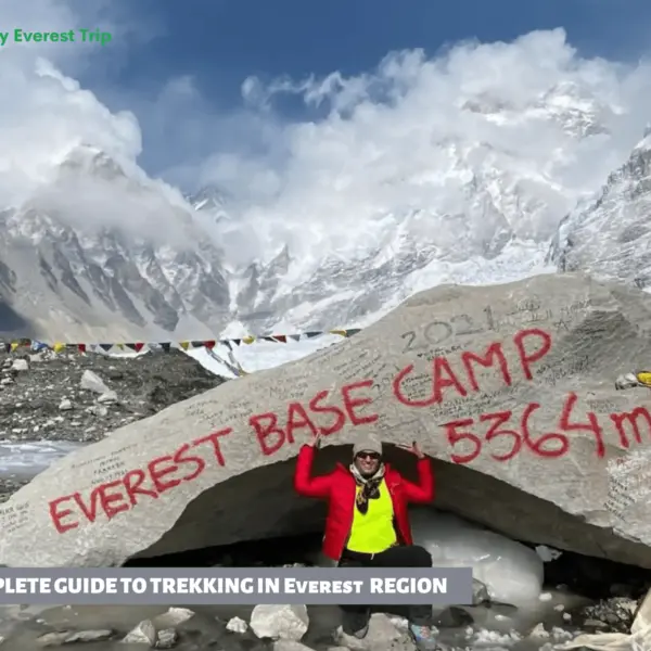
- Stand at Everest Base Camp at 5,364 m / 17,598 ft, alongside the Khumbu Icefall.
- View a beautiful sunrise at Kala Patthar (5,545 m / 18,192 ft) and a close-up view of Mount Everest.
Trip Overview
The Everest Base Camp Trek by road is a unique way to experience one of the world’s most famous trekking routes. Rather than flying directly to Lukla, this trip starts with an overland trip from Kathmandu to the lowlands of Solu. This will enable you to explore more of rural Nepal before beginning your walk. You pass off hills, rivers, terraced farms, and little mountain towns, slowly approaching the high Himalayas. The drive becomes an integral part of the adventure, fostering a deeper attachment to the scenery and the local community.
Everest Base Camp Trek by road begins with a drive, and you gradually move forward on the trekking trail to the center of the Khumbu region. You pass through pine and rhododendron-clad hills, cross long suspension bridges over the river Dudh Koshi, and pass through Sherpa villages with old traditional architecture, hung with prayer flags and mani stones.
The first major acclimatization point will be Namche Bazaar at 3,440 m (11,286 ft). The mountain town is vibrant, with stores, bakeries, and expansive views of the nearby mountains. The landscape varies with the elevation. The trees grow smaller, the valleys get larger, and the mountains covered with snow get closer.
One of the strongest points of the Everest Base Camp Trek by road is its gradual elevation gain. You do not begin at a high level but gradually progress from lower levels, giving your body time to adapt.
The acclimatization days in destinations such as Namche Bazaar and Dingboche (4,410 m / 14,469 ft) decrease the likelihood of altitude sickness. On these rest days, you go on a hike to elevated points like Hotel Everest View (3,880 m / 12,730 ft) or Nangkartshang Peak (5,083 m / 16,677 ft) and then go to sleep at a lower place. The “walk high, sleep low” strategy is a way to complete the Everest Base Camp trek safely by road.
A visit to Everest Base Camp (5,364 m / 17,598 ft.) is the climax of the trip, as it puts you next to the Khumbu Icefall with its massive mountains towering over the base. Kala Patthar (5,545 m / 18,192 ft) is also ascended by trekkers who wish to see the sunrise over Mount Everest. From this perspective, the highest mountain in the world seems near and clear, offering one of the most memorable experiences of the Everest Base Camp trek by road.
The Everest Base Camp Trek by road is culturally rich, too. You walk through monasteries like Tengboche (3,860 m / 12,664 ft), meet local families, and lead the daily life of the people living in the mountains. Teahouses and lodges are basic yet comfortable places to stay, enjoy home-cooked meals, and have friendly dining areas where trekkers gather every evening.
This overland version is attractive to travelers who do not want to fly to Lukla and is better suited to the journey into the Himalayas. The trek is not only tough but also rewarding, with experienced guidance, a well-planned acclimatization schedule, and well-organized logistics.
The Everest Base Camp trek by road is well planned and supported by My Everest Trip (MET), making it safe, well-structured, and a significant Himalayan experience at every step.
Why Choose the Everest Base Camp Trek by Road?
The Everest Base Camp Trek by road provides an alternative, less steep path than the popular Lukla fly route. You do not fly at high altitude; instead, you start with an overland trip from Kathmandu to the lower Solu area. This will enable your body to adapt more naturally and then increase the height of the villages up to Namche Bazaar. The slower pace of altitude increase promotes safer acclimatization and minimizes the risk of rapid exposure to thin air.
The other advantage of the Everest Base Camp Trek by road is the broader cultural experience. You pass through villages and rural hilly areas, farming villages, and get to the main Khumbu trail. This provides better insight into local life beyond the normal trekking corridor.
Road travel is also a sure way to avoid Lukla flights, which are often delayed due to weather. Although mountain routes are weather-dependent, this overland journey remains a favorite among many passengers.
Lastly, the feeling of travel is complete. It starts in the mid-hills and gradually peaks at Everest Base Camp at 5,364 m / 17,598 ft, and at Kala Patthar (5,545 m / 18,192 ft), through gradual effort. The Everest Base Camp Trek by road is an adventure, a cultural experience, and a regulated altitude gain, all in a single, wholesome Himalayan experience.
Everest Base Camp Trek by Road – 15 Days Itinerary
Day 01: Drive from Kathmandu to Phaplu or Salleri (Solu Gateway)
You take an early-morning drive out of Kathmandu and embark on a long yet picturesque ride to Phaplu or Salleri (2,413 m / 7,917 ft). The initial part of the ride is on a wide highway; however, after several hours, the road narrows and has many curves. You go by green hills, terraced farms, rivers, and small road towns. As you travel farther into the Solu region, the landscape gradually transforms as well.
On the way, you have lunch and short tea breaks. These are the stops where you can stretch your legs and get some fresh air. The higher you climb, the colder it is. In the evening, you arrive in Phaplu or Salleri and check into a nice lodge. This road trip lets you explore rural Nepal and begin your adventure at a slow pace.
Lunch and Dinner
Lodge
270 km drive
2,413 m / 7,917 ft
9 hrs Drive
Day 02: Drive from Phaplu or Salleri to Paiya or Thamdanda
Your trip continues after breakfast in a 4×4 off-road jeep to Paiya or Thamdanda, at an elevation of approximately 2,730 m / 8,957 ft. The road is basic and mostly rough. You go at a slow pace through mountain roads with steep inclines and wooded parts. The landscape is more distant and natural than it was the day before.
You drive past small towns, and local people are working in the fields. The drive is constant in the dry season, whereas when it is raining, the road is muddy and difficult. Patience is important today. On the way, you have lunch in a basic teahouse.
In the evening, you arrive at Paiya and take up your stay in a lodge. You prepare your trekking gear, pack your backpack, and you’re set to start your first day of walking tomorrow. You are ready with an early dinner and a good rest.
Breakfast, Lunch, and Dinner
Lodge
45 km drive
2,730 m / 8,957 ft
6 hrs drive
Day 03: Trek from Paiya to Chaurikharka
From this day of your Everest Base Camp Trek by road, the walking days start. The path cuts through forests, small farms, and small villages. You climb over little brooks, crossing houses and little bridges. The road contrasts with the fresh mountain air.
You begin to acclimatize to the altitude as you head towards Chaurikharka (2,800 m / 9,186 ft). The walking time is average, and this is when your body becomes acclimatized. You walk at an easygoing, slower pace, with brief intervals to drink water, relax, and take in the scenery.
The trail is decorated with prayer flags and mani stones, which demonstrate the area’s strong Buddhist presence. Some hours later, you arrive at Chaurikharka, a tranquil village with no trekking environment in sight. You rest in a teahouse, have a hot meal, and plan for the following day.
Breakfast, Lunch, and Dinner
Teahouse
8 km
2,800 m / 9,186 ft
6 hrs
Day 04: Trek from Chaurikharka to Namche Bazaar
You take your time in the morning, have breakfast, and head up the valley of the Dudh Koshi River. The path takes through tiny villages, crosses suspension bridges, and goes through pine forests. On the road, permit checks are done at the entrance to the Sagarmatha National Park.
During a sunny day, you can have your first clear sight of Mount Everest as you walk. The long, steep climb to the Namche Bazaar (3,440 m / 11,286 ft) is the most difficult. It is a gradual climb that demands patience. Taking short breaks helps you to control your breathing.
Namche Bazaar is a vibrant mountain town shaped like a natural amphitheater. Then you get to your teahouse, after some 8 hours of walking, and rest. The increased altitude in sleeping necessitates the intake of lots of fluids.
Breakfast, Lunch, and Dinner
Teahouse
10.4 km
3,440 m / 11,286 ft
8 hrs
Day 05: Namche Bazaar Acclimatization Hike (Hotel Everest View)
Today is a day of getting acclimatized. You walk up to the Hotel Everest View (3,880 m / 12,730 ft). The trail leads slowly over Namche. From this perspective, Everest, Lhotse, Nuptse, and Ama Dablam are visible during clear days.
This hike helps your body acclimate to thin air. You step slowly, exhale deeply, and pause briefly. After spending some time at the higher elevation, you return to Namche to rest. This is a way of avoiding altitude sickness.
During the afternoon, you may go about in the little shops or take a rest at the lodge. It is essential to eat well and drink plenty of fluids.
Breakfast, Lunch, and Dinner
Teahouse
7 km
3,880 m / 12,730 ft
4 hrs
Day 06: Trek from Namche Bazaar to Tengboche or Deboche
You leave Namche and take a picturesque trail with broad views of the mountains. It leads down to the river at Phunge Thenga, and up the slope in the forest to Tengboche at 3,860 m / 12,664 ft.
Walking up the hill demands regular breathing and slow movement. On the way to Tengboche, you begin to see huge Himalayan mountains in closer proximity. The Tengboche Monastery is a popular structure located in an open area, with Everest and Ama Dablam in the background. You can go to the monastery and see the quietness there.
In case of full lodges (which are unlikely), you do a short walk down to Deboche, a little lower, yet still around 3,860 m / 12,664 ft. Then, approximately after 6 hours of hiking, you arrive at the lodge and sleep at night.
Breakfast, Lunch, and Dinner
Teahouse
18 km
3,860 m / 12,664 ft
6 hrs
Day 07: Breakfast, Lunch, and Dinner
In the morning, you walk to Pangboche, where Ama Dablam is looming over the valley. As altitude increases, the area becomes less forested, with a more open landscape. The air is less humid and cooler.
You have lunch at Somare, then proceed to Dingboche at 4,410 m (14,469 ft). The last section is slow but perceptible due to the increased elevation. You can walk at a comfortable pace and concentrate on regular breathing.
Dingboche is located in a broad valley with stone walls that shield crops from the wind. There are sweeping mountain sceneries. Upon reaching your tea house, you take hot fluids and sleep. One more day of acclimatization will help you be ready for even higher altitudes.
Breakfast, Lunch, and Dinner
Teahouse
9.1 km
4,410 m / 14,469 ft
5 hrs
Day 08: Dingboche Acclimatization Hike (Nangkartshang Peak)
You are going to hike to the Nangkartshang Peak (5,083 m / 16,677 ft) today to acclimatize. Breakfast is followed by a leisurely walk with your guide. The path ascends over Dingboche, and the terrain turns rocky and exposed. The higher you rise, the broader the horizon of Ama Dablam, Makalu, and other mountain summits.
The higher up in the air, the finer it gets. You take brief pauses and concentrate on deep breathing. This hike helps your body acclimate to high altitudes above 5,000 m / 16,404 ft, and the elevation increases further as you progress through the trek.
When you have a good time at the top, you slowly go down to Dingboche. You rest in the afternoon, take warm drinks, and nutritious food. The light movement is useful, yet it should be properly recovered.
Breakfast, Lunch, and Dinner
Teahouse
5 km
5,083 m / 16,677 ft
4 hrs
Day 09: Trek from Dingboche to Lobuche
You part ways from Dingboche and walk on a slow path to Thugla. The trail is easy-going at the start, although the elevation increases with every step. You rest after a good walk, then have lunch, and then climb the steep hill to the memorial ridge.
The peak at the ridge is approximately 4,830 m / 15,846 ft, and you find stone memorials that have been constructed in remembrance of climbers and Sherpas who couldn’t make it to Everest. The location is silent and significant. After spending some time there, you set out on a rocky path to Lobuche (4,940 m / 16,207 ft).
It is cold, and the wind may be stronger here. As soon as you get there, you get yourself into a lodge and take all the warm drinks. The rest is very important at this altitude.
Breakfast, Lunch, and Dinner
Teahouse
6.6 km
4,940 m / 16,207 ft
4 hrs
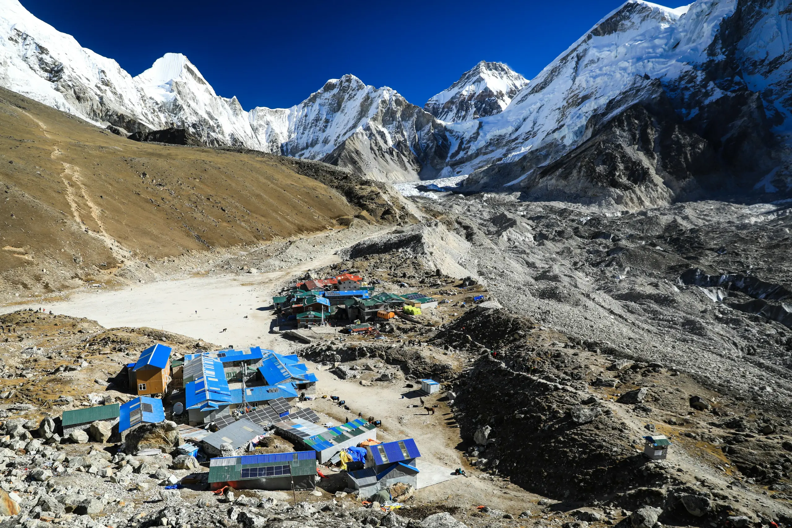
Day 10: Trek from Lobuche to Gorak Shep, Hike to Everest Base Camp
Today is a big day during the Everest Base Camp Trek by road. You leave Lobuche and traverse moraine rocky terrain to reach Gorak Shep (5,164 m/16,942 ft). The path is not smooth; thus, it is important to exercise caution. Once you get to Gorak Shep, you stop to have lunch, and you head on to Everest Base Camp at 5,364 m / 17,598 ft.
The trail is along the Khumbu Glacier side. Upon reaching the base camp, you are near the Khumbu Icefall and the Himalayan mountains. Colorful tents are visible during the climbing season. You capture photos and live in the moment.
You spend some time there and go back to Gorak Shep at night. The wind is very strong, and thus you sleep and stay warm.
Breakfast, Lunch, and Dinner
Teahouse
11 km
5,364 m / 17,598 ft
9 hrs
Day 11: Sunrise hike to Kala Patthar, Trek to Pheriche
You wake up early in the morning before sunrise and reach the Kala Patthar (5, 545 m /18, 192 ft). It is a steep, cold climb, but the payoff is a clear view of the sunrise over Mount Everest and the surrounding mountains. This is the greatest point of your journey.
You come back to Gorak Shepto for breakfast after taking in the view. Then you start going down to Pheriche at 4,371 m / 14,340 ft. The downhill walk is easier to breathe, though be careful not to overstrain your knees.
You have lunch at the way side, and proceed through open valleys. It is a blessing to get to Pheriche, which follows the nights at great elevation.
Breakfast, Lunch, and Dinner
Teahouse
10 km
5,545 m / 18,192 ft
8 hrs
Day 12: Trek from Pheriche to Namche Bazaar
The trail begins at Pheriche and descends through Pangboche and Tengboche. With the descent, breathing becomes simpler. The forested areas are green and warmer than the high valley.
Once you have crossed suspension bridges and are walking along the Dudh Koski River, you have only one more uphill stretch before you arrive in Namche Bazaar at 3,440 m / 11,286 ft. Although you are going downhill overall, the final climb may be difficult after several hours of hiking.
Upon arrival in Namche, you are greeted by a vibrant scene. After the rugged mountain days are over, a hot shower and a good meal are satisfying.
Breakfast, Lunch, and Dinner
Teahouse
22 km
3,440 m / 11,286 ft
10 hrs
Day 13: Trek from Namche Bazaar to Chaurikharka
After having a fulfilling breakfast in Namche Bazaar, you go down through Monjo and other minor villages. It follows the river valley and crosses several suspension bridges. The lower you get, the more oxygen there is in the air.
A lengthy downhill walk may be very unpleasant for your knees, and walking sticks and trekking poles will help. You take a break for lunch by the river and go through woods and agricultural lands.
Towards the end of the afternoon, you arrive at Chaurikharka (2,800 m / 9,186 ft). The village is quieter than Namche. You sit down in your lodge and have a pleasant evening.
Breakfast, Lunch, and Dinner
Lodge
20 km
3,440 m / 11,286 ft
8 hrs
Day 14: Trek from Chaurikharka to Paiya
You start your last day trekking from Chaurikharka to Paiya. The trail consists of moderate ascents and descents, passing through forests and small villages. The landscape is serene and not as congested.
When you are walking to Paiya (2,730 m / 8,957 ft), you reminisce about how you got to the Everest Base Camp at 5,364 m / 17,598 ft. You can see that you are now stronger and more confident than you were in the early days.
Once you have walked through the valley, you arrive at Paiya and stay in a lodge. On your final day in the mountains, you spend enjoying it and are ready to take the long journey back to Kathmandu.
Breakfast, Lunch, and Dinner
Lodge
9 km
2,800 m / 9,186 ft
5 hrs
Day 15: Drive from Paiya to Kathmandu via Phaplu or Salleri
You set off early from Paiya and make your way to Phaplu or Salleri (2,413 m / 7,917 ft) in a 4W Jeep. Some parts of the road are not very smooth, and some are smoother. The trip is long because you have to pass through hills, rivers, and small towns.
You take breakfast and lunch on the way. The view lets you see the mountains and villages you glimpsed on the trek. Slowly, the road leads to the main highway to Kathmandu (1,400 m / 4,593 ft).
In the evening, you get to the city and end your Everest Base Camp Trek by road.
Breakfast and Lunch
270 km drive
2,730 m / 8,957 ft
9 hrs drive
What To Expect?
What's Included
- Three meals a day during the trek with seasonal fruits.
- Teahouse accommodation during the trek in twin sharing.
- Sagarmatha National Park permit and Khumbu Pasang Lhamu Rural Municipality permit.
- Transportation from Kathmandu to Phaplu to Paiya and back to Kathmandu by ground transportation in a private 4×4.
- Professional, government-certified, and English-speaking trekking guide, including their salary, meals, accommodation, transportation, and insurance.
- Porters (one per two trekkers), one-half of the salary, board, lodging, and insurance.
- First-aid kit and an oximeter.
- Helicopter rescue (MET arranged emergency evacuation; insurance covered).
- The taxes and official fees imposed by the government
- Official completion certificate and Trekking route map.
What's Excluded
- International Airfare and entry visa fees for Nepal.
- Personal travel insurance, such as high altitude and helicopter evacuation cover.
- Dinner and lunch in Kathmandu.
- Personal costs include alcohol, bottled water, candies, hot showers, and charging up batteries on the trek.
- Guide and porter tips.
- Other expenses that arise due to delays or changes of itinerary not in control of MET, like weather, road blockages, illness, and strikes.
- Anything else not mentioned in the inclusion section.
Tripadvisor Reviews
Google Reviews
Everest Base Camp Trek by Road – 15 Days Additional Information
Climate, Weather Patterns & Best Climbing Seasons
The Everest Base Camp Trek by road has the same seasonal pattern as the rest of the Everest area. Autumn (September to November) and spring (March to May) are the most favorable and predictable seasons for this trek.
In spring, temperatures gradually increase, flowers blossom in some of the lower villages, such as Namche Bazaar (3,440 m / 11,286 ft), and most trekkers go to the Base Camp (5,364 m / 17,598 ft) during this season. The mood is quite dynamic and motivating.
The monsoon season ends, and then autumn begins. The skies tend to be clear, and mountainous scenery in places such as Kala Patthar (5,545 m / 18,192 ft) can be crisp and expansive. The months are perfect for viewpoint days and photography.
On the Everest Base Camp Trek by road, weather affects the trail and jeep route. June through September experience heavy rainfall, which can damage roads and cause landslides. My Everest Trip (MET) plans departures carefully during safer months so you can travel by road and trek comfortably while enjoying the journey.
Altitude Profile & Acclimatization Strategy
The Everest Base Camp Road Trek involves an ascent of incredibly high-altitude terrain to Everest Base Camp, beginning in the lower Solu villages. The Sagarmatha National Park has altitudes ranging from 2,845 m / 9,334 ft at Monjo to 8,848 m / 29,029 ft at the summit of Everest. This elevation difference is significant, underscoring the importance of appropriate acclimatization.
My Everest Trip (MET) will incorporate two major acclimatization days in the itinerary. The former is at Namche Bazaar (3,440 m / 11,286 ft), and the latter is at Dingboche (4,410 m / 14,469 ft). During such days, you will walk uphill and then come back to go to bed at a lower elevation.
Such a ” walk high, sleep low approach is a way of getting used to the elevation. Altitude sickness may also take place even during the Everest Base Camp Trek by road. You need a slow pace, adequate hydration, and immediate reporting of symptoms to minimize risk.
Physical Requirements Training
The Everest Base Camp Road Trek is not a technical climbing expedition, though it requires endurance. The days consist of 4-7 hours of walking, most days, and a few days can reach up to 22 km. The highest altitude will be around 5,545 m / 18,192 ft at Kala Patthar, which is why it is necessary to prepare for the fitness demands.
Train your body for 8 to 12 weeks before the trek. Pay attention to the uphill walking, downhill control, and leg strength. Train to carry a light pack on your back, as you will need to carry everyday essentials during the trek, though you may have someone carry your main bag.
Because such a route requires extensive road travel, flexibility and mobility training are also beneficial. The initial days of the trek can be made more comfortable with lower back and hip stretches. You must feel confident hiking 5–7 hours on back-to-back days at home before joining the Everest Base Camp Trek by road.
Teahouse Accommodation and Food Availability in this Trek
The predominant form of accommodation at the Everest Base Camp Trek by road is teahouses. My Everest Trip (MET) also organizes lodge accommodations along the way. There are simple twin beds in rooms and shared bathrooms at higher altitudes.
Food preferences remain the same, but there are fewer choices at higher altitudes. Some popular meals include dal bhat (rice and lentils), noodles, soups, fried rice, potatoes, eggs, and bread. Menus become wider at Namche Bazaar (3,440 m / 11,286 ft), and at the base of Everest (5,364 m 17,598 ft), more rigid because of transport restrictions.
MET provides three meals per day during trekking days. Teahouses are also social spaces where trekkers exchange stories and weather reports. Good eating habits, handwashing, and eating freshly cooked foods will help maintain good health during the trip.
Visa Requirements, Permits & Official Documentation
Participants in the Everest Base Camp Trek by road must have a valid tourist visa to enter Nepal. Upon arrival, most visitors are issued an on-arrival visa at Tribhuvan International Airport in Kathmandu.
For trekking permits, two documents are required. The first one is the Sagarmatha National Park entry permission. The second is the Khumbu rural municipality permit, commonly referred to as a Trek Card. They are inspected on the way at Monjo at 2,845 m /9334 ft.
My Everest Trip (MET) will handle the permit process for you and ensure you are up to date with the latest regulations. Trekking in restricted and protected regions of Nepal requires travelers to be accompanied by a licensed guide.
Always carry copies of your passport and permits on the trek, as they may be checked at checkpoints. The correct documentation ensures unhindered travel by road during the Everest Base Camp Trek.
Health Protocols, Safety Standards & Emergency Response
The Everest Base Camp Trek by road is focused on safety. My Everest Trip (MET) provides licensed guides who are trained in high-altitude response. The prevention plan includes acclimatization days at Namche Bazaar (3,440 m / 11,286 ft) and Dingboche (4,410 m / 14,469 ft).
Guides also carry a first-aid kit and keep an eye on the trekkers to monitor their symptoms, such as headache, nausea, or unusual fatigue. Simple oxygen saturation tests can be performed in larger villages such as Gorak Shep (5,164 m / 16,942 ft).
In case of severe altitude sickness, the first step of treatment is to descend. MET can organize helicopter evacuation, should the need arise, and high-altitude evacuation above 5,000 m / 16,404 ft. needs to be covered by travel insurance for a safe trip.
Ground Transfers & Logistics
The Everest Base Camp Trek by road is determined by ground travel. My Everest Trip (MET) involves the use of privately operated 4×4 vehicles from Kathmandu to Phaplu or Salleri (2,413 m /7, 917 ft) and Paiya (2,730 m /8,957 ft).
The initial drive is approximately 270 km and can take 8-10 hours, depending on traffic and road conditions. The second part is shorter but more difficult, often taking hours because the road runs through the mountains.
Such an overland route provides a more in-depth picture of rural Nepal than air travel. Apart from that, however, road conditions vary with the season. Landslides may occur during the months of heavy monsoon and block access.
MET plans the itinerary carefully, and backup plans are also in place, so that the logistics of the Everest Base Camp Trek by road proceed without any hindrance.
Travel & High-Altitude Insurance Requirements
The Everest Base Camp Trek by road requires insurance. You will arrive at Everest Base Camp at 5,364 m / 17,598 ft and have the option to hike to Kala Patthar (5,545 m / 18,192 ft). In your policy, it should be made clear that you have covered trekking above 5,000 m / 16,404 ft and helicopter evacuation.
High mountain rescues are costly and usually rely on the weather. My Everest Trip (MET) can arrange emergency services, whereas the insurance company must pay according to the terms stated in the policy.
Know your maximum covered altitude, evacuation limits, and whether coverage is direct or reimbursed before you travel. Coverage of delays when traveling should also be included, as road and weather conditions can affect the timing of the Everest Base Camp Trek by road. Health and money are taken care of with proper insurance.
Route Variations & Alternative Options
Everest Base Camp Trek by road is the standard route, starting with a jeep journey into the Solu region before heading to the popular Khumbu trail. This is a better alternative to the Lukla flight and allows one to be slowly initiated into the life of the mountain.
My Everest Trip (MET) will allow you to tailor the itinerary to your preferences. Some trekkers opt to fly to Lukla to reduce travel time. Others include additional acclimatization days in Dingboche (4,410 m / 14,469 ft) to take it at a slower pace. In those with limited time, a helicopter turnaround at or around the Everest Base Camp (5,364 m / 17,598 ft) is also available.
To have a more cultural experience, it is possible to include the historic Jiri route. The options vary in timing and permit information. MET lets you compare these differences and choose the Everest Base Camp Trek by road that best meets your objectives and comfort level.
Personal Expenses & Budget Planning
On the Everest Base Camp Trek by road, most essential services are provided by My Everest Trip (MET), but you are advised to budget for personal expenses.
Meals (lunch and dinner) are not included in Kathmandu. Beverages such as tea, coffee, soft drinks, chocolates, hot showers, and charging rates are an addition during the trek. The higher you climb, the higher the prices go due to the costs of carrying supplies up the mountain by porters or yaks.
What you spend is based on your habits. If you are fond of bottled drinks and hot showers every day, you should increase your budget.
Guide and porter tipping is also not part of the package; therefore, it should be prepared beforehand.
You should have a small buffer budget for the Everest Base Camp Trek by road, as weather may affect road conditions or require an additional overnight stay.
Language, Cultural Insights & Communication
The Everest Base Camp trek by road passes through various cultural areas. The national language is Nepali, and the Sherpa communities in Khumbu have their traditions and dialects. In trekking centers, such as Namche Bazaar (3,440 m / 11,286 ft), English is widely spoken, but in small villages, communication can be basic.
My Everest Trip (MET) guides fulfill the language barrier and local culture. Respect is very important. Dress modestly, seek permission before taking pictures, and abide by the monasteries’ rules. At the Tengboche Monastery (3,860 m / 12,664 ft), maintain a low voice and circle mani walls and prayer wheels in a clockwise direction.
The advantage of the Everest Base Camp Trek by road is that more culture is exposed. From rural Solu villages, you pass on to the main Khumbu trail. This adventure allows you to explore the mountain’s day-to-day life, agricultural culture, and religious activities beyond the normal trekking route.
Seasonal Festivals Along the Trail
Part of the Everest Base Camp Trek by road is culture. The Sherpa people observe significant Buddhist events, including Mani Rimdu and Dumje. The latter usually occur in monasteries such as Tengboche, at 3,860 m / 12,664 ft.
Monks use masks to perform dances and prayers during festivals, as well as perform ceremonies. People are singing in villages in their traditional attire, and the atmosphere is festive and religious. Because festival dates depend on the lunar calendar, they vary annually. My Everest Trip (MET) will first verify local schedules before verifying timing.
Even outside festival days, you will see prayer flags, chortens, and mani stones along the trail, especially between Namche Bazaar (3,440 m / 11,286 ft) and Everest Base Camp (5,364 m / 17,598 ft).
If cultural immersion is important to you, ask MET to schedule your Everest Base Camp Trek by road to match local festival dates.If you want fewer people around, come on dates other than the big celebrations.
Private vs Group Joining
The Everest Base Camp Trek by road may be arranged in a group-joining trip or as a private one. My Everest Trip (MET) offers both options based on your choice and departure timeline.
A private trip provides you with the flexibility. You may speed up or slow down, spend an additional evening at Dingboche (4,410 m / 14,469 ft), or spend more days at a viewing point, such as Kala Patthar (5,545 m / 18,192 ft). This is a good alternative for families, couples, or travelers who do not have fixed travel dates.
A group-joining trip reduces costs and fosters group motivation. The day-long walks form good friendships.
MET can also offer mixed options, such as private guiding with shared transport. The decision will be based on the price, the flexibility, and the social feeling of what you want your Everest Base Camp Trek by road to be.
Connectivity, Mobile Network & Charging Facilities
The Everest Base Camp Trek by road is better connected in larger villages and becomes restricted at higher altitudes. Wi-Fi and mobile signals are typically available in Namche Bazaar (3,440 m / 11,286 ft) for a fee. Connection is weak or weather-dependent near Gorak Shep (5,164 m / 16,942 ft).
It is a personal cost to charge their gadgets. Sharing of charging stations in the dining halls is common in lodges. It is a good idea to carry a power bank to save some money and keep your electronic devices charged at all times.
Turn on airplane mode when walking, and leave devices on while charging at night to save battery. Lower-elevation areas tend to have stronger road signals, so download maps and other valuable documents before entering high terrain.
Being prepared will make it easier for you to communicate during your Everest Base Camp Trek by road.
Photography, Filming & Drone Regulations
The Everest Base Camp Trek by road is also characterized by photography. Hotel Everest View at 3,880 m / 12,730 ft and Kala Patthar at 5,545 m / 18,192 ft have far-reaching views of Everest and other mountain ranges. Mornings are usually the clearest with light.
My Everest Trip (MET) promotes respect for photography. There should always be a request before making close-ups of local people or monasteries.
Nepal has strict rules regarding the use of drones. The operation of a drone should adhere to the Civil Aviation Authority’s regulations, such as line-of-sight flying and altitude restrictions. Registration and formal drone permission are necessary, particularly in restricted zones around Everest Base Camp at 5,364 m / 17,598 ft.
Due to the complexity of permissions, drone filming should be viewed as a formal process. MET can provide guidance; however, final approval is up to the authorities. Responsible photography takes care of both culture and the environment when you go on your Everest Base Camp Trek by road.
Essential Advice for First-Time Visitors
In case this is your first time at the Everest Base Camp Trek by road, pay attention to the slow pace. Altitude is serious above Namche Bazaar. Proper acclimatization and a gradual climb with rest days in Dingboche (4,410 m / 14,469 ft) can help reduce risk.
Pack smart in layers: the bottom layer, insulation jacket, windproof layer, gloves, and a warm hat. The weather may change very fast, particularly in the vicinity of the Everest Base Camp at 5,364 m / 17,598 ft.
Respect road travel timing. Mountain roads can be altered following heavy rain. My Everest Trip (MET) has an extremely thought-out process, though flexibility is beneficial.
Lastly, adhere to permit regulations and follow licensed guides. Listen to your body, drink water, and let your guide know early on if you are not feeling well. Your Everest Base Camp Trek by road will be safer and more rewarding when you are prepared and tell the truth.
Everest Base Camp Trek by Road – 15 Days FAQs
What is the duration of the Everest Base Camp Trek by Road?
The standard itinerary will cover 15 days, including road transfers, trekking days, acclimatization days, and days spent returning to Kathmandu.
What is the highest elevation to sleep at night?
The maximum overnight stop is at Gorak Shep being 5,164 m / 16,942 ft.
Where is the highest point of the trek?
The highest trekking point is Kala Patthar at an elevation of 5,545 m / 18,192 ft.
What is the level of difficulty of the Everest Base Camp Trek by road?
It is a moderate to difficult trek that involves good stamina, but does not require any technical skills to move up.
Do I need previous trekking experience?
Experiencein high altitude trekking is desirable but not obligatory with adequate preparation.
What is the number of acclimatization days?
The acclimatization will take two days, first in Namche Bazaar and then in Dingboche.
What permits are required?
Sagarmatha National Park Permit and Khumbu Pasang Lhamu Rural Municipality Permit are needed.
Are porters provided?
Yes, there are porters who are usually one to every two trekkers.
Do I need a licensed guide?
Yes, one has to be accompanied by a licensed guide in this area.
What kind of accommodation is offered?
You stay in the teahouse lodges with simple twin rooms.
Are single rooms available?
There can be single rooms in the lower villages, but in the higher altitude, there are few.
Does it have safe drinking water?
Lodges charge you to use boiled water, or you can use purification methods to make drinking water safe.
Are hot showers available?
Most lodges have hot showers at an extra fee.
Is it possible to charge my phone and camera?
Most lodges have charging facilities at a fee.
Is Wi-Fi available on the trek?
Larger villages such as Namche Bazaar have Wi-Fi, most often at a fee.
When is the most appropriate time to do the Everest Base Camp Trek by road?
The most stable conditions are in spring (March-May) and autumn (September-November).
Is there a possibility of weather affecting the road section?
Monsoon rains are heavy and may lead to landslides, as well as road delays.
Do I need travel insurance?
Trekking insurance above 5,000 m / 16,404 ft and insurance on helicopter evacuation are needed.
What is done if I have altitude sickness?
Emergency follow-up and check-up are scheduled in case of severe symptoms.
Do they offer vegetarian food on the trail?
The trek has a great availability of vegetarian meals.
How cold does it get at night?
The village temperatures may even reach a point of freezing at higher altitudes, such as Lobuche at 4,940 m / 16,207 ft.
Does the trail have mobile network coverage?
Mobile network is accessible in most villages, but has a poor signal in elevated areas.
What currency is used during the trek?
Personal expenses along the route are done using Nepalese Rupees (NPR).
Does the trail have ATM facilities?
There are very few ATMs in Namche Bazaar at 3,440 m / 11,286 ft.
Are beginners allowed to take part in the Everest Base Camp Trek by road?
In case of adequate preparation and training, beginners complete the trek successfully.
Does it have a helicopter return option?
As an option, a helicopter return can be scheduled at the discretion of the weather and cost.
Does the route have medical amenities?
Some villages, such as Pheriche at 4,371 m / 14,340 ft., have basic health posts.
What type of terrain is to be expected?
The path has rocky moraine parts, rocky steps, dirt paths, and suspension bridges.
Is tipping compulsory?
Tipping is a normal but not mandatory practice.
US$ 1,300 per person
- Best Price Guarantee
- Secured Payment System
- Tailored and Personalized Itinerary
- 70% repeat customers
24 X 7 Live Support

Puru (+977-9851069558)
Related Trips
Recent From Our Blog Places of attractions, travel tips, news and more.
Everest, Blog, Trekking in Nepal
A Complete Everest Trekking Guide
Everest Trekking Guide A Complete Everest Trekking Guide is many treks globally, but none are…
Read the full post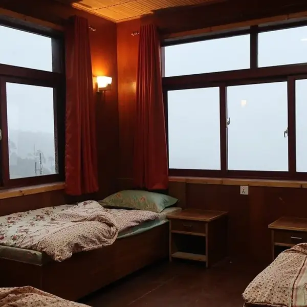
Everest, Blog
Accommodation on Everest Base Camp Trek
Accommodation is a major concern for trekkers, especially in remote Himalayan areas like the Everest…
Read the full post
Everest, Blog
Best Things To Do During The Everest Base Camp Trek
What are the best things to do during the Everest Base Camp trek, explorer? We’ve…
Read the full post