There are many mountain views during the Everest Base Camp trail. On the route to the highest base camp in the world, we can expect to see some of the highest mountains along the way. Everest’s base camp is situated at 5364 m/17594 ft. The base camp is located to the south of Mount Everest, and usually hikers wander to see the majestic snow-capped Himalayan range along the trail to Everest Base Camp.
Lhotse Mountain is the fourth-highest peak in the world and is visible between our trails. Nuptse, Ama Dablam, Thamserku, Kangtega, Pumori, and Cho Oyu are also some of the highest peaks that can be seen along the trail to base camp.
Table of Contents
Now, we will dive into the day-by-day itinerary of the Everest base camp trek, including the mountains and peaks we can see each day.
Mountain View From Lukla to Phakding
Phakding is situated at an elevation of 2652 m (8699 ft). During the trek to Everest base camp, the distance from Lukla to Phakding is 8km. While trekking between Lukla and Phakding, on the northwest side, you’ll get to see the Kongde Ri (6,187 meters / 20,298 feet) in the starting phase of today’s trail.
You’ll get to see the three summit mountains: Kusum Kanguru (6,367 meters / 20,889 feet). Thamserku (6,623 meters / 21,729 feet) is a famous mountain that can be seen to the north as heading towards Phakding. Thamserku is a sharp and jagged mountain peak.
Numbur (6,959 meters / 22,831 feet) is not very popular, but it is part of the Rolwaling Himal Range, which can also be seen.
Karyolung (6,511 meters / 21,359 feet) can also be seen along the trail from Lukla to Phakding, but visibility may be affected by weather conditions, so make sure to trek to Everest Base Camp during the best season.
Mountain View From Phakding to Namche Bazaar
Many additional mountain peaks can be seen along the trail from Phakding to Namche Bazaar on the way to Everest Base Camp. Namche Bazaar is situated at an elevation of 3440 m / 11283 ft. The distance of the trek from Phadking to Namche Bazaar is 11km.
As before, Kongde Ri, Kusum Kanguru, and Thamserku are also visible on the trail to Namche Bazaar. Kangtega (6,782 meters / 22,251 feet), also known as snow saddle peak, is seen on the trail. While trekking forward, you got a glimpse of Nuptse (7,861 meters / 25,791 feet).
As it is close to Namche Bazaar, we can see Everest (8,849 meters / 29,032 feet). Also, we can see the Lhotse (8,516 meters / 27,940 feet) and Ama Dablam (6,812 meters / 22,349 feet).
Mountain View From Namche Bazaar to Tengboche
Besides the previously named mountains, such as Kangtega, Kusum Kanguru, Kongde Ridge, and others. Several other peaks can be seen from the trail. Tengboche is situated at an elevation of 3860 m (12660 ft). The distance from Namche to Tengboche is 11km.
On the Everest Base Camp Trail between Namche and Tengboche, we saw the prominent peak Taboche (6,495 meters / 21,309 feet). The pyramid-shaped summit is Kwangde Ri (6,011 meters / 19,721 feet) and Tawoche (6,501 meters / 21,329 feet).
The trekking trail from Namche Bazaar to Tengboche offers a delightful mix of lush forests, suspension bridges, and magnificent mountain landscapes. As you walk, the views of the surrounding peaks keep changing, giving trekkers a sense of progress through the diverse and breathtaking terrain of the Everest region.
Mountain View From Tengboche to Dingboche
The route from Tengboche to Dingboche is 11km. Dingboche is situated at an elevation of 4410 m/14464 ft. Acclimatization: Many trekkers stay in Dingboche to acclimatize. Not only that, but people also stay here to enjoy the clear, panoramic views of various mountains.
We can see several new mountains and landscapes from Tengboche during the trail to Dingboche. The Ama Dablam (6,812 meters / 22,349 feet) is a stunning presence on the trail towards Dingboche. It is pyramid-shaped and a highlight of the Everest base camp trek.
In Dingboche, we can see the Lhotse Peak more clearly than at any other destination along the route. During the trial, we got to see Island Peak (Imja Tse) (6,189 meters / 20,305 feet), another popular trekking peak in Nepal.
Cholatse (6,440 meters / 21,126 feet) and Pangboche Peaks are other mountain peaks that can be seen during the trail. While Taboche, Thamserku, and Kangtega can also be seen.
The trail between Tengboche and Dingboche crosses the Imja Khola, which offers amazing views of the surrounding mountains.
Mountain View From Dingboche to Lobuche
The trail from Dingboche to Lobuche is a 5-hour trek covering 12 km. The Lobuche is situated at an elevation of 4910 m (16105 ft). The trek from Dingboche to Lobuche will gradually gain altitude with a barren landscape. The mountain view from Lobuche will make you feel a sense of awe and accomplishment, combined with the challenging terrain.
The mountains visible from the trail are largely the same, and we get panoramic views of Ama Dablam, Lhotse, Island Peak (Imja Tse), Cho Oyu, Thamserku, Kangtega, Pumori, and Nuptse.
Cho Oyu (8,188 meters / 26,864 feet) is another mountain that is seen for the first time between the trails. The Cho Oyu is the sixth-highest mountain in the world and can be seen from certain points during the trail. Pumori (7,161 meters / 23,494 feet) is also seen for the first time between the trails.
Mountain View From Lobuche to Gorakshep
The distance from Lobuche to Gorakshep is 4.5km, and it takes around 4 hours to reach there. Gorakshep is situated at an elevation of 5180 m (16,990 ft). The trek is challenging yet rewarding, offering breathtaking views of some of the world’s highest and most iconic peaks.
We’ll see the same mountain peaks as in Lobuche, but the new mountain peak visible from here is Lingtren (6,749 meters / 22,142 feet), a distinct peak in the area, visible as you make your way toward Gorakshep.
Khumbutse (6,640 meters / 21,785 feet) is another mountain in the region that may come into view during this part of the trek. Changtse (7,543 meters / 24,747 feet), although situated in Tibet, is visible from certain points along the trail to Gorakshep. And, of course, Everest.
While trekking, you can also reach Gorakshep by helicopter from Kathmandu.
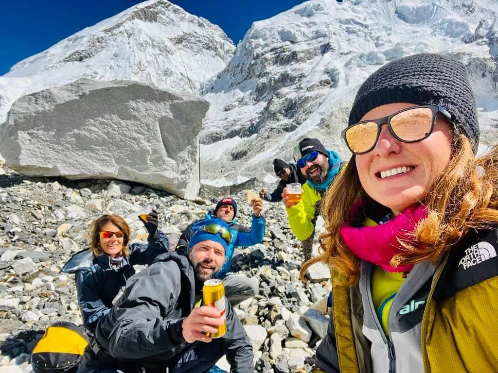
Mountain View From Everest Base Camp
The trek distance from Gorakshep to Everest Base Camp is 3.3km, and it takes 2 hours to reach there. From the Everest base camp, we’ll get to see the panoramic views of several mountains in the Everest Region.
Mount Everest (8,849 meters / 29,032 feet), Nuptse (7,861 meters / 25,791 feet), Lhotse (8,516 meters / 27,940 feet), Pumori (7,161 meters / 23,494 feet), Changtse (7,543 meters / 24,747 feet), Khumbutse (6,640 meters / 21,785 feet), Lingtren (6,749 meters / 22,142 feet), and Thamserku (6,623 meters / 21,729 feet).
Other Things About Everest Base Camp Trekking
Quick Advice:
While trekking en route to either Everest, Annapurna, or other regions. There are many Android and iOS apps, such as Peak Finder and Peak Name. You can know the name of a mountain just by showing the mountain on that app. This gives you the mountain’s altitude and name, and is very useful while trekking.
Mountain Views During The Everest Base Camp Trail
Everest Trekking Photos: