




Imagine standing somewhere in Sagarmatha National Park in the Everest Region, trying to reach Mount Everest’s base camp. Breathtaking panoramic views of the Mountains surround you. The landscape is simply stunning. But the catch is that you are lost. You don’t know which way takes you where. No one is around you. How would you ensure you follow the right trail toward your station?
That’s where the Everest Base Camp Trek Map comes in. It is not your ordinary tool. Think of it as your trek companion, a guide that gives you information about trails, teahouses, locations, and elevations. It is your means of safety. If you are planning a trek to Everest Base Camp and are in the preparation phase, take a moment to read this article about the EBC Trek Map. This article explains why the map matters for the EBC trek. We hope this article helps.
Everest Base Camp Trek – 12 Days
Imagine standing somewhere in Sagarmatha National Park in the Everest Region, trying to reach Mount Everest's base camp. Breathtaking panoramic views of…
Everest Base Camp Trek Map
Like any other trek map, the Everest Trek map is a detailed guide showing routes, landmarks, and elevations. Throughout your journey, this map will give you confidence and hope. You are stranded somewhere. It will show you the way, and you can follow the trail back. You are hungry and don’t know how far the teahouses are. It will show you how far away they are and assure you you won’t go long without food. You are feeling breathless, and you don’t know the elevation.
It will display the elevation and remind you to rest and acclimate. Most route maps are based on the itinerary destination, so they may differ between trek variants; for example, a 14-day EBC trek and a 12-day EBC trek may differ a bit, but the destinations remain the same, so you can reuse it. When buying a trek map, make sure it covers a standard route with plenty of alternatives and hikes, giving you a sense of the entire area. Now, let’s look at its key features and importance in more detail.
Key Features and Importance of EBC Trek Map
The Everest Base Camp Trek map includes every minute location, starting from Lukla. No matter your route, it lists every place you will encounter on your trek. It lists hotels (indicated by a capital “H”). It also lists mountains and monasteries along the way. Having this map will help you prepare mentally. You can anticipate what’s coming ahead and prepare for it. So, a trek map at this high altitude is not just your guide; it is also your well-wisher.
Assists trekkers in Planning
The Trek to EBC map is your key element in Planning. It tells you everything you’ll encounter, from routes to landmarks to villages. It has everything in it. You can study the trails, distances, and elevation from your table and visualize the trek. You can plan your entire journey with the map’s help. And once you hit the trails, you can easily navigate with the map.
Elevation Profiles and Altitude Markers
Altitude sickness is always a risk on this journey. The elevation and cold atmosphere will make it hard for your body to adjust. You will need to plan your acclimatization. For that, you will need elevation profiling and altitude markers. The map will show you changes in altitude. It will also help you to fix your pace.
Trail Routes and Distance Breakdown
The EBC Trek isn’t your ordinary one-route hike. Multiple routes and ways to reach the camp. Take it lightly; you will be a mouse in the maze trying to get out. The map shows a clear trail path (indicated by a dotted yellow line), junctions, and turns. The map also has distances between various key points. You can look at them and estimate how long it would take you to reach your destination. So, while planning your itinerary, you can study these paths and devise the perfect route based on which way you want to trek and what you want to explore.
Notable landmarks, Rest stops, and Teahouses
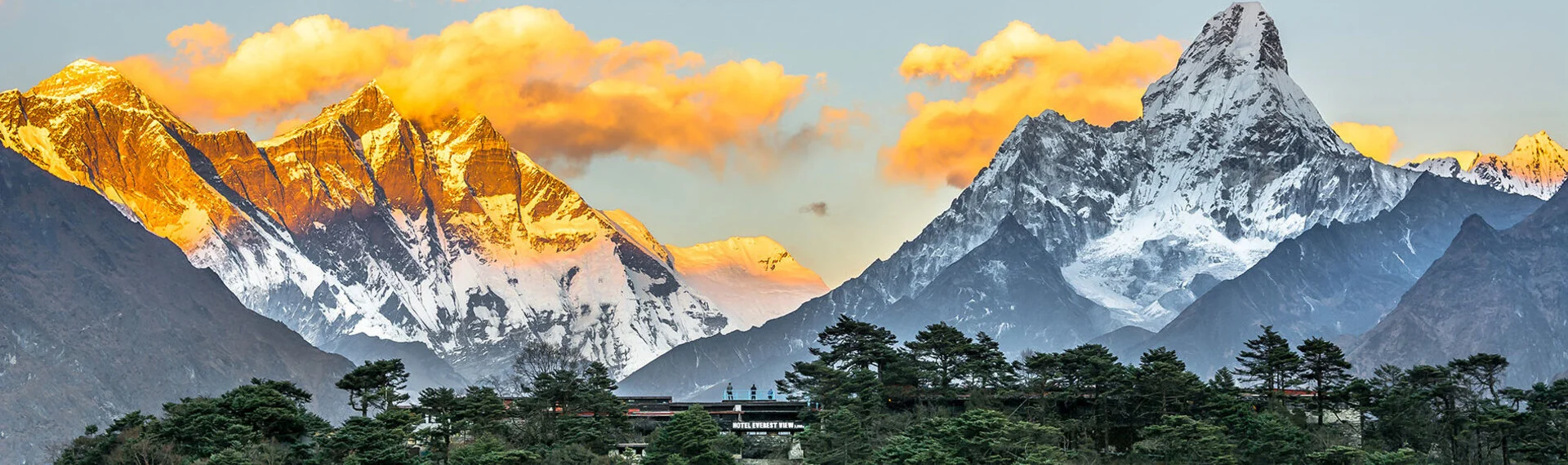
The EBC Trek map highlights the essential landmarks, teahouses, and lodges where you will rest, eat, and sleep. You will know exactly where Tengboche Monastery is, where to look for Ama Dablam or Lhotse, and how far your station is. The map lists villages like Gorak Shep, Pheriche, Dingboche, and Lobuche. It also shows landmarks like Kala Patthar, Khumbu Glacier, and many other Himalayan peaks. With one look at the map, you will know exactly what to expect next. This will give you a sense of security and familiarity with the location.
EBC Trek Route Overview
Three routes lead to the base camp. The Everest Base Camp Trek map includes all these routes leading to views of Everest.
Classic EBC Route
This is the most famous and main trekking route to Everest Base Camp, the heart of Nepal’s Khumbu region. This classic EBC trail takes at least 14 days to complete. Trekkers pass through the popular Sherpa settlement of Namche Bazaar and Tengboche. Here is a quick highlight of this route.
- Starts From Lukla
- Namche Bazaar
- Tengboche Monastery
- Dingboche
- Everest Base Camp and Kala Patthar
Three Passes Trek to EBC
The Three Passes Trek to Base Camp is the most challenging trekking route in the Everest Region. But it is equally rewarding. It involves crossing three high-altitude passes: Renjo La, Cho La, and Kongma La. This trek takes at least 18 days to complete. The major highlights of this route are:
- Renjo La, Kongma La, and Cho La Pass
- A wide view of Mt. Everest and other Himalayan Peaks of Nepal
- Visit to Gokyo Lakes
- Crossing glaciers
Imagine standing somewhere in Sagarmatha National Park in the Everest Region, trying to reach Mount Everest's base camp. Breathtaking panoramic views of…
Gokyo Lakes Trek to EBC
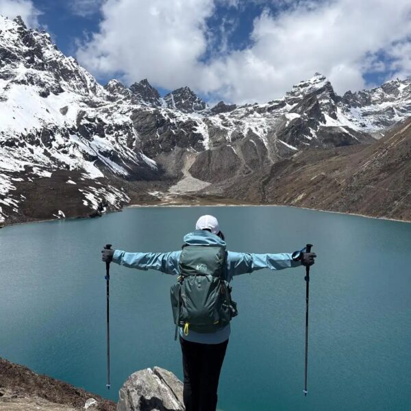
This route lets trekkers explore the classic trail and the Gokyo Lakes at the same time. The six Gokyo Lakes are located at elevations ranging from 4,700 m to 5,000 m. These lakes were named after Gokyo Ri Peak. As you ascend, you’ll enjoy panoramic views of Mount Everest, Lhotse, and Makalu. This trek takes at least 15 days to complete. Here are the major highlights:
- Gokyo Lakes and Gokyo Ri Peak
- Cho La Pass
- Stunning views of mountains along the route, including Mt Everest, Lhotse, and Makalu.
- Challenging off-the-beaten-path.
Types of Everest Base Camp Trek Maps
Physical maps: Topographic details and reliability.
Physical maps for the Everest Base Camp Trek are traditional paper maps. They include everything a regular Trek map would have, from elevation profiles to scale to landmarks and the trek route. They are the most reliable and durable navigation tools in the remote Khumbu Region, where network connections are rare. You don’t need batteries, GPS, a signal, or any network to use them. Physical maps now come with a plastic coating, making them moisture-resistant.
Digital maps: Mobile apps and GPS tools
Digital maps for the trek to base camp are electronic maps you can access on Mobile phones and GPS devices. They offer real-time navigation, route tracking, and elevation profiles with minimal hassle. Unlike physical maps, you don’t have to look closely to identify landmarks and routes. Features like instant updates and Zoom will make navigation easier. They may also include a compass, making them an essential tool. However, they rely on batteries and an internet connection, which may not be available in remote areas. Some mobile apps do offer offline maps. Please consider our Luxury Base Camp Trek.
How to Choose the Best Map
- Look for accuracy- the map’s places, trails, and other aspects are updated annually. Make sure you buy the latest one.
- Important details – Check for trails, landmarks, rest points, altitudes, and emergency contact points when buying.
- Scale: Scale is important when it comes to maps. It determines the accuracy of maps. 1:50,000 or 1:100,000 is considered ideal for trekking. You can also choose 1:25,000 if you want more detail.
- Recommendations for trusted map providers: Many sellers and trekking agencies have been making and selling maps for a long time. When they recommend something, listen to them.
Where to Get Everest Base Camp Trek Maps
- Local availability in Nepal – Many map shops and bookshops in Kathmandu sell detailed Everest Base Camp trek maps. You can even buy them in Lukla or Namche Bazaar.
- Online resources and downloads – Various travel agencies have uploaded maps with Everest Base Camp trek routes. You can download them from there.
- Popular smartphone trekking apps – Many apps, like Maps and Gaia GPS, are available on the Play Store. You can download them, set the location to Nepal, and view the map. So that you know, you might have to pay for some of the services.
EBC Itinerary Elevation & Altitude Gain
Here is a brief 14-day Everest Base Camp Trek Itinerary through the classic route:
| Days | Activity | Average Hiking Duration | Elevation |
| Day 1 | Arrive in Kathmandu, Nepal. Explore Kathmandu | – | Kathmandu-1,400m |
| Day 2 | Flight to Lukla from Kathmandu and hike to Phakding | Flight- 35 minutes Trekking- 3 hours | Lukla- 2,800 m Phakding-2,652 |
| Day 3 | Trek to Namche Bazaar | 6 hours | Namche- 3,440 m |
| Day 4 | Acclimatize at Namche Bazaar, Hike to Everest View Hotel | 3 to 4 hours | Everest View Hotel- 3,962 |
| Day 5 | Trek to Tengboche | 5 hours | Tengboche-3,860m |
| Day 6 | Trek to Dingboche | 5 hours | Dingboche- 4,410m |
| Day 7 | Acclimatize at Dingboche, hike to Nagarjun Hill | 4 to 5 hours | Nagarjun Hill- 5,100m |
| Day 8 | Trek from Dingboche to Lobuche | 5 hours | Lobuche- 4,910m |
| Day 9 | Trek to Gorak Shep to Everest camp and return back to Gorak Shep | 8 hours | Gorak Shep- 5,180m EBC- 5,364m |
| Day 10 | Hike to Kala Patthar and back to Pheriche | 7 hours | Kalapatthar-5,545m Pheriche-4,210m |
| Day 11 | Pheriche to Namche Bazaar | 7 hours | Namche- 3,440 m |
| Day 12 | Namche to Lukla | 7 hours | Lukla-2,800m |
| Day 13 | Lukla to Kathmandu | Flight-35 minutes | Kathmandu-1,400m |
| Day 14 | Sightseeing and return to your home country. | – | – |
Note: Reaching Everest Base Camp and Kala Patthar is also possible through alternative routes. You can plan your route with a map.
Trip not found.
Conclusion
If someone ever asked me about the importance of a Trek Map, I’d say it’s the trekker’s equivalent of a surgeon’s scalpel. A trek map is not your ordinary geographical map. It is a detailed guide showing routes, landmarks, and elevations. While a surgeon can’t perform surgery without a scalpel, a trekker might trek without a map. But there will be consequences.
Having a map during a base camp trek is always a good idea. It helps you plan routes and altitudes, navigate rough terrain, and choose where to stop. A map helps keep your Everest journey safe and secure. Plus, a map takes up little space; you can easily fit it in your pocket.